
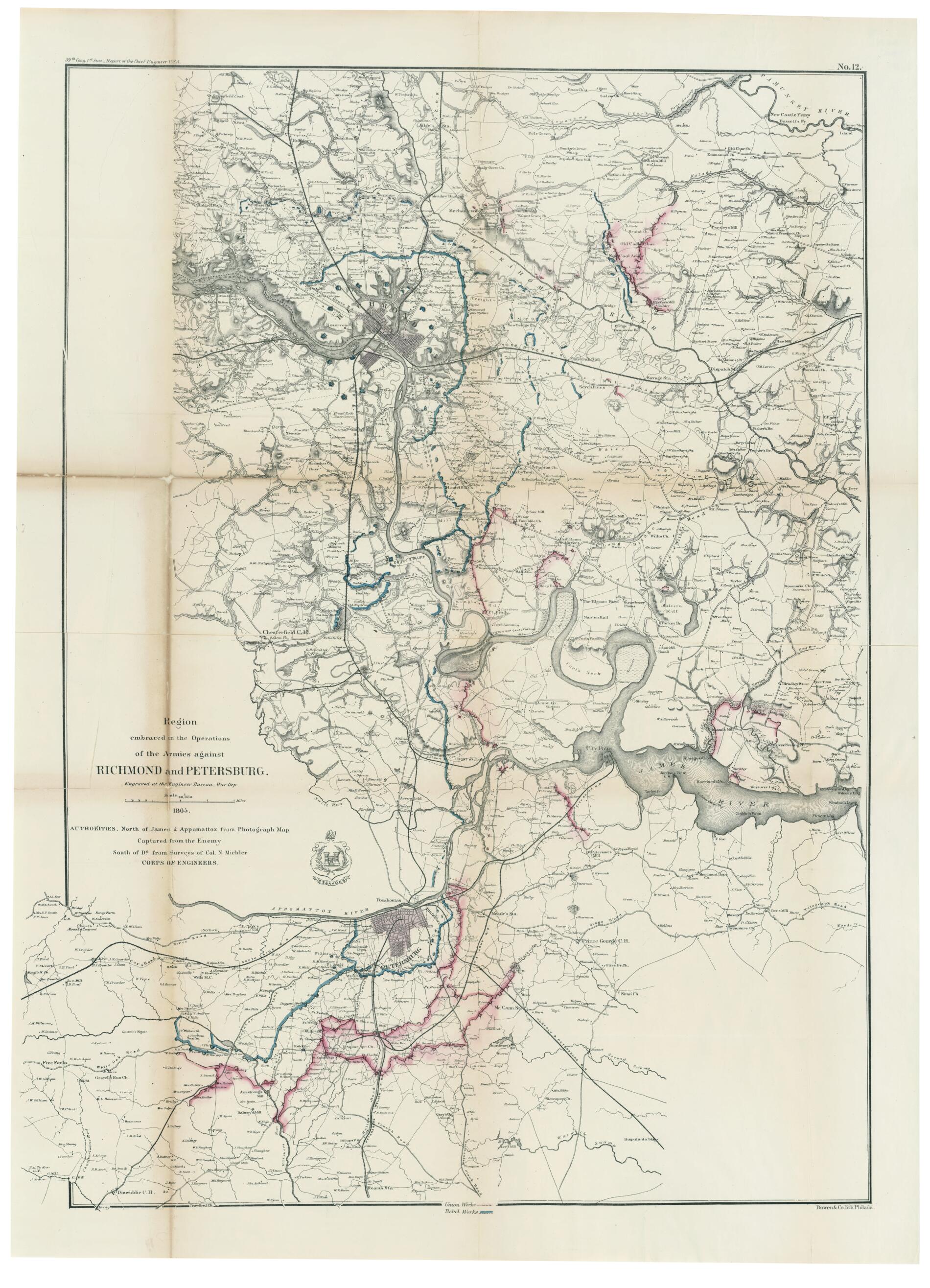
Region Embraced In the Operations of the Armies Against Richmond and Petersburg 1865
- Regular price
-
$100.95 - Regular price
-
$95.95 - Sale price
-
$100.95
Shipping calculated at checkout.
Buy one map, get any other map in our collection for 50% OFF! Add to cart to see discount.
Couldn't load pickup availability
About This Map
Old map of Petersburg Region, Richmond Region, United States, Virginia.
Created by Bowen & Co., N. (Nathaniel) Michler, United States. Army. Corps of Engineers, United States. War Dept. Engineer Bureau in 1865.
Created by Bowen & Co., N. (Nathaniel) Michler, United States. Army. Corps of Engineers, United States. War Dept. Engineer Bureau in 1865.
- "39th Cong. 1st Sess.--Report of the Chief Engineer U.S.A. No. 12."
- Description derived from published bibliography.
- From: Report of the Secretary of War, 1865. United States. 39th Congress, 1st Session, 1865-66.
- Relief shown by hachures.
- This item is in the Map Collection of the Library of Virginia; please contact the Library's Archives Research Services department for more information.
- Union works outlined in pink, rebel works outlined in blue. Maps includes roads, railroads, towns, street patterns of Petersburg, Richmond and Manchester, drainage, relief by hachures, and houses and names of residents in outlying areas.
- Civil War Map
- C.1 source unknown; c. 2, removed from serial set July 1945; Feb. 2004, Map Cataloging Team.
- C. 1 map accession no. 5234X; c. 2 map accession no. 5251X.
- Civil War project no.: lva00182.
- Conservation: restored April 1947; Etherington Conservation Center, Dec. 2003.
- Digital image available: 23 x 32 in.
- Previously filed as: 755.5 M6 1861-1865 (1).
Map Sizing Information
- For the best legibility, order your map in the original size or larger. Most maps have intricate detail and small text that is best appreciated when the print size hasn't been reduced.
- Sizes labeled "Fits a Standard Frame" will drop right into any frame that you purchase in that size. The sizes that we offer are commonly available online and at most retail stores.
- Our standard sizes are recommendations based on the aspect ratio of the original map, but still may require some added "white space" in one dimension to fit.
- Non-standard sizes will require custom framing, and we suggest taking your print to the frame shop of your choice after you receive it for the best results.
- Custom sizes are available, simply contact us for a quote.
Below is an approximation of the scale of a few standard sizes, and how they might appear in your space.

