


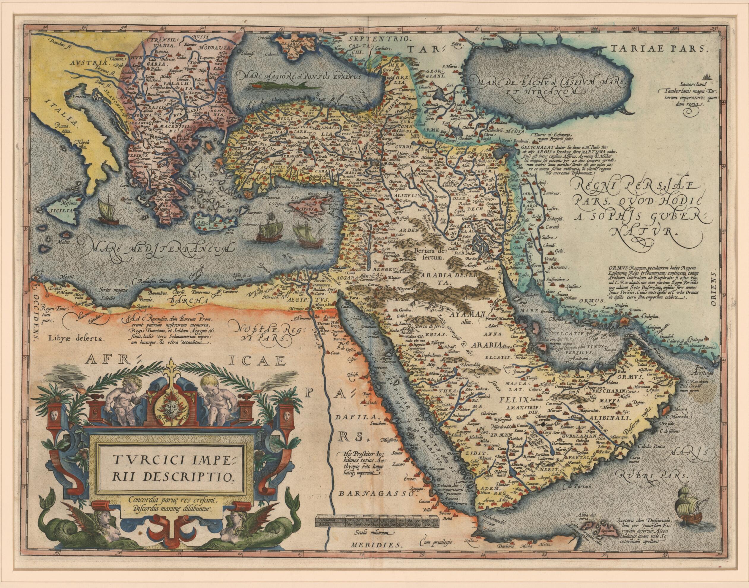
Representation of the Turkish Empire. (Turcici Imperii Descriptio) 1570
- Regular price
-
$69.95 - Regular price
-
$64.95 - Sale price
-
$69.95
Shipping calculated at checkout.
Buy one map, get any other map in our collection for 50% OFF! Add to cart to see discount.
Couldn't load pickup availability
About This Map
98) published the first edition of his Theatrum orbis terrarum (Theater of the world) in 1570. It contained 53 maps, each with a detailed commentary. It was the first true atlas in the modern sense: a bound book of map plates and accompanying text specifically produced to give a uniform, complete presentation. More than 7,300 copies of the atlas appeared in 31 editions between 1570 and 1612 in various languages, including French, Dutch, English, German, Italian, Latin, and Spanish. Ortelius began to produce his own maps from about 1560. This map of the Turkish Empire, created in about 1570 and included in the atlas, covers the Middle East, from Egypt in the west to the Caspian Sea in the east, prominently featuring the Arabian Peninsula, and extending north of the Mediterranean from Turkey across Greece to Italy. It is based on Ortelius's 1567 map of Asia but has greater detail. That map in turn depended for information on Arabia on Giacomo Gastaldi's Il Disegno della Seconda Parte dell'Asia (1561). A description of the Kingdom of Ormus (present-day Hormuz) is given in space under the ornamental label "Regni Persiae pars, quod hodie a sophis gubernator" (Part of Persia, which today is governed by philosophers). Other labels also convey information or the wisdom of the day, as in the title cartouche, which bears the aphorism "Concordia parue res crescent, Discordia maxime dilabuntur" (Harmony enables things to grow, Discord brings the greatest to ruin). Some of the coastlines are fairly accurate, although the shape of the Arabian Gulf is distorted. The map is the best known of all the 16th-century maps of the Ottoman Empire.
Created by Giacomo Gastaldi, Abraham Ortelius in 1570.
Created by Giacomo Gastaldi, Abraham Ortelius in 1570.
- Title devised, in English, by Library staff.
- Original resource extent: 1 map : hand colored ; 37 x 48 centimeters.
- Original resource at: Qatar National Library.
- Content in Latin.
- Description based on data extracted from World Digital Library, which may be extracted from partner institutions.
Map Sizing Information
- For the best legibility, order your map in the original size or larger. Most maps have intricate detail and small text that is best appreciated when the print size hasn't been reduced.
- Sizes labeled "Fits a Standard Frame" will drop right into any frame that you purchase in that size. The sizes that we offer are commonly available online and at most retail stores.
- Our standard sizes are recommendations based on the aspect ratio of the original map, but still may require some added "white space" in one dimension to fit.
- Non-standard sizes will require custom framing, and we suggest taking your print to the frame shop of your choice after you receive it for the best results.
- Custom sizes are available, simply contact us for a quote.
Below is an approximation of the scale of a few standard sizes, and how they might appear in your space.

