
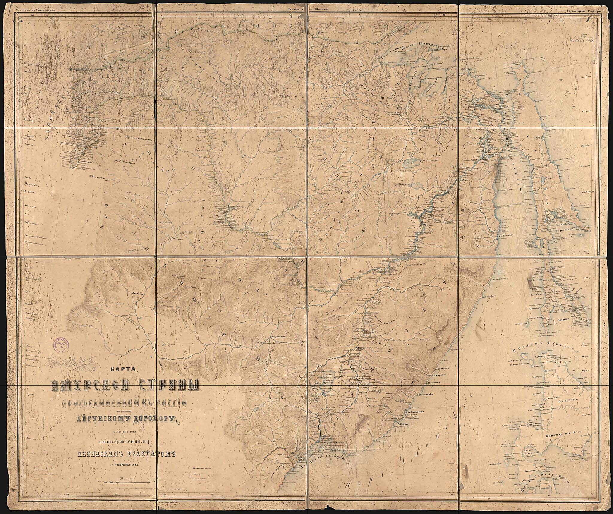
Karta Amurskoĭ Strany Prisoedinënnoĭ K Rossii Po Aĭgunskomu Dogovoru. (Карта Амурской страны присоединённой к России по Айгунскому договору.) 1860
- Regular price
-
$209.95 - Regular price
-
$204.95 - Sale price
-
$209.95
Buy one map, get any other map in our collection for 50% OFF! Add to cart to see discount.
Couldn't load pickup availability
About This Map
Discover the timeless beauty of our fine art quality printed reproduction of this antique map. Perfect for history enthusiasts, collectors, and interior decorators.
Restored with meticulous attention to detail by our team with over a decade of experience, this stunning reproduction captures the intricate artistry and historical significance of the original map.
Whether you're a collector or seeking a unique decor piece, this archival-quality map reproduction is a timeless addition to any space. Order now to bring history to life!
Old map of Amur Oblast, Russian Federation.- This map shows the Amur area acquired by Russia as part of the Treaty of Aigun. The topography of the terrain, hydrography and settled areas (cities and villages) are drawn on this map with great detail. Both the old and new borders are shown.
- 16 mai︠a︡ 1858 goda, podtverzhdennomu Pekinskim traktatom i︠a︡ noi︠a︡bri︠a︡ 1860 goda. - Sost. V Upravlenii General'nogo shtaba Vostochnoĭ Sibiri-Vyr. Slova top. Osipov; Vyr. Gory top.: Belkin, Volkov. Po Zapadnoĭ i Vostochnoĭ ramkam pokazany sootvetstvenno shiroty gorodov Evropy.
- Setka geogr. koord.; Karta ochen' vetkhai︠a︡.
- Original map at: Russian State Library
- 16 мая 1858 года, подтвержденному Пекинским трактатом я ноября 1860 года. - Сост. В Управлении Генерального штаба Восточной Сибири-Выр. Слова топ. Осипов; Выр. Горы топ.: Белкин, Волков. По Западной и Восточной рамкам показаны соответственно широты городов Европы.
- Сетка геогр. коорд.; Карта очень ветхая.
Map Subjects
Amur Oblast
Russian Federation
1860
- For the best legibility, order your map in the original size or larger. Most maps have intricate detail and small text that is best appreciated when the print size hasn't been reduced.
- Sizes labeled "Fits a Standard Frame" will drop right into any frame that you purchase in that size. The sizes that we offer are commonly available online and at most retail stores.
- Our standard sizes are recommendations based on the aspect ratio of the original map, but still may require some added "white space" in one dimension to fit.
- Non-standard sizes will require custom framing, and we suggest taking your print to the frame shop of your choice after you receive it for the best results.
- Custom sizes are available, simply contact us for a quote.
Below is an approximation of the scale of a few standard sizes, and how they might appear in your space.

