
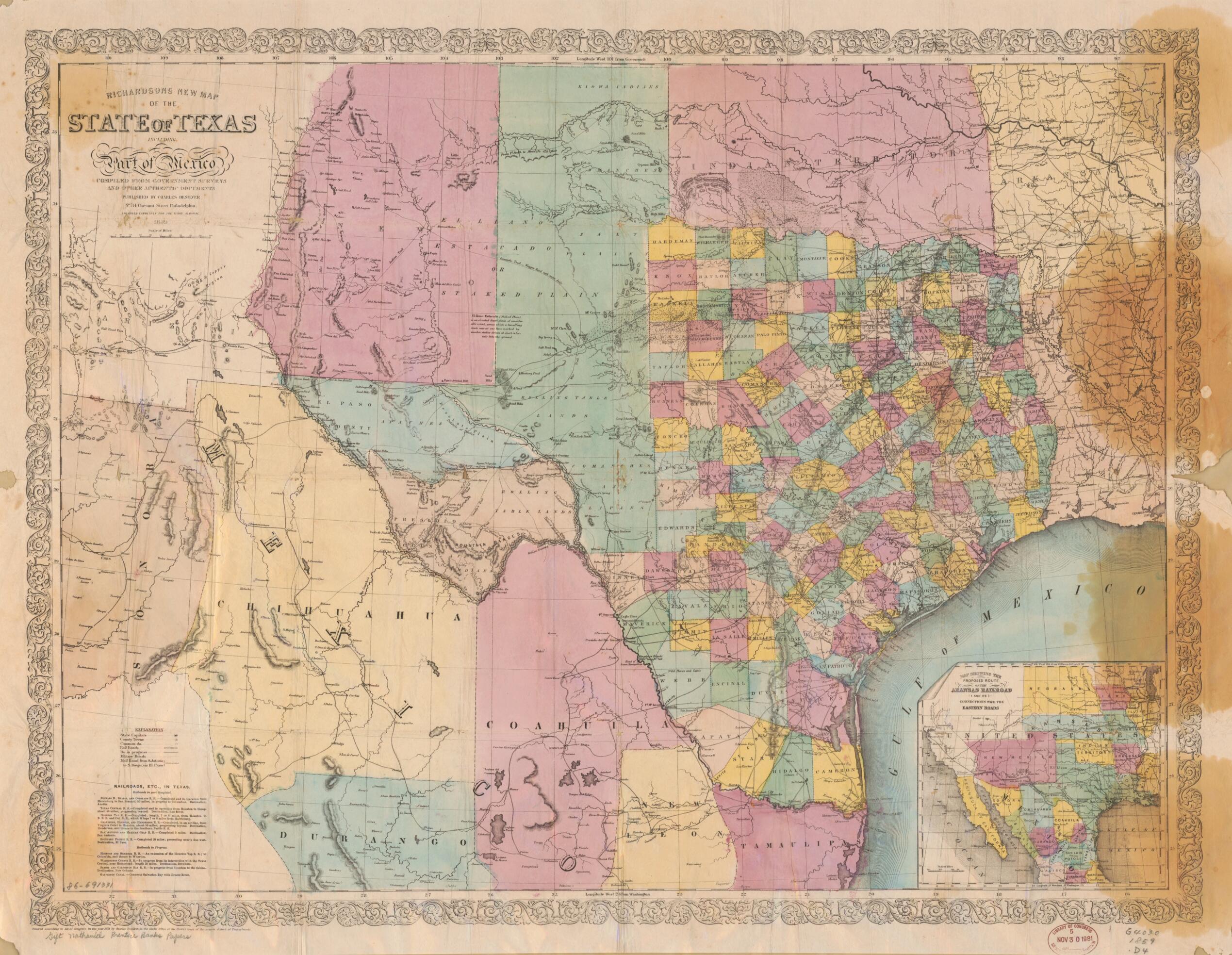
Richardsons New Map of the State of Texas, Including Part of Mexico 1859
- Regular price
-
$94.95 - Regular price
-
$89.95 - Sale price
-
$94.95
Shipping calculated at checkout.
Buy one map, get any other map in our collection for 50% OFF! Add to cart to see discount.
Couldn't load pickup availability
About This Map
Old map of Texas, United States.
Created by Nathaniel Prentiss Banks, Charles Desilver in 1859.
Created by Nathaniel Prentiss Banks, Charles Desilver in 1859.
- Shows railroads.
- Relief shown by hachures. Depths shown by form lines.
- "Compiled from government surveys and other authentic documents ... engraved expressly for the Texas almanac."
- "Entered according to Act of Congress in the year of 1858, by Charles Desilver ..."
- Includes list of railroads, etc. and "Map showing the proposed route of the Aransas railroad (and its) connections with the eastern roads."
- Acquisitions control no. 20-83
Map Sizing Information
- For the best legibility, order your map in the original size or larger. Most maps have intricate detail and small text that is best appreciated when the print size hasn't been reduced.
- Sizes labeled "Fits a Standard Frame" will drop right into any frame that you purchase in that size. The sizes that we offer are commonly available online and at most retail stores.
- Our standard sizes are recommendations based on the aspect ratio of the original map, but still may require some added "white space" in one dimension to fit.
- Non-standard sizes will require custom framing, and we suggest taking your print to the frame shop of your choice after you receive it for the best results.
- Custom sizes are available, simply contact us for a quote.
Below is an approximation of the scale of a few standard sizes, and how they might appear in your space.

