
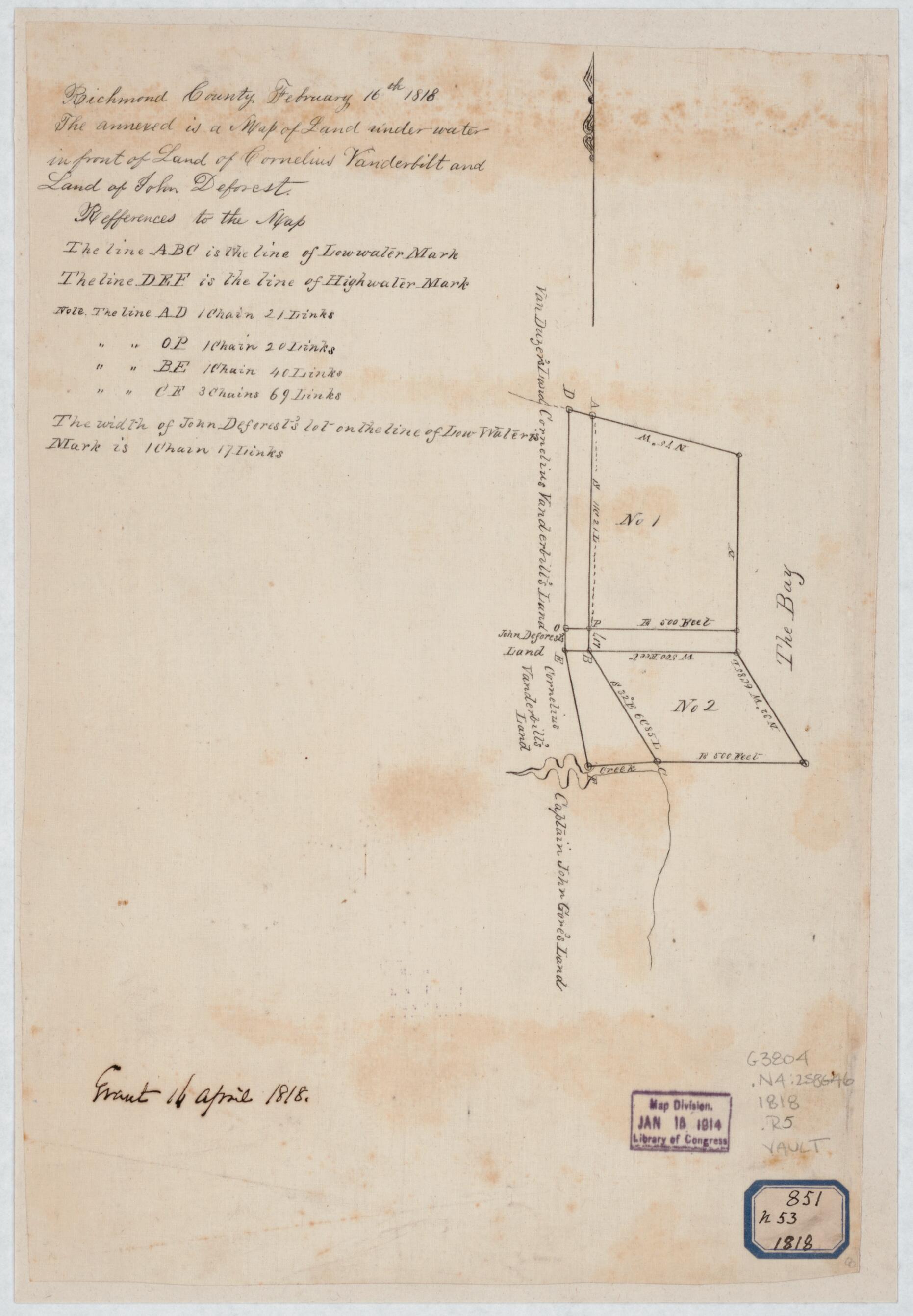
Richmond County, February 16th in 1818 : the Annexed Is a Map of Land Under Water In Front of Land of Cornelius Vanderbilt and Land of John Deforest
- Regular price
-
$49.95 - Regular price
-
$34.95 - Sale price
-
$49.95
Shipping calculated at checkout.
Buy one map, get any other map in our collection for 50% OFF! Add to cart to see discount.
Couldn't load pickup availability
About This Map
Old manuscript map / cadastral map of New York, New York (State), Staten Island, United States.
Created by U.S. Coast and Geodetic Survey, Cornelius Vanderbilt in 1818.
Created by U.S. Coast and Geodetic Survey, Cornelius Vanderbilt in 1818.
- A manuscript copy of a manuscript original.
- Pen-and-ink on tracing linen, mounted on cloth.
- In ink in another hand: grant 14 April 1818.
- Includes notes.
- In pen and ink on octagonal blue bordered label in lower right corner: 851 n 53 1818.
- Transferred from the USCGS January 15, 1914.
- Ga10 change call number
Map Sizing Information
- For the best legibility, order your map in the original size or larger. Most maps have intricate detail and small text that is best appreciated when the print size hasn't been reduced.
- Sizes labeled "Fits a Standard Frame" will drop right into any frame that you purchase in that size. The sizes that we offer are commonly available online and at most retail stores.
- Our standard sizes are recommendations based on the aspect ratio of the original map, but still may require some added "white space" in one dimension to fit.
- Non-standard sizes will require custom framing, and we suggest taking your print to the frame shop of your choice after you receive it for the best results.
- Custom sizes are available, simply contact us for a quote.
Below is an approximation of the scale of a few standard sizes, and how they might appear in your space.

