
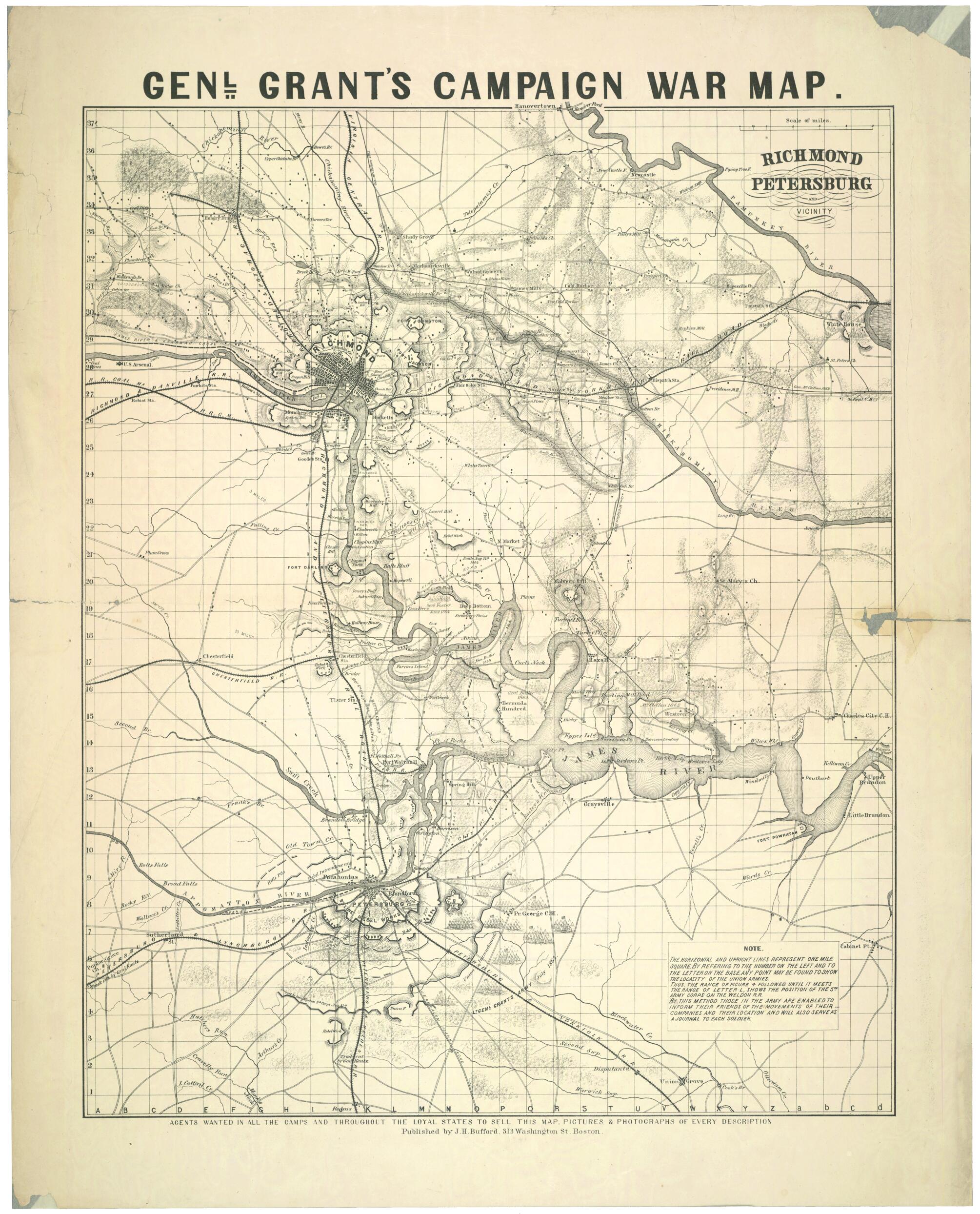
Richmond, Petersburg, and Vicinity Genl. Grant's Campaign War Map (Genl. Grant's Camgaign War Map) 1864
- Regular price
-
$70.95 - Regular price
-
$65.95 - Sale price
-
$70.95
Shipping calculated at checkout.
Buy one map, get any other map in our collection for 50% OFF! Add to cart to see discount.
Couldn't load pickup availability
About This Map
Old map of Petersburg Region, Richmond Region, Roanoke, United States, Virginia.
Created by J. Baumgarten, John Henry Bufford in 1864.
Created by J. Baumgarten, John Henry Bufford in 1864.
- "The horizontal and upright lines represent one mile square. By referring to the number on the left and to the letter on the base, any point may be found to show the locality of the Union armies ... those in the army are enabled to inform their friends of the movements of their companies, and [the map] will also serve as a journal to each soldier."
- Includes text.
- Relief shown by hachures and pictorially. Depths shown by bathymetric isolines.
- This item is in the Map Collection of the Library of Virginia; please contact the Library's Archives Research Services department for more information.
- Civil War Map
- Dec. 1999, Philadelphia Print Shop, gdc, ALE.
Map Sizing Information
- For the best legibility, order your map in the original size or larger. Most maps have intricate detail and small text that is best appreciated when the print size hasn't been reduced.
- Sizes labeled "Fits a Standard Frame" will drop right into any frame that you purchase in that size. The sizes that we offer are commonly available online and at most retail stores.
- Our standard sizes are recommendations based on the aspect ratio of the original map, but still may require some added "white space" in one dimension to fit.
- Non-standard sizes will require custom framing, and we suggest taking your print to the frame shop of your choice after you receive it for the best results.
- Custom sizes are available, simply contact us for a quote.
Below is an approximation of the scale of a few standard sizes, and how they might appear in your space.

