
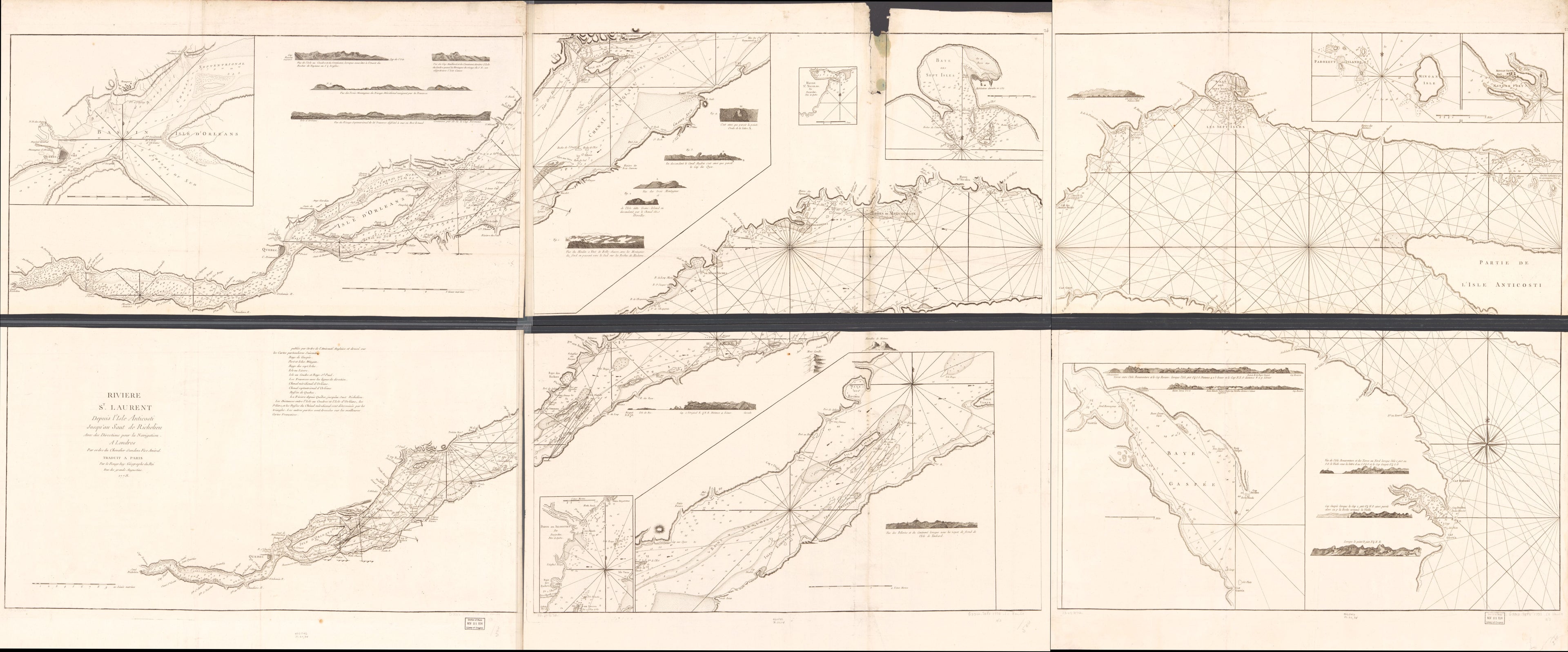
Rivière St. Laurent Depuis L'Isle Anticosti Jusqu'au Saut De Richelieu Avec Des Directions Pour La Navigation in 1778
- Regular price
-
$321.95 - Regular price
-
$316.95 - Sale price
-
$321.95
Shipping calculated at checkout.
Buy one map, get any other map in our collection for 50% OFF! Add to cart to see discount.
Couldn't load pickup availability
About This Map
Old map of North America, Saint Lawrence River.
Created by Louis in 1778.
Created by Louis in 1778.
- Scale ca. 1:150,000.
- Relief shown pictorially and by hachures. Depths shown in fathoms.
- Each sheet consists of 2 sections glued together.
- "Publiée par ordre de l'ámirauté anglaise et dressé sur les cartes particulieres suivantes."
- From the author's Pilote américain septentrional. 1778-9, v. 2.
- Plate no: 26,24,22.
- Includes text and 17 coastal views.
- Insets: [Rivière St. Laurent: Quebec à l'isle d'Orléans]--[Rivière St. Laurent: Sauts Richelieu à Banc Anglais]--Havre St. Nicolas.--Baye des Sept Isles.--[Mingan Isle]--[Mingan Port]--[Baye Gaspée]--[Rivière St. Laurent: Banc Anglais à Isle Verte]--Pointe aux Allouettes.
- ACCR2
Map Sizing Information
- For the best legibility, order your map in the original size or larger. Most maps have intricate detail and small text that is best appreciated when the print size hasn't been reduced.
- Sizes labeled "Fits a Standard Frame" will drop right into any frame that you purchase in that size. The sizes that we offer are commonly available online and at most retail stores.
- Our standard sizes are recommendations based on the aspect ratio of the original map, but still may require some added "white space" in one dimension to fit.
- Non-standard sizes will require custom framing, and we suggest taking your print to the frame shop of your choice after you receive it for the best results.
- Custom sizes are available, simply contact us for a quote.
Below is an approximation of the scale of a few standard sizes, and how they might appear in your space.
