
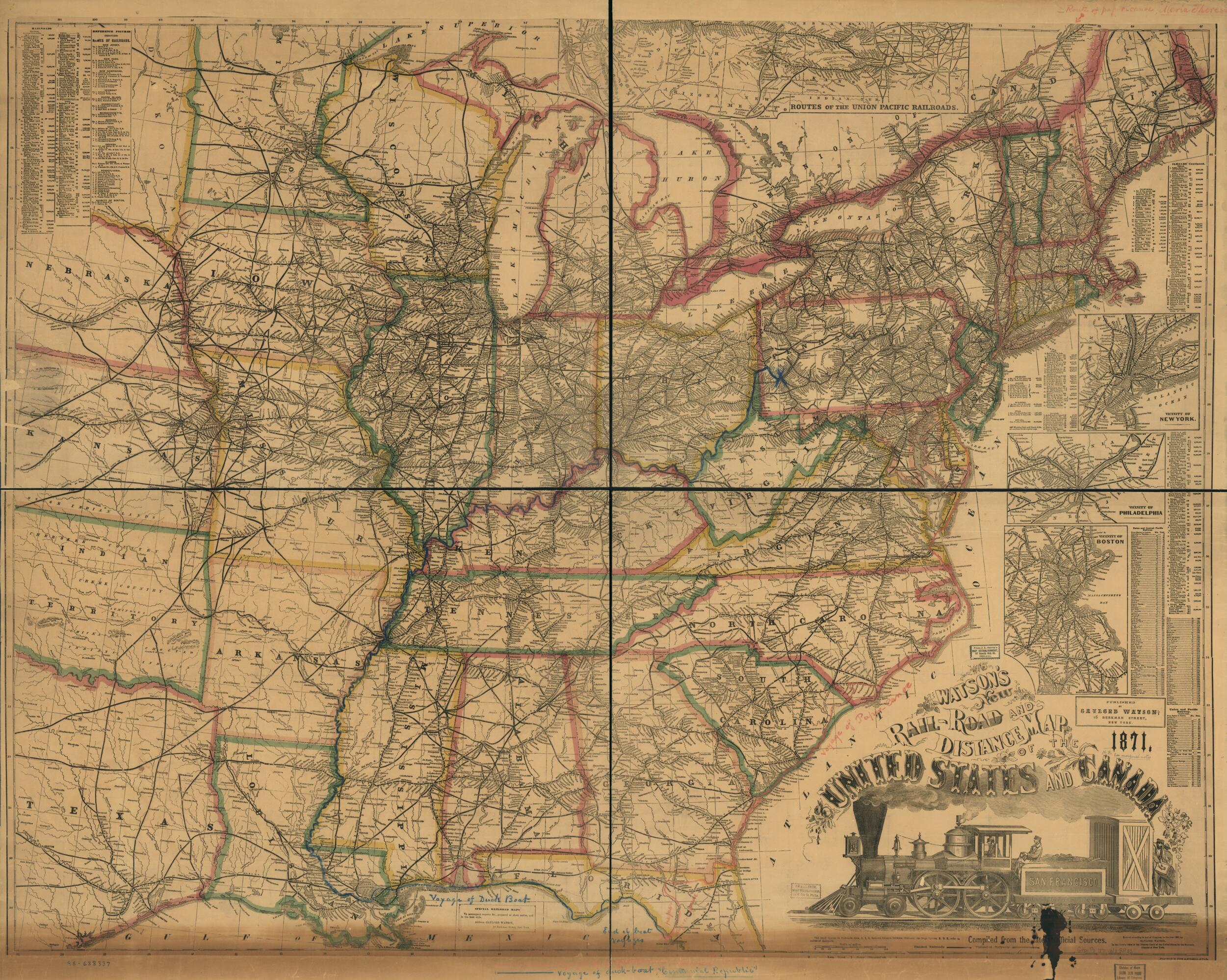
Road and Distance Map of the United States and Canada, in 1871; Compiled From the Latest Official Sources
- Regular price
-
$178.95 - Regular price
-
$173.95 - Sale price
-
$178.95
Shipping calculated at checkout.
Buy one map, get any other map in our collection for 50% OFF! Add to cart to see discount.
Couldn't load pickup availability
About This Map
Old map of Canada, United States.
Eastern half of the United States showing drainage, cities and towns, counties, and the railroads with mileage and names of lines. Smithsonian Deposit May 27, 1931.
Created by Gaylord Watson in 1871.
Eastern half of the United States showing drainage, cities and towns, counties, and the railroads with mileage and names of lines. Smithsonian Deposit May 27, 1931.
Created by Gaylord Watson in 1871.
- Scale ca. 1:2,300,000.
- "Special railroad maps to accompany reports &c., prepared at short notice, and in best style. Address Gaylord Watson, 16 Beckman Street, New York."
- Annotated in colored crayons to show "Voyage of duck-boat Centennial Republic" and "paper canoe Maria Theresa."
- Description derived from published bibliography.
- Insets: Routes of the Union Pacific Railroads. 40 x 9 cm.--Vicinity of New York. 12 x 12 cm.--Vicinity of Philadelphia. 9 x 16 cm.--Vicinity of Boston. 17 x 13 cm.
Map Sizing Information
- For the best legibility, order your map in the original size or larger. Most maps have intricate detail and small text that is best appreciated when the print size hasn't been reduced.
- Sizes labeled "Fits a Standard Frame" will drop right into any frame that you purchase in that size. The sizes that we offer are commonly available online and at most retail stores.
- Our standard sizes are recommendations based on the aspect ratio of the original map, but still may require some added "white space" in one dimension to fit.
- Non-standard sizes will require custom framing, and we suggest taking your print to the frame shop of your choice after you receive it for the best results.
- Custom sizes are available, simply contact us for a quote.
Below is an approximation of the scale of a few standard sizes, and how they might appear in your space.

