
Road Road Route from Boston, Massachusetts to Chicago, Illinois 1859
- Regular price
-
$49.95 - Regular price
-
$34.95 - Sale price
-
$49.95
Shipping calculated at checkout.
Buy one map, get any other map in our collection for 50% OFF! Add to cart to see discount.
Couldn't load pickup availability
About This Map
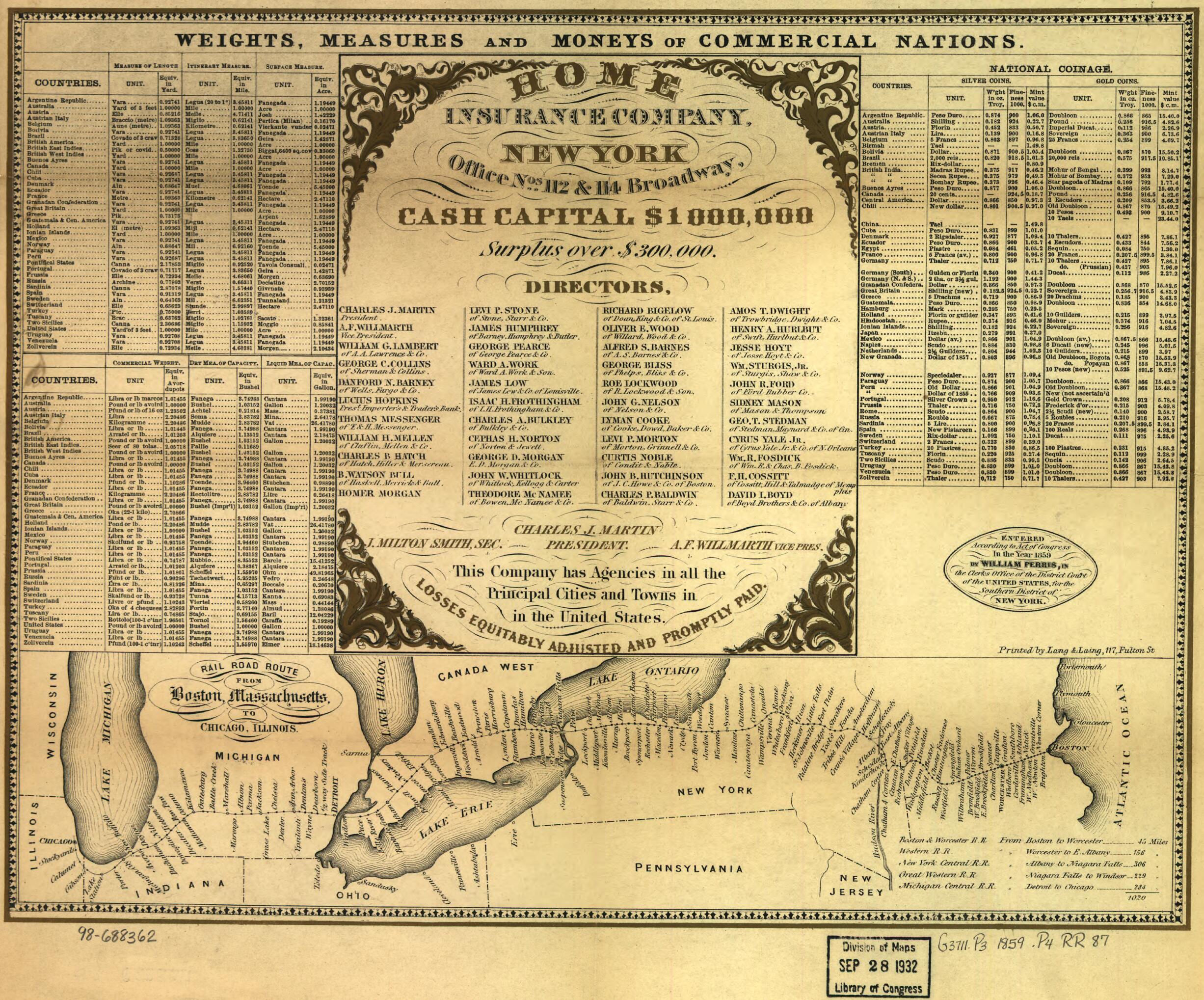
Old map of Canada, Northeastern States, Ontario, United States.
Outline map of a strip between Boston and Chicago showing one schematic rail line with many railroad stations named along the line. Mileage table indicating five railroads is at lower right of map.
Created by William Perris in 1859.
Outline map of a strip between Boston and Chicago showing one schematic rail line with many railroad stations named along the line. Mileage table indicating five railroads is at lower right of map.
Created by William Perris in 1859.
- Scale ca. 1:6,300,000.
- At top of map: Weights, measures and moneys of commercial nations.
- At top center of map: Color advertisement of the "Home Insurance Company, New York"
- Description derived from published bibliography.
Map Sizing Information
- For the best legibility, order your map in the original size or larger. Most maps have intricate detail and small text that is best appreciated when the print size hasn't been reduced.
- Sizes labeled "Fits a Standard Frame" will drop right into any frame that you purchase in that size. The sizes that we offer are commonly available online and at most retail stores.
- Our standard sizes are recommendations based on the aspect ratio of the original map, but still may require some added "white space" in one dimension to fit.
- Non-standard sizes will require custom framing, and we suggest taking your print to the frame shop of your choice after you receive it for the best results.
- Custom sizes are available, simply contact us for a quote.
Below is an approximation of the scale of a few standard sizes, and how they might appear in your space.

