
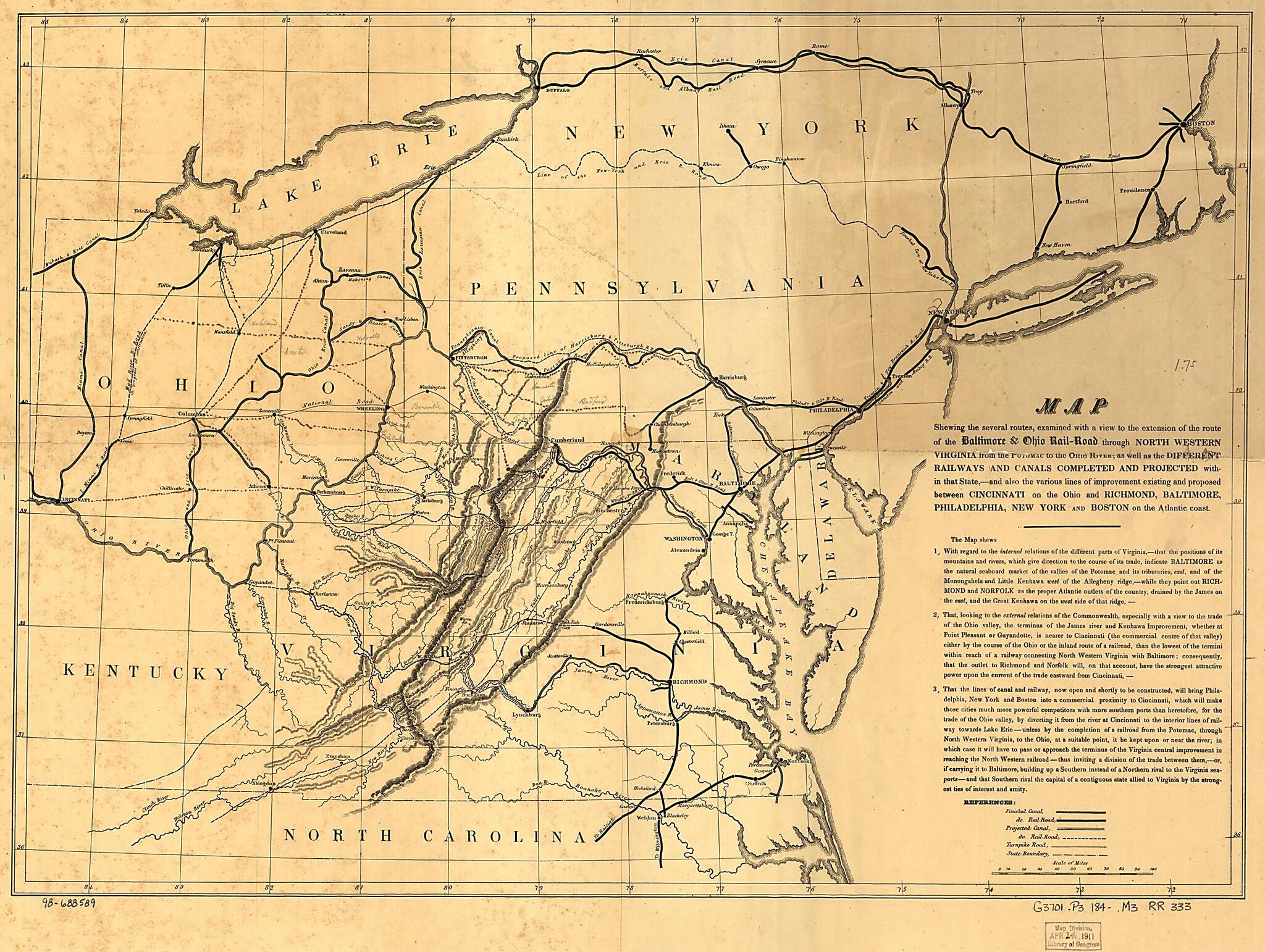
Road Through North Western Virginia from the Potomac to the Ohio River; As Well As the Different Railways and Canals Completed and Projected Within That State,--and Also the Various Lines of Improvement Existing and Proposed Between Cincinnati On the ...
- Regular price
-
$52.95 - Regular price
-
$47.95 - Sale price
-
$52.95
Shipping calculated at checkout.
Buy one map, get any other map in our collection for 50% OFF! Add to cart to see discount.
Couldn't load pickup availability
About This Map
Old map of Middle Atlantic States, United States.
Map of the northeastern United States showing drainage, relief by hachures, important cities, the existing railroads, turnpike roads, canals, and the projected railroads; a statement below the title explains the feasibility of the extension; ink and pencil annotations indicate other connecting lines and several cities.
Created by Baltimore and Ohio Railroad Company in 1840.
- Scale ca. 1:2,000,000.
- Description derived from published bibliography.
Map Subjects
Baltimore And Ohio Railroad Company
Middle Atlantic States
Railroads
United States
1840
Map Sizing Information
- For the best legibility, order your map in the original size or larger. Most maps have intricate detail and small text that is best appreciated when the print size hasn't been reduced.
- Sizes labeled "Fits a Standard Frame" will drop right into any frame that you purchase in that size. The sizes that we offer are commonly available online and at most retail stores.
- Our standard sizes are recommendations based on the aspect ratio of the original map, but still may require some added "white space" in one dimension to fit.
- Non-standard sizes will require custom framing, and we suggest taking your print to the frame shop of your choice after you receive it for the best results.
- Custom sizes are available, simply contact us for a quote.
Below is an approximation of the scale of a few standard sizes, and how they might appear in your space.

