
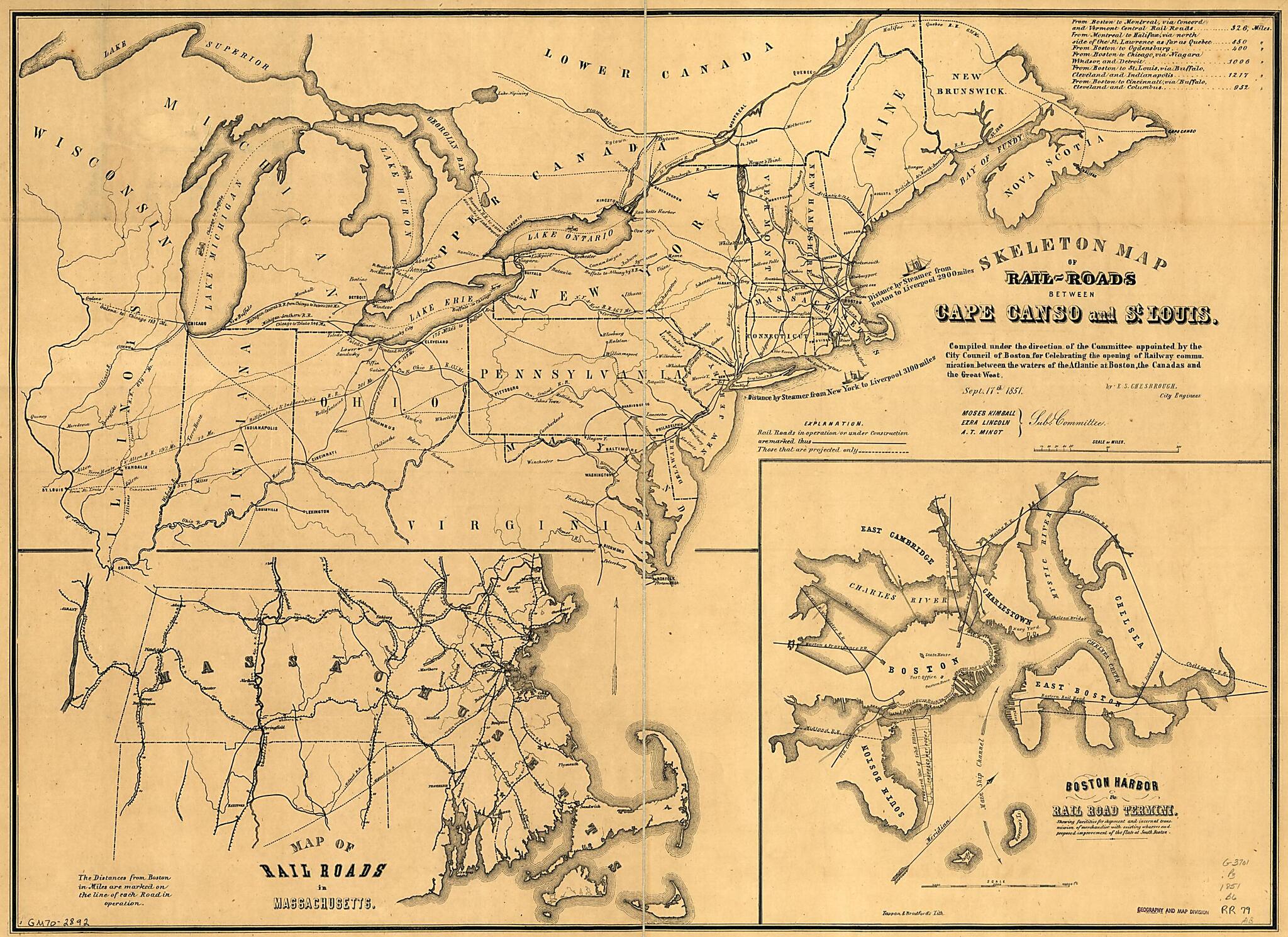
Roads Between Cape Canso and St. Louis 1851
- Regular price
-
$81.95 - Regular price
-
$76.95 - Sale price
-
$81.95
Shipping calculated at checkout.
Buy one map, get any other map in our collection for 50% OFF! Add to cart to see discount.
Couldn't load pickup availability
About This Map
Created by Boston (Mass.). Engineering Department, Ellis Sylvester Chesbrough, Tappan & Bradford in 1851.
- Scale ca. 1:3,375,000.
- Shows railroads in operation or under construction and projected railroads in the northeastern United States and part of Canada..
- Includes distance chart and insets "Map of rail roads in Massachusetts" and "Boston harbor & rail road termini."
- Same as G3711.P3 1851 .B6 (81-692879)
Map Subjects
Railroads
United States
Boston (Mass.). Engineering Department
Ellis Sylvester Chesbrough
Tappan & Bradford
1851
Map Sizing Information
- For the best legibility, order your map in the original size or larger. Most maps have intricate detail and small text that is best appreciated when the print size hasn't been reduced.
- Sizes labeled "Fits a Standard Frame" will drop right into any frame that you purchase in that size. The sizes that we offer are commonly available online and at most retail stores.
- Our standard sizes are recommendations based on the aspect ratio of the original map, but still may require some added "white space" in one dimension to fit.
- Non-standard sizes will require custom framing, and we suggest taking your print to the frame shop of your choice after you receive it for the best results.
- Custom sizes are available, simply contact us for a quote.
Below is an approximation of the scale of a few standard sizes, and how they might appear in your space.

