
Roads of the State of New York 1861
- Regular price
-
$81.95 - Regular price
-
$76.95 - Sale price
-
$81.95
Shipping calculated at checkout.
Buy one map, get any other map in our collection for 50% OFF! Add to cart to see discount.
Couldn't load pickup availability
About This Map
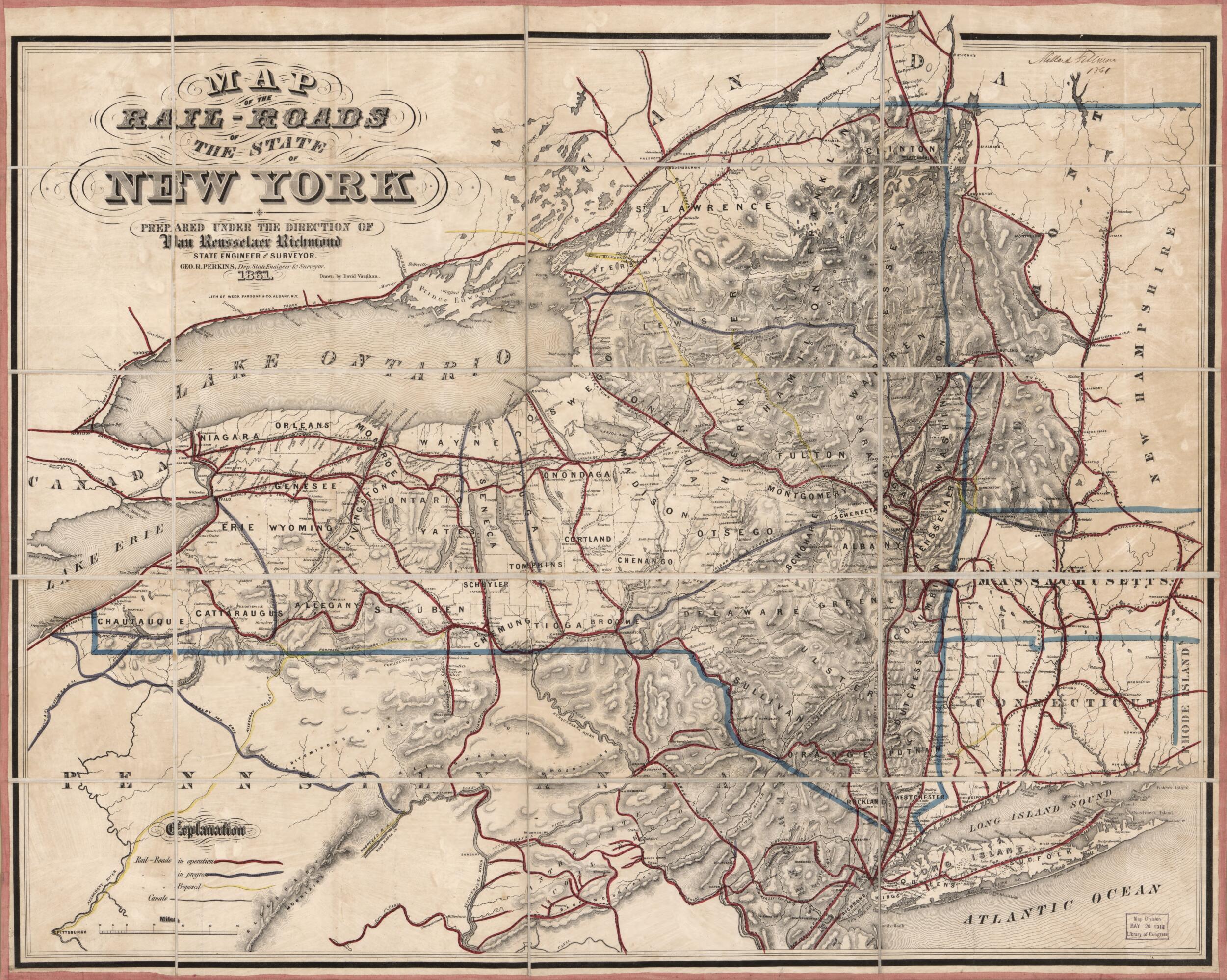
Old map of New York, New York (State), United States.
Created by New York (State). State Engineer and Surveyor, George R. (George Roberts) Perkins, Van Rensselaer Richmond in 1861.
Created by New York (State). State Engineer and Surveyor, George R. (George Roberts) Perkins, Van Rensselaer Richmond in 1861.
- Covers New York State and parts of adjacent states/provinces.
- Also shows canals.
- Relief shown by hachures.
- Hand colored in red to emphasize railroads in service/abuilding/proposed and in blue to emphasize state lines.
- Signed in ink script at upper right: Millard Fillmore 1861; and on verso on cloth backing: No. 107. Millard Fillmore. May 15, 1861.
- Paper label with inked script attached to verso: New York rail roads 1861. No. 107.
Map Sizing Information
- For the best legibility, order your map in the original size or larger. Most maps have intricate detail and small text that is best appreciated when the print size hasn't been reduced.
- Sizes labeled "Fits a Standard Frame" will drop right into any frame that you purchase in that size. The sizes that we offer are commonly available online and at most retail stores.
- Our standard sizes are recommendations based on the aspect ratio of the original map, but still may require some added "white space" in one dimension to fit.
- Non-standard sizes will require custom framing, and we suggest taking your print to the frame shop of your choice after you receive it for the best results.
- Custom sizes are available, simply contact us for a quote.
Below is an approximation of the scale of a few standard sizes, and how they might appear in your space.

