
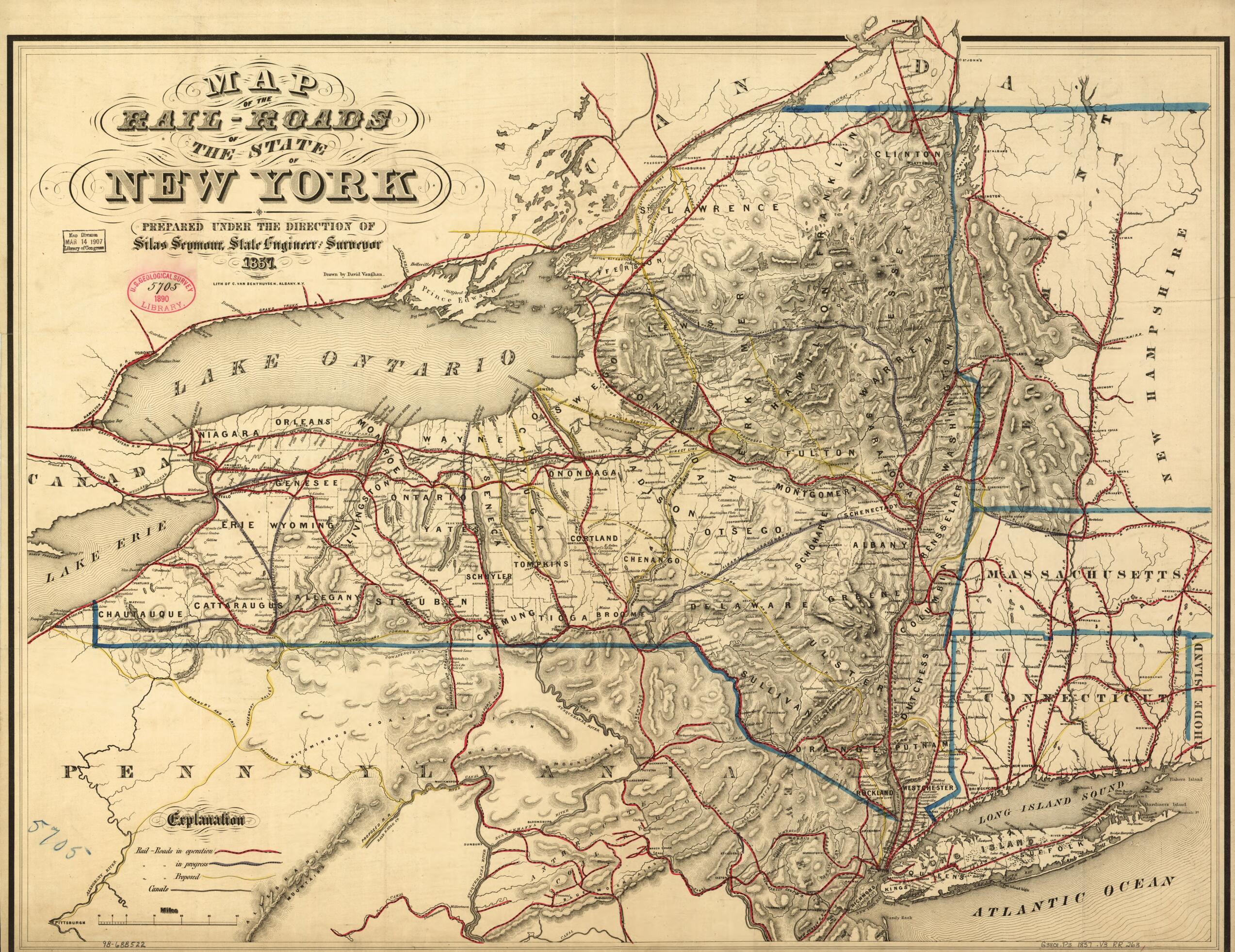
Roads of the State of New York Prepared Under the Direction of Silas Seymour, State Engineer Surveyor in 1857
- Regular price
-
$78.95 - Regular price
-
$73.95 - Sale price
-
$78.95
Shipping calculated at checkout.
Buy one map, get any other map in our collection for 50% OFF! Add to cart to see discount.
Couldn't load pickup availability
About This Map
Old map of New York, New York (State), United States.
Map of New York and parts of adjacent states showing drainage, relief by hachures, county boundaries, cities and towns. Different colors indicate railroads in operation, in progress of construction, and proposed.
Created by David Vaughan in 1857.
Map of New York and parts of adjacent states showing drainage, relief by hachures, county boundaries, cities and towns. Different colors indicate railroads in operation, in progress of construction, and proposed.
Created by David Vaughan in 1857.
- Scale ca. 1:1,000,000.
- Description derived from published bibliography.
Map Sizing Information
- For the best legibility, order your map in the original size or larger. Most maps have intricate detail and small text that is best appreciated when the print size hasn't been reduced.
- Sizes labeled "Fits a Standard Frame" will drop right into any frame that you purchase in that size. The sizes that we offer are commonly available online and at most retail stores.
- Our standard sizes are recommendations based on the aspect ratio of the original map, but still may require some added "white space" in one dimension to fit.
- Non-standard sizes will require custom framing, and we suggest taking your print to the frame shop of your choice after you receive it for the best results.
- Custom sizes are available, simply contact us for a quote.
Below is an approximation of the scale of a few standard sizes, and how they might appear in your space.

