
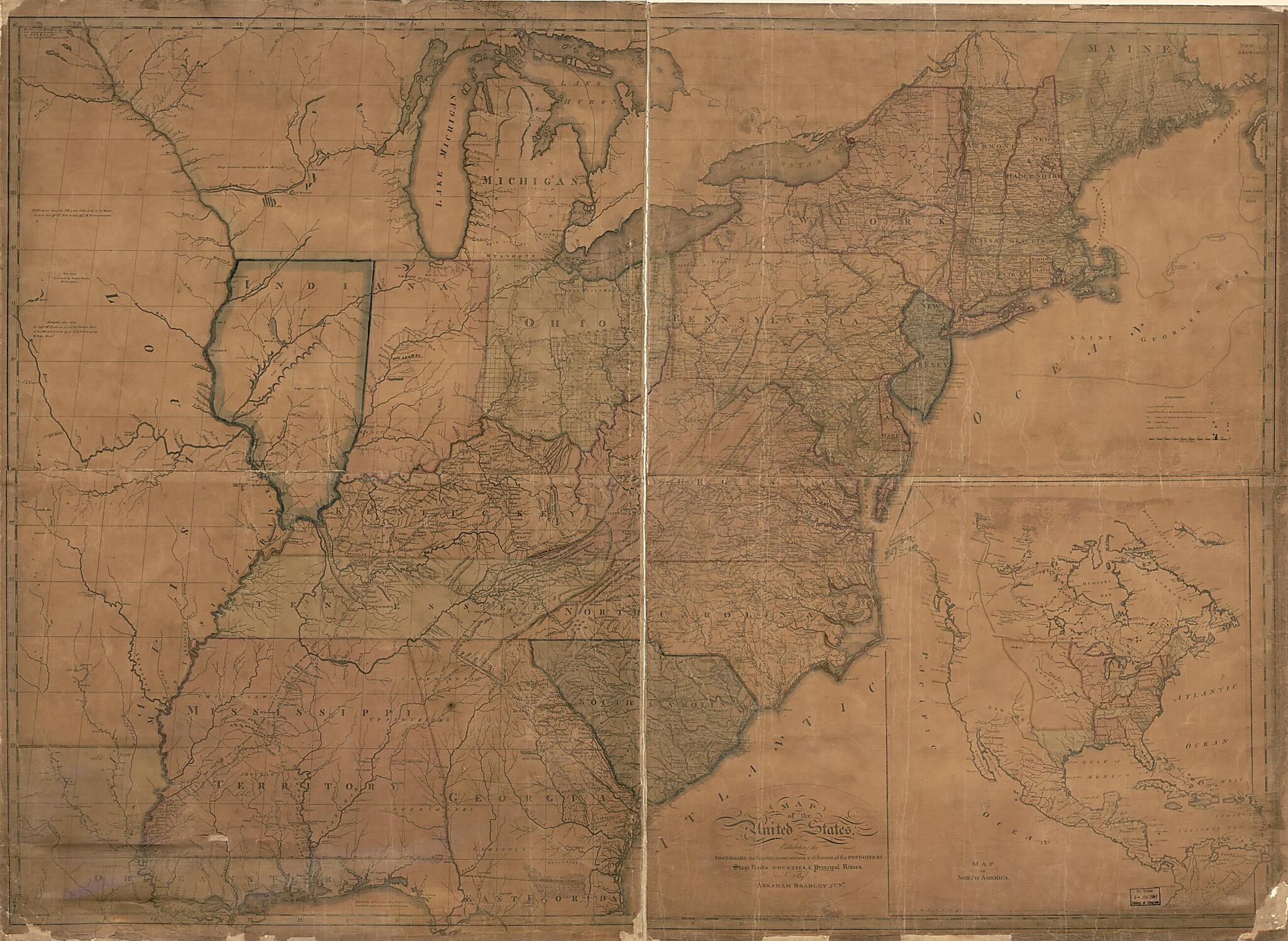
Roads, the Situations, Connexions & Distances of the Post-offices, Stage Roads, Counties & Principal Rivers (Bradley's Map of the United States :) 1804
- Regular price
-
$204.95 - Regular price
-
$199.95 - Sale price
-
$204.95
Shipping calculated at checkout.
Buy one map, get any other map in our collection for 50% OFF! Add to cart to see discount.
Couldn't load pickup availability
About This Map
Old map of North America, United States.
Created by Abraham Bradley, Caldcleugh and Thomas in 1804.
Created by Abraham Bradley, Caldcleugh and Thomas in 1804.
- Relief shown pictorially.
- Also shows townships in parts of Maine, New York, and Indiana Territory. Illinois (not named) is shown as part of Indiana Territory.
- Slipcase title and publisher's statement from printed labels affixed to slipcase.
- Earliest state of the 5th ed.
- Prime meridian: Washington D.C.
- "Entered according to the Act of Congress the 2nd day of June 1804 by Abraham Bradley Jun'r of the District of Columbia."
- Sectioned (to 36 panels) and mounted on cloth backing to fold to 23 x 17 cm.
- This map has some imperfections: lightly foxed, worm-holed in margin, slip-case flattened. We'll do our best to restore the image before printing.
- Includes notes in map area and inset "Map of North America" (scale ca. 1:17,000,000).
Map Subjects
Counties
North America
Post Roads
United States
Abraham Bradley
Caldcleugh And Thomas
1804
Map Sizing Information
- For the best legibility, order your map in the original size or larger. Most maps have intricate detail and small text that is best appreciated when the print size hasn't been reduced.
- Sizes labeled "Fits a Standard Frame" will drop right into any frame that you purchase in that size. The sizes that we offer are commonly available online and at most retail stores.
- Our standard sizes are recommendations based on the aspect ratio of the original map, but still may require some added "white space" in one dimension to fit.
- Non-standard sizes will require custom framing, and we suggest taking your print to the frame shop of your choice after you receive it for the best results.
- Custom sizes are available, simply contact us for a quote.
Below is an approximation of the scale of a few standard sizes, and how they might appear in your space.

