
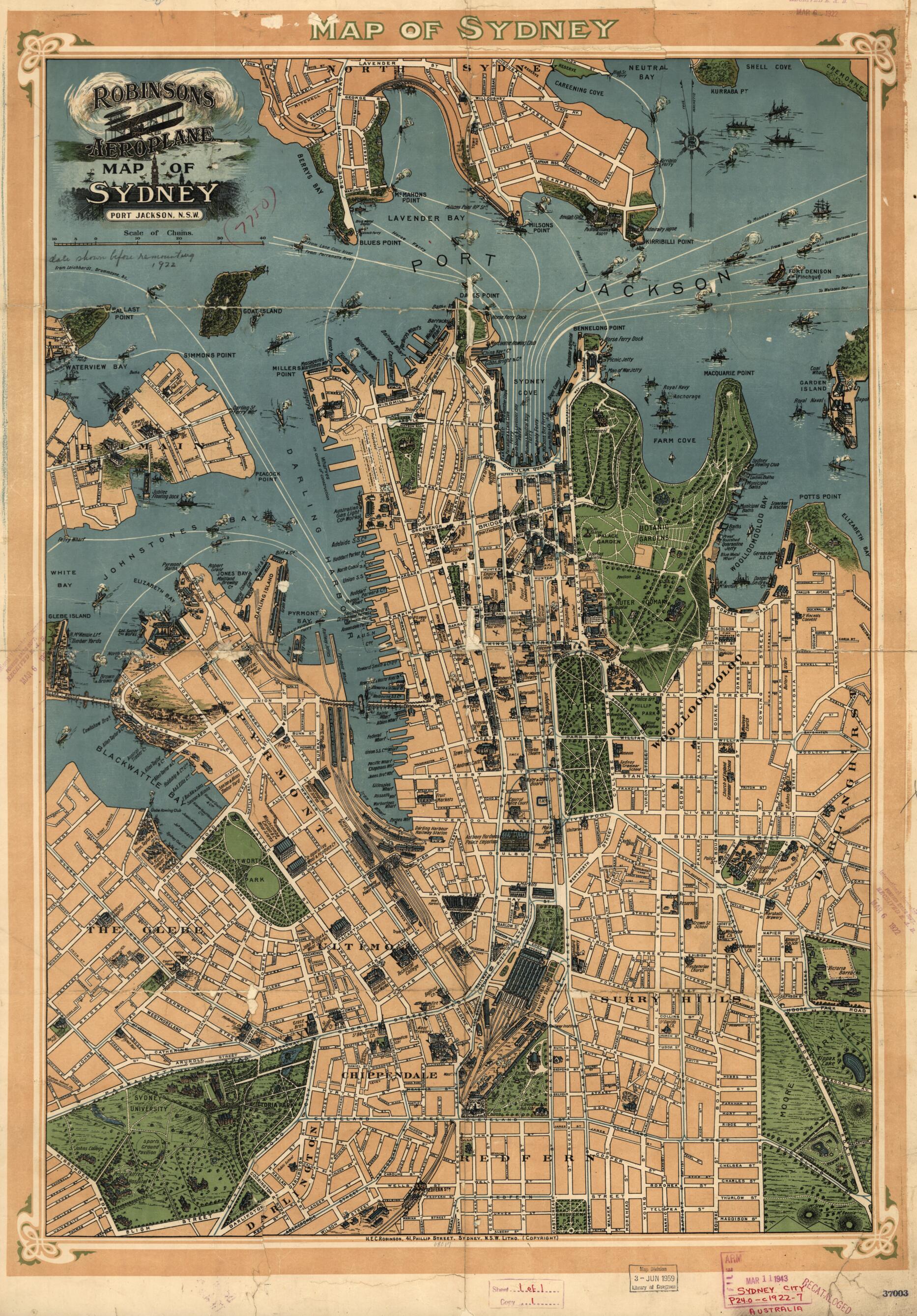
Robinson's Aeroplane Map of Sydney., Robinson's Aeroplane Map of Sydney in 1909, 1909
- Regular price
-
$83.95 - Regular price
-
$78.95 - Sale price
-
$83.95
Shipping calculated at checkout.
Buy one map, get any other map in our collection for 50% OFF! Add to cart to see discount.
Couldn't load pickup availability
About This Map
Old map of Australia, New South Wales, Sydney, Australia, New South Wales, Sydney.
Created by H.E.C. Robinson Pty. Ltd, H.E.C. Robinson Pty. Ltd in 1909, 1909.
Created by H.E.C. Robinson Pty. Ltd, H.E.C. Robinson Pty. Ltd in 1909, 1909.
- At head of title above neat line: Map of Sydney.
- Covers Sydney from Careening Cove to Redfern Park and from Glebe Island to Elzabeth Bay.
- Selected buildings shown pictorially.
- Shows pictorial views of important buildings, named roads and streets, wharves, parks and ferry routes.
- Publication date inferred from date on OPAC of National Library of Australia, Jan. 21, 2020; Dating: 1909?. Wharves between Miller's Point and Gasworks under construction 1909-10. Wharves between Millers Point were reconstructed from 1910 on. (Source: Sydney Harbour Trust; Report, 1910). Finger wharf, completed 1915, not shown on this map.
- Available also through the Library of Congress web site as a raster image.
Map Sizing Information
- For the best legibility, order your map in the original size or larger. Most maps have intricate detail and small text that is best appreciated when the print size hasn't been reduced.
- Sizes labeled "Fits a Standard Frame" will drop right into any frame that you purchase in that size. The sizes that we offer are commonly available online and at most retail stores.
- Our standard sizes are recommendations based on the aspect ratio of the original map, but still may require some added "white space" in one dimension to fit.
- Non-standard sizes will require custom framing, and we suggest taking your print to the frame shop of your choice after you receive it for the best results.
- Custom sizes are available, simply contact us for a quote.
Below is an approximation of the scale of a few standard sizes, and how they might appear in your space.

