
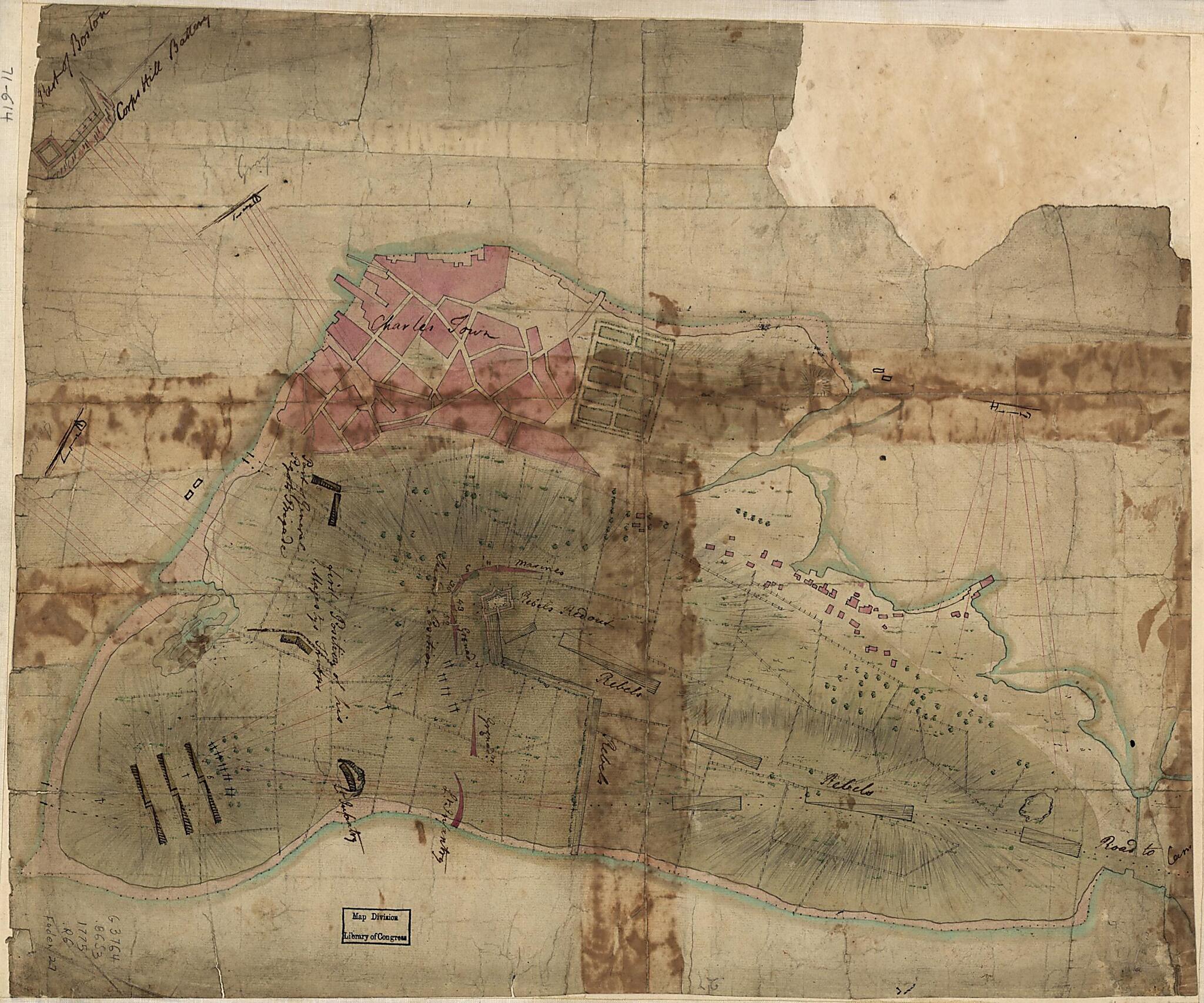
Rough Draft of Charlestown, In Water Colour 1775
- Regular price
-
$49.95 - Regular price
-
$29.95 - Sale price
-
$49.95
Shipping calculated at checkout.
Buy one map, get any other map in our collection for 50% OFF! Add to cart to see discount.
Couldn't load pickup availability
About This Map
Old map of Boston (Bunker Hill), Massachusetts, United States.
- Scale ca. 1:4,500.
- Title from William Faden's Catalogue of a curious and valuable collection of original maps and plans, 1862.
- Manuscript, pen-and-ink and watercolor.
- Has watermarks.
- Oriented with north toward the upper right.
- Relief shown by hachures.
- Shows position of British and "Rebel" troops during the Battle of Bunker Hill.
- North is oriented to the bottom.
- Called a rough draft of the same cartographer's "Plan of Charles Town... after the action of the 17th. June 1775." (Faden 28). It is however, a detailed delineation of the Battle of Bunker Hill.
- Names and writing are similar to Lieut. Page's Plan of action which happen'd 17th. June 1775. (Faden 25)
Map Subjects
Boston (Bunker Hill)
Bunker Hill Battle Of Boston Mass
Early Works To 1800
Maps Manuscript
Massachusetts
United States
1775
Map Sizing Information
- For the best legibility, order your map in the original size or larger. Most maps have intricate detail and small text that is best appreciated when the print size hasn't been reduced.
- Sizes labeled "Fits a Standard Frame" will drop right into any frame that you purchase in that size. The sizes that we offer are commonly available online and at most retail stores.
- Our standard sizes are recommendations based on the aspect ratio of the original map, but still may require some added "white space" in one dimension to fit.
- Non-standard sizes will require custom framing, and we suggest taking your print to the frame shop of your choice after you receive it for the best results.
- Custom sizes are available, simply contact us for a quote.
Below is an approximation of the scale of a few standard sizes, and how they might appear in your space.

