
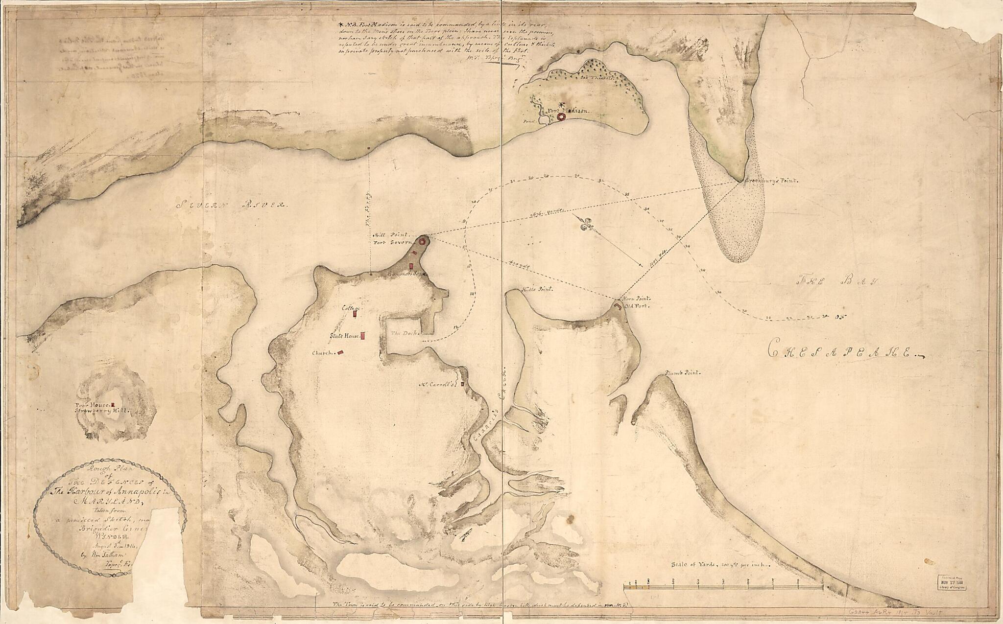
Rough Plan of the Defences of the Harbour of Annapolis In Maryland (Plan of the Works for the Defense of Annapolis) 1814
- Regular price
-
$185.95 - Regular price
-
$180.95 - Sale price
-
$185.95
Shipping calculated at checkout.
Buy one map, get any other map in our collection for 50% OFF! Add to cart to see discount.
Couldn't load pickup availability
About This Map
Old map of Annapolis, Maryland, Severn River, United States.
Created by William Tatham, William Henry Winder in 1814.
Created by William Tatham, William Henry Winder in 1814.
- Shows forts in Annapolis and along the lower Severn River. Also shows harbor and public buildings in Annapolis.
- Relief shown by shading.
- Oriented with north toward the upper left.
- Manuscript: Black ink, red watercolor for forts and buildings, green and brown watercolor washes for shading.
- Watermark: JWhathan [sp.?].
- Originally drawn on 2 sheets (now conjoined).
- Sheet halved to enable folding.
- Missing edge sections and portion of title cartouche including small parts of title wording.
- Mounted on stiff paper base with cloth backing.
- Includes handwritten text re Fort Madison at top, note at bottom, and bordered ovoid title cartouche.
Map Subjects
Annapolis
Annapolis (Md.)
Fortification
Harbors
Maps Manuscript
Maryland
Severn River
Severn River (Md.)
United States
William Tatham
William Henry Winder
1814
Map Sizing Information
- For the best legibility, order your map in the original size or larger. Most maps have intricate detail and small text that is best appreciated when the print size hasn't been reduced.
- Sizes labeled "Fits a Standard Frame" will drop right into any frame that you purchase in that size. The sizes that we offer are commonly available online and at most retail stores.
- Our standard sizes are recommendations based on the aspect ratio of the original map, but still may require some added "white space" in one dimension to fit.
- Non-standard sizes will require custom framing, and we suggest taking your print to the frame shop of your choice after you receive it for the best results.
- Custom sizes are available, simply contact us for a quote.
Below is an approximation of the scale of a few standard sizes, and how they might appear in your space.
