
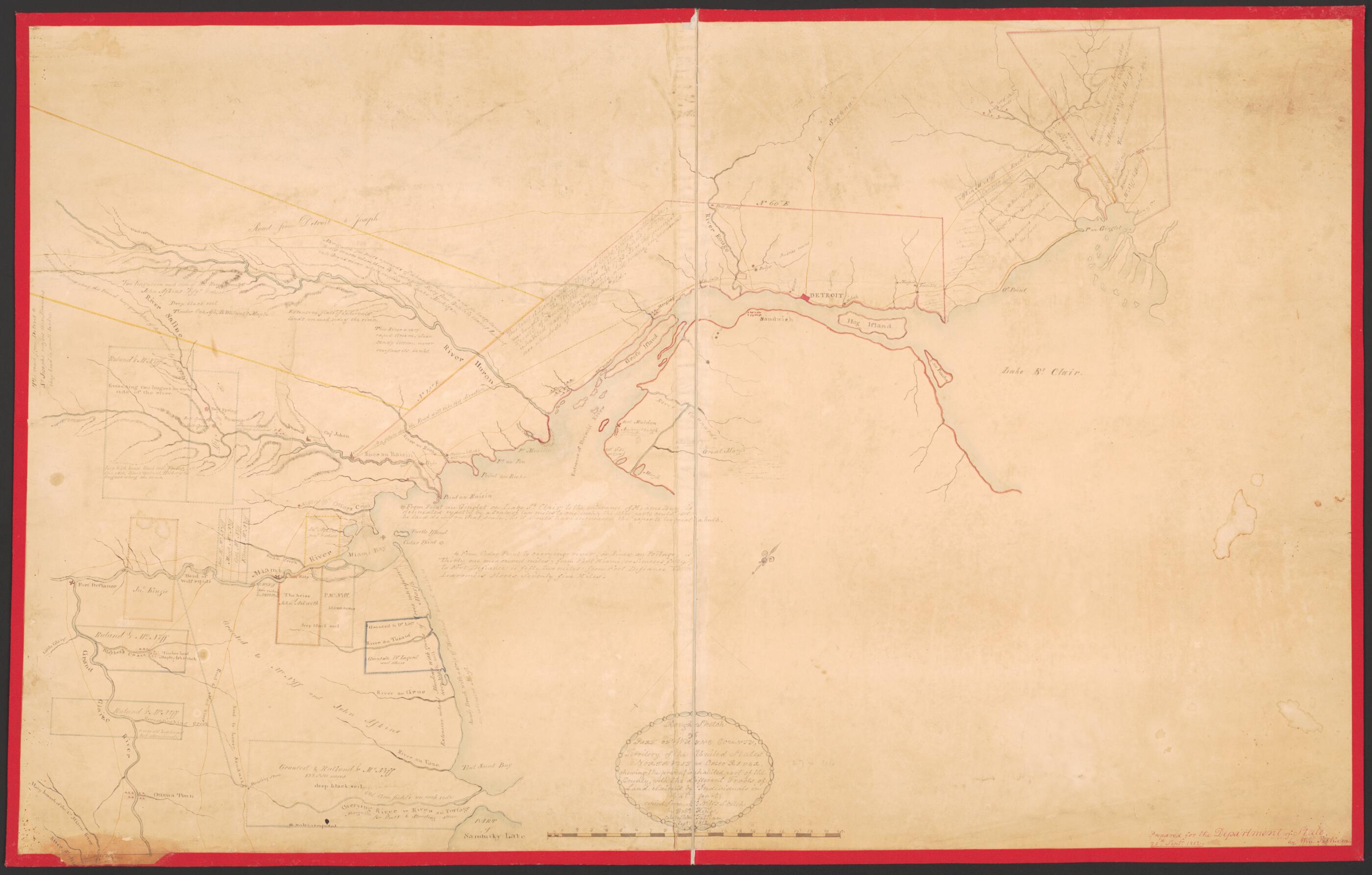
Rough Sketch of Part of Wayne County, Territority of United States : Northwest of Ohio River, Showing the Present Inhabited Part of the Country, With the Different Tracts of Land Claimed by Individuals In That Part 1812
- Regular price
-
$135.95 - Regular price
-
$130.95 - Sale price
-
$135.95
Shipping calculated at checkout.
Buy one map, get any other map in our collection for 50% OFF! Add to cart to see discount.
Couldn't load pickup availability
About This Map
Old manuscript map of Michigan, United States, Wayne County.
Created by William Tatham in 1812.
Created by William Tatham in 1812.
- Map of the western shore of Lake Erie from Sandusky Bay, Ohio to Lake St. Clair.
- "Prepared for the Department of State by Wm. Tatham, 25th Septr. 1812"--Lower right in red ink.
- Land Ownership Map
Map Sizing Information
- For the best legibility, order your map in the original size or larger. Most maps have intricate detail and small text that is best appreciated when the print size hasn't been reduced.
- Sizes labeled "Fits a Standard Frame" will drop right into any frame that you purchase in that size. The sizes that we offer are commonly available online and at most retail stores.
- Our standard sizes are recommendations based on the aspect ratio of the original map, but still may require some added "white space" in one dimension to fit.
- Non-standard sizes will require custom framing, and we suggest taking your print to the frame shop of your choice after you receive it for the best results.
- Custom sizes are available, simply contact us for a quote.
Below is an approximation of the scale of a few standard sizes, and how they might appear in your space.
