
Rough Sketch Showing the Mississippi River from Its Junction With the Ohio to a Little Below Memphis 1803
- Regular price
-
$49.95 - Regular price
-
$34.95 - Sale price
-
$49.95
Shipping calculated at checkout.
Buy one map, get any other map in our collection for 50% OFF! Add to cart to see discount.
Couldn't load pickup availability
About This Map
Old manuscript map of Mississippi River Region, United States.
Created by William Clark in 1803.
Created by William Clark in 1803.
- Title devised by cataloger.
- Pen-and-ink sketch with numerous notations on the east bank of the Mississippi. "Wolf Isld." and "Big Island" are named.
- Condition This map has some imperfections: foxed, torn and missing small internal sections at fold lines, fragile (cut in center), mounted on cloth backing. We'll do our best to restore the image before printing.
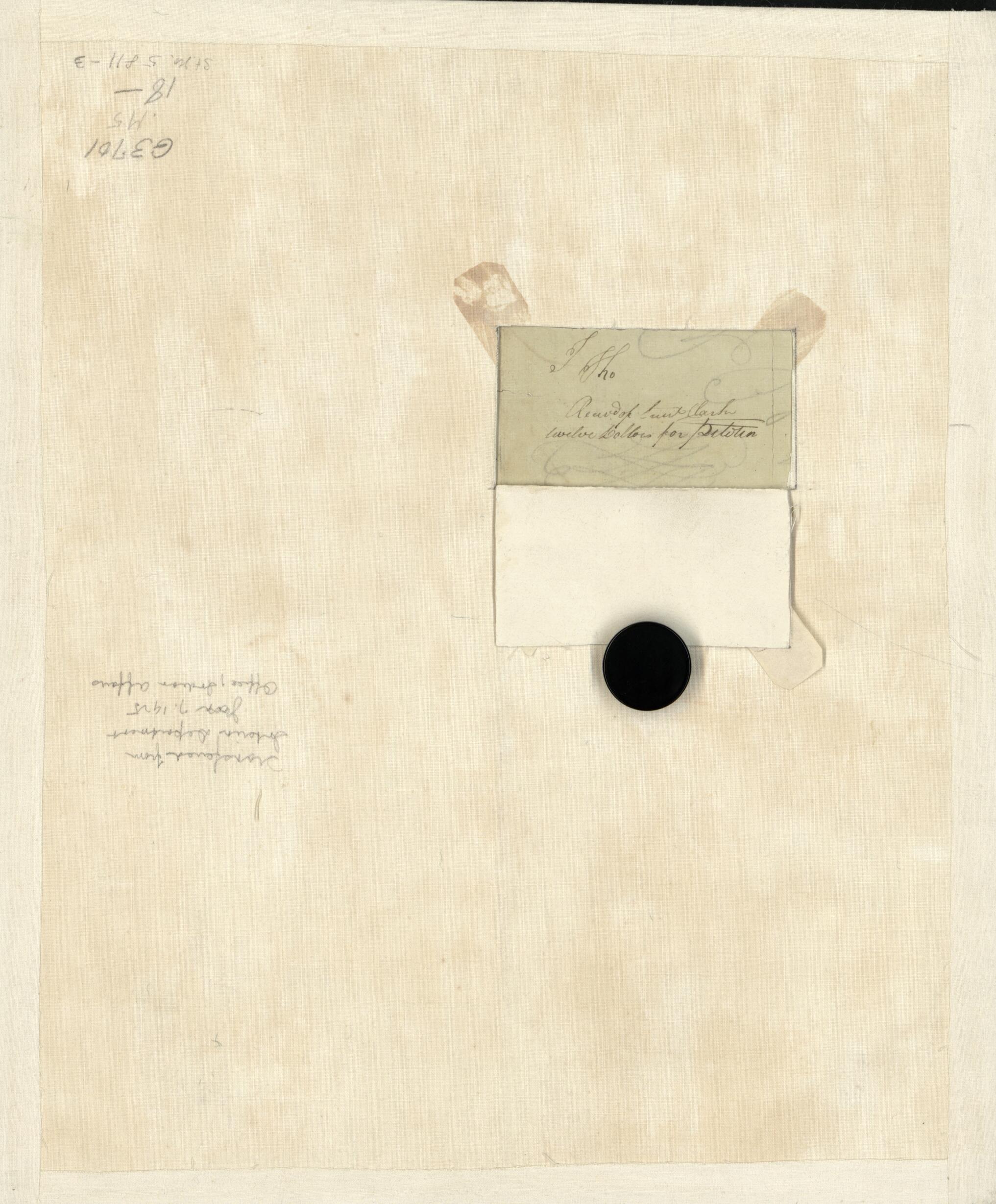
- Illegible writing on verso of map covered by cloth backing with cut to form a flap: Record of Lieut. Clark for twelve dollars for .... (illegible).
- On verso: Transferred from Interior Department Jan. 7, 1925, Office, Indian Affairs.
- In pencil in lower right corner on verso: St. no. 5811-3.
Map Sizing Information
- For the best legibility, order your map in the original size or larger. Most maps have intricate detail and small text that is best appreciated when the print size hasn't been reduced.
- Sizes labeled "Fits a Standard Frame" will drop right into any frame that you purchase in that size. The sizes that we offer are commonly available online and at most retail stores.
- Our standard sizes are recommendations based on the aspect ratio of the original map, but still may require some added "white space" in one dimension to fit.
- Non-standard sizes will require custom framing, and we suggest taking your print to the frame shop of your choice after you receive it for the best results.
- Custom sizes are available, simply contact us for a quote.
Below is an approximation of the scale of a few standard sizes, and how they might appear in your space.

