
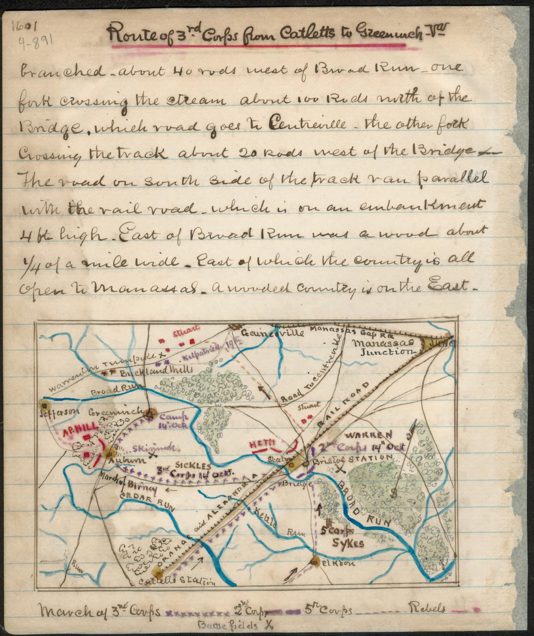
Route of 3rd Corps from Cattlet's sic to Greenwich, Va 10-14
- Regular price
-
$49.95 - Regular price
-
$29.95 - Sale price
-
$49.95
Shipping calculated at checkout.
Buy one map, get any other map in our collection for 50% OFF! Add to cart to see discount.
Couldn't load pickup availability
About This Map
Old map of Fauquier County, Prince William County, United States, Virginia.
The maps shows the location of the Union III Corps under Sickles and Confederate troops under A.P. Hill between Catlett's Station and Manassas Junction, Va. The Manassas Gap and the Orange and Alexandria railroads are also indicated, and also shown is the location of the skirmish that took place at Auburn earlier in the day.
Created by Robert Knox Sneden in 10-14.
- Color coding indicates the location of Union and Confederate forces.
- This item is from the collections of the Virginia Historical Society; please contact the institution for more information.
- In the Robert Knox Sneden Diary (Mss5:1 Sn237:1 v. 4, p. 891).
- Manuscripts
Map Sizing Information
- For the best legibility, order your map in the original size or larger. Most maps have intricate detail and small text that is best appreciated when the print size hasn't been reduced.
- Sizes labeled "Fits a Standard Frame" will drop right into any frame that you purchase in that size. The sizes that we offer are commonly available online and at most retail stores.
- Our standard sizes are recommendations based on the aspect ratio of the original map, but still may require some added "white space" in one dimension to fit.
- Non-standard sizes will require custom framing, and we suggest taking your print to the frame shop of your choice after you receive it for the best results.
- Custom sizes are available, simply contact us for a quote.
Below is an approximation of the scale of a few standard sizes, and how they might appear in your space.

