
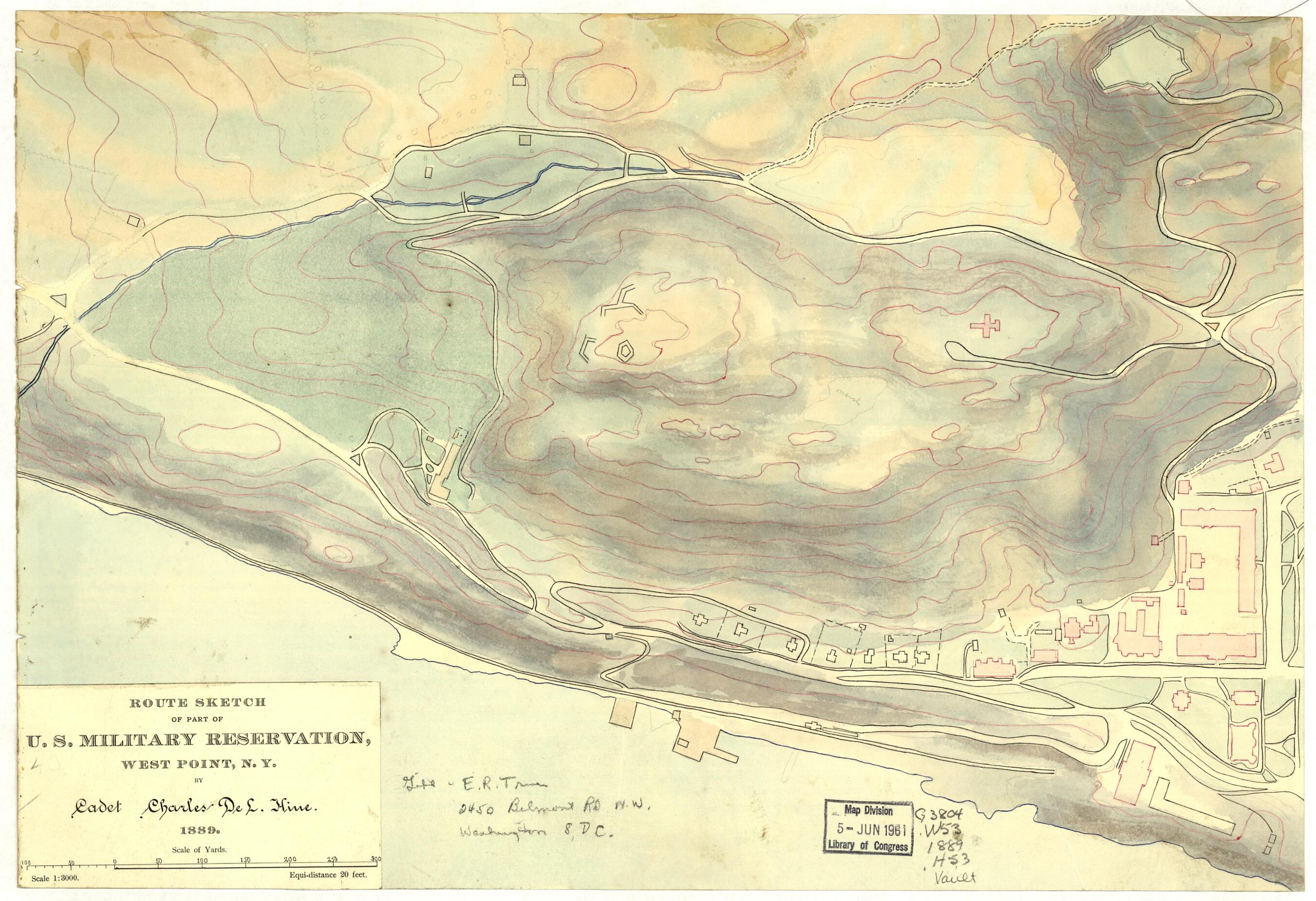
Route Sketch of Part of U.S. Military Reservation, West Point, New York 1889
- Regular price
-
$49.95 - Regular price
-
$34.95 - Sale price
-
$49.95
Shipping calculated at checkout.
Buy one map, get any other map in our collection for 50% OFF! Add to cart to see discount.
Couldn't load pickup availability
About This Map
Old topographic map / manuscript map of New York, New York (State), United States, West Point.
Created by Charles De Lano Hine in 1889.
Created by Charles De Lano Hine in 1889.
- Relief shown by contours and shading.
- Oriented with north toward the upper right.
- Pen-and-ink and watercolors.
- Title and date printed on card affixed to recto at lower left; personal name handwritten in ink on card.
- Sheet fold-lined, slightly torn at left edge, stained on verso.
- Gift; E.R. True; June 1961.
Map Sizing Information
- For the best legibility, order your map in the original size or larger. Most maps have intricate detail and small text that is best appreciated when the print size hasn't been reduced.
- Sizes labeled "Fits a Standard Frame" will drop right into any frame that you purchase in that size. The sizes that we offer are commonly available online and at most retail stores.
- Our standard sizes are recommendations based on the aspect ratio of the original map, but still may require some added "white space" in one dimension to fit.
- Non-standard sizes will require custom framing, and we suggest taking your print to the frame shop of your choice after you receive it for the best results.
- Custom sizes are available, simply contact us for a quote.
Below is an approximation of the scale of a few standard sizes, and how they might appear in your space.
