
План Харьковского наместничества городу Белополью in 1859
- Regular price
-
$54.95 - Regular price
-
$38.95 - Sale price
-
$54.95
Shipping calculated at checkout.
Buy one map, get any other map in our collection for 50% OFF! Add to cart to see discount.
Couldn't load pickup availability
About This Map
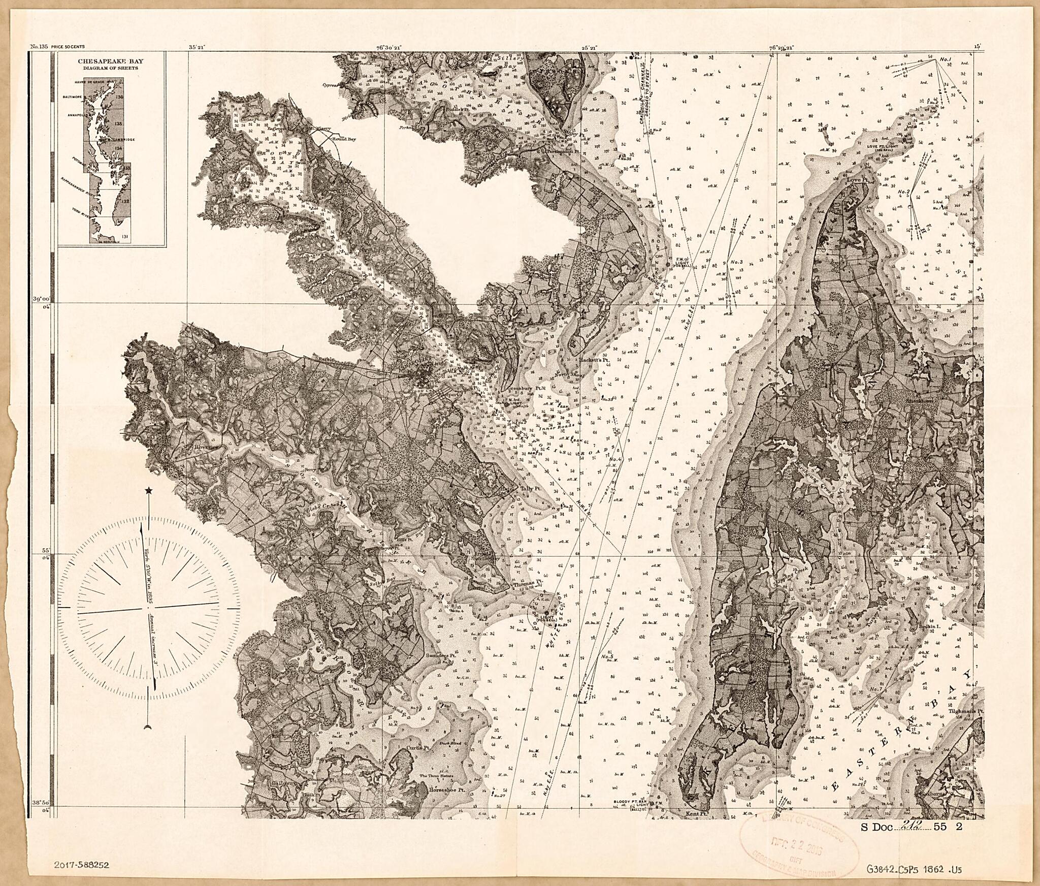
Old nautical chart of Annapolis Region, Chesapeake Bay, Chesapeake Bay Watershed, Maryland, United States, Virginia.
Created by United States Coast Survey, United States. Congress. Senate in 1862.
Created by United States Coast Survey, United States. Congress. Senate in 1862.
- Nautical chart of part of the Chesapeake Bay between the Magothy River (at north) and Kent Point (at south) including the Annapolis city region.
- Relief shown by hachures; depths shown by shading and soundings.
- Map sheet removed from documentary publication (U.S. Senate document).
- Includes inset map of "Chesapeake Bay, diagram of sheets".
Map Subjects
Annapolis Region (Md.)
Chesapeake Bay
Chesapeake Bay (Md. And Va.)
Chesapeake Bay Watershed
Congress
Information Services
Maryland
Nautical Charts
Senate
United States
Annapolis Region
Virginia
United States Coast Survey
United States. Congress. Senate
1862
Map Sizing Information
- For the best legibility, order your map in the original size or larger. Most maps have intricate detail and small text that is best appreciated when the print size hasn't been reduced.
- Sizes labeled "Fits a Standard Frame" will drop right into any frame that you purchase in that size. The sizes that we offer are commonly available online and at most retail stores.
- Our standard sizes are recommendations based on the aspect ratio of the original map, but still may require some added "white space" in one dimension to fit.
- Non-standard sizes will require custom framing, and we suggest taking your print to the frame shop of your choice after you receive it for the best results.
- Custom sizes are available, simply contact us for a quote.
Below is an approximation of the scale of a few standard sizes, and how they might appear in your space.

