Skip to product information
1 of 1

План Харьковского наместничества городу Краснокутску in 1859

Regular price
$119.95
Regular price
$167.95
Sale price
$119.95
Help with Choosing a Map Size

Add to cart to see discount!

90-Day Satisfaction Guarantee & Free Returns

About This Map
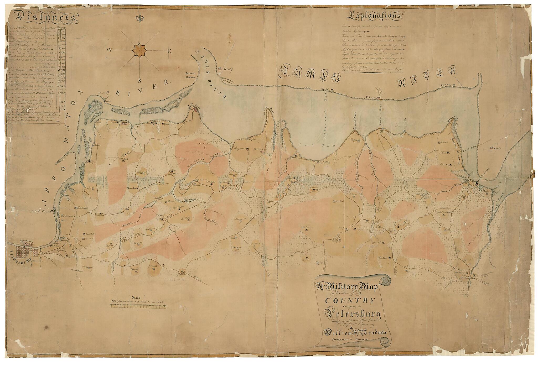
Old map of Petersburg Region, Prince George County, United States, Virginia.

Created by William H. Brodnax, John Pegram in 1864.
  • Description derived from published bibliography.
  • Includes a table of distances and an explantion of the colored lines and colored areas of the map.
  • Shows public highways, private carriage ways, woods, open fields, landing places, marshes, bogs and houses with names of residents.
  • This item is in the Map Collection of the Library of Virginia; please contact the Library's Archives Research Services department for more information.
  • Swem, E.G. Maps relating to Virginia, 1138
  • C. 1 source unknown; c. 2 Dec. 1954, photocopy, LVA; c. 3 Feb. 1970, photocopy, LVA; March 2004, Map Cataloging Team.
  • Civil War project no.: lva00188.
  • Digital image available: 27 x 21 in.
  • Previously filed as: 755.61 1864 (1).

Map Subjects

Civil War

History

Maps Manuscript

Petersburg Region

Petersburg Region (Va.)

Prince George County

Prince George County (Va.)

United States

Virginia

William H. Brodnax

John Pegram

1864

Map Tags

1864

Civil War

History

John Pegram

Map

Maps Manuscript

Petersburg Region

Petersburg Region (Va.)

Prince George County

Prince George County (Va.)

United States

Virginia

William H. Brodnax

Secure Checkout
Lifetime Warranty
Money-Back Guarantee
This old map of A Military Map of a Section of the Country Contiguous to Petersburg from 1864 was created by William H. Brodnax, John Pegram in 1864