
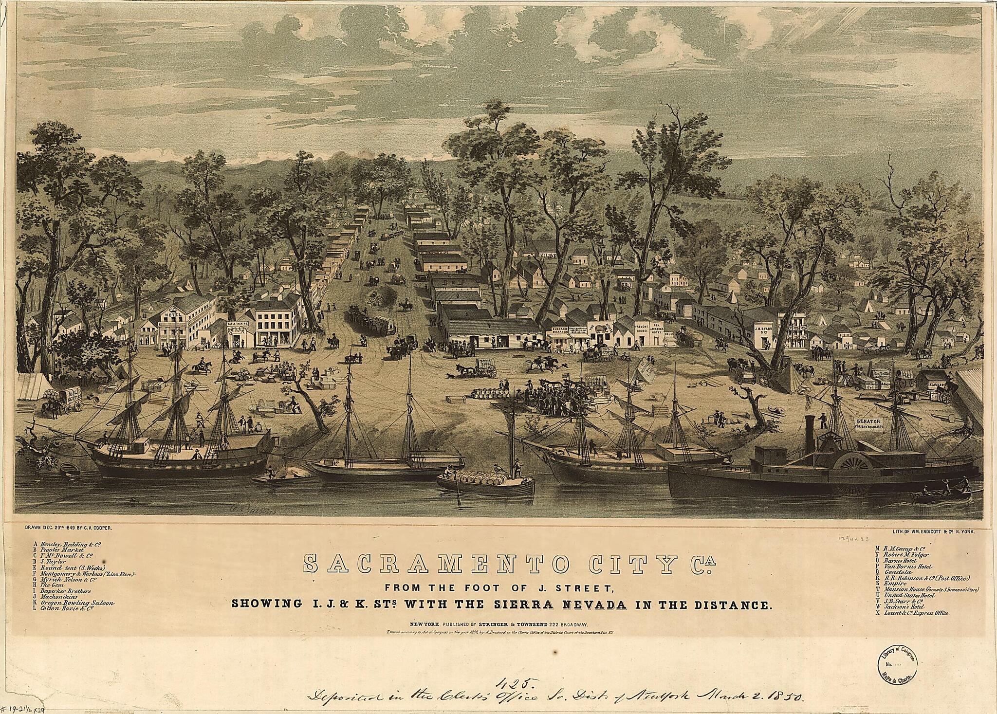
Sacramento City, Ca. from the Foot of J. Street, Showing I., J., & K. Sts. With the Sierra Nevada In the Distance / C. Parsons ; Drawn Dec. 20th 1849 by G.V. Cooper ; Lith. of Wm. Endicott & County, N. York 1850
- Regular price
-
$61.95 - Regular price
-
$43.95 - Sale price
-
$61.95
Buy one map, get any other map in our collection for 50% OFF! Add to cart to see discount.
Couldn't load pickup availability
About This Map
Discover the timeless beauty of our fine art quality printed reproduction of this antique map. Perfect for history enthusiasts, collectors, and interior decorators.
Restored with meticulous attention to detail by our team with over a decade of experience, this stunning reproduction captures the intricate artistry and historical significance of the original map.
Whether you're a collector or seeking a unique decor piece, this archival-quality map reproduction is a timeless addition to any space. Order now to bring history to life!
Old bird's eye view / color / bird's eye view / color of California, Sacramento, United States.Created by George Victor Cooper, Charles Parsons in 1850.
- Caption label from exhibit "American Treasures--Memory": Sacramento City. Sacramento's rise from settlement to state capital began with the discovery of gold in January 1848, some fifty miles northeast at John Sutter's sawmillustrations Situated along the Sacramento and American Rivers, the city became the gateway to the California gold fields. Print publishers all around the country produced views of the new city, both to encourage more visitors and to sell prints. Local businesses depicted in the image supported the publication by paying an advertising fee.
- Prominent buildings identified by letter with key below image.
- Copyright by A. Brainerd.
Map Subjects
Bird's Eye View
California
City & Town Life
Cityscape Prints
Color
Lithographs
Sacramento
Sacramento (Calif.)
Ships
United States
Waterfronts
Bird's Eye Views
George Victor Cooper
Charles Parsons
Photo Print Drawing
1850
- For the best legibility, order your map in the original size or larger. Most maps have intricate detail and small text that is best appreciated when the print size hasn't been reduced.
- Sizes labeled "Fits a Standard Frame" will drop right into any frame that you purchase in that size. The sizes that we offer are commonly available online and at most retail stores.
- Our standard sizes are recommendations based on the aspect ratio of the original map, but still may require some added "white space" in one dimension to fit.
- Non-standard sizes will require custom framing, and we suggest taking your print to the frame shop of your choice after you receive it for the best results.
- Custom sizes are available, simply contact us for a quote.
Below is an approximation of the scale of a few standard sizes, and how they might appear in your space.

