
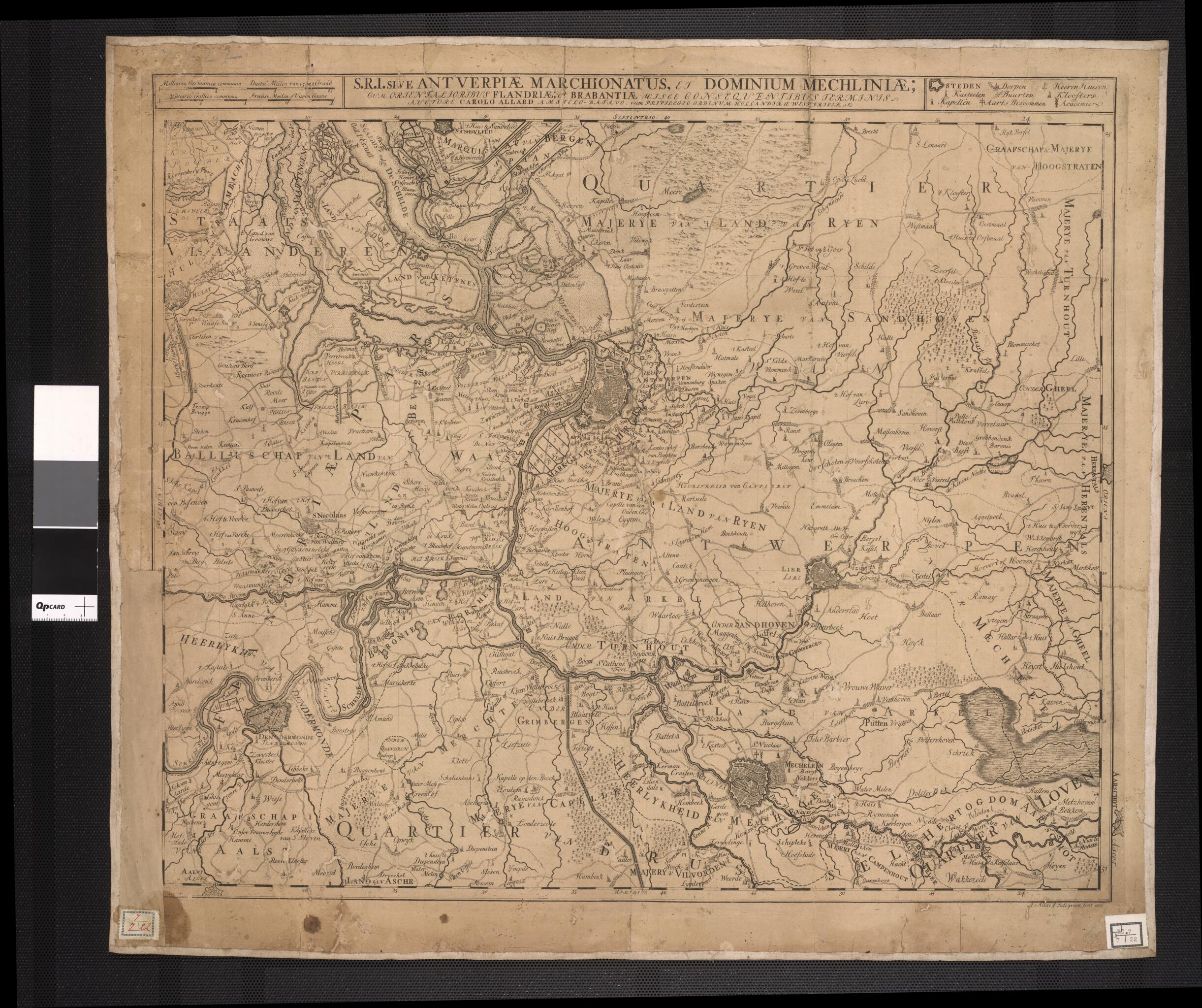
The Holy Roman Empires Duchy of Antwerp and the Dominium of Malines: With the Eastern Flemish Areas and the Boundaries of Brabant Following from These. (Sacri Romani Imperii Sive Antverpiae Marchionatus Et Dominium Mechliniae : Cum Orientalioribus Fla...
- Regular price
-
$70.95 - Regular price
-
$65.95 - Sale price
-
$70.95
Buy one map, get any other map in our collection for 50% OFF! Add to cart to see discount.
Couldn't load pickup availability
About This Map
Discover the timeless beauty of our fine art quality printed reproduction of this antique map. Perfect for history enthusiasts, collectors, and interior decorators.
Restored with meticulous attention to detail by our team with over a decade of experience, this stunning reproduction captures the intricate artistry and historical significance of the original map.
Whether you're a collector or seeking a unique decor piece, this archival-quality map reproduction is a timeless addition to any space. Order now to bring history to life!
Old map of Antwerp, Belgium, Flanders, Netherlands.17th century map shows the Duchy of Brabant, including the cities of Antwerp and Mechelen. The duchy consisted of the modern-day Belgian provinces of Flemish Brabant, Walloon Brabant, Antwerp, and Brussels, as well as the province of North Brabant in the present-day Netherlands. The map was published in Amsterdam by Karel Allard (1648-1706) who, with his brother Abraham, had taken over the business of their father, the Amsterdam map publisher Hugo Allard. The Allard family was known more for publishing atlases of maps by others than for original cartography.
Created by Carel Allard in 1688.
- Title devised, in English, by Library staff.
- Original resource extent: 1 map : 50 x 58.5 centimeters.
- Original resource at: National Library of Brazil.
- Content in Dutch.
- Description based on data extracted from World Digital Library, which may be extracted from partner institutions.
- For the best legibility, order your map in the original size or larger. Most maps have intricate detail and small text that is best appreciated when the print size hasn't been reduced.
- Sizes labeled "Fits a Standard Frame" will drop right into any frame that you purchase in that size. The sizes that we offer are commonly available online and at most retail stores.
- Our standard sizes are recommendations based on the aspect ratio of the original map, but still may require some added "white space" in one dimension to fit.
- Non-standard sizes will require custom framing, and we suggest taking your print to the frame shop of your choice after you receive it for the best results.
- Custom sizes are available, simply contact us for a quote.
Below is an approximation of the scale of a few standard sizes, and how they might appear in your space.

