
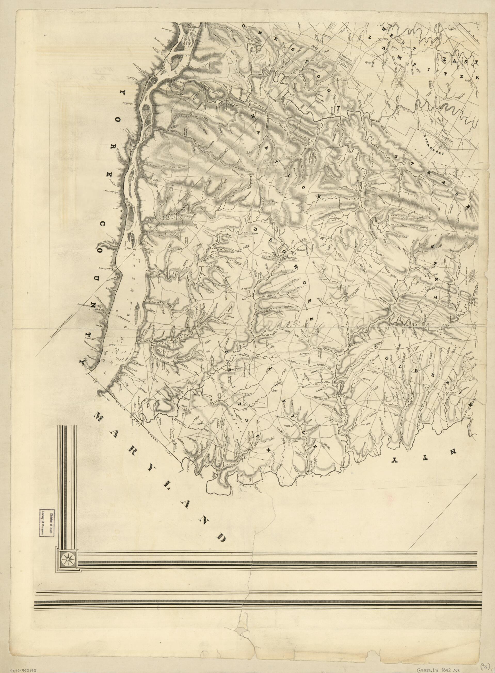
Scott's Map of Lancaster County, Pennsylvania in 1842
- Regular price
-
$190.95 - Regular price
-
$185.95 - Sale price
-
$190.95
Buy one map, get any other map in our collection for 50% OFF! Add to cart to see discount.
Couldn't load pickup availability
About This Map
Discover the timeless beauty of our fine art quality printed reproduction of this antique map. Perfect for history enthusiasts, collectors, and interior decorators.
Restored with meticulous attention to detail by our team with over a decade of experience, this stunning reproduction captures the intricate artistry and historical significance of the original map.
Whether you're a collector or seeking a unique decor piece, this archival-quality map reproduction is a timeless addition to any space. Order now to bring history to life!
Old map of Havre De Grace Region, Lancaster County, Maps, Maryland, Pennsylvania, United States.Created by Joshua Scott, Tide Water Canal Company in 1842.
- General-content county map also showing rural buildings with householders' names, lot lines in rural subdivisions/villages, and election districts.
- Relief shown by hachures.
- Differs from other 1842 ed. in not being hand col., not being shellacked, and in being oriented with north toward the upper right.
- "Entered according to Act of Congress in the Year 1842 by Jos'a Scott, in the Clerks Office of the Eastern District of Pennsylvania."
- Printed in north/south/east/west segments (sheets).
- Land Ownership Map
- Includes inset of "Tide water canal, Maryland" along Susquehanna River northward of Havre de Grace (Md.); also includes extra printed sections of map border designed to be cut away and repositioned when the 4 sheets are conjoined.
- For the best legibility, order your map in the original size or larger. Most maps have intricate detail and small text that is best appreciated when the print size hasn't been reduced.
- Sizes labeled "Fits a Standard Frame" will drop right into any frame that you purchase in that size. The sizes that we offer are commonly available online and at most retail stores.
- Our standard sizes are recommendations based on the aspect ratio of the original map, but still may require some added "white space" in one dimension to fit.
- Non-standard sizes will require custom framing, and we suggest taking your print to the frame shop of your choice after you receive it for the best results.
- Custom sizes are available, simply contact us for a quote.
Below is an approximation of the scale of a few standard sizes, and how they might appear in your space.

