1
/
of
1
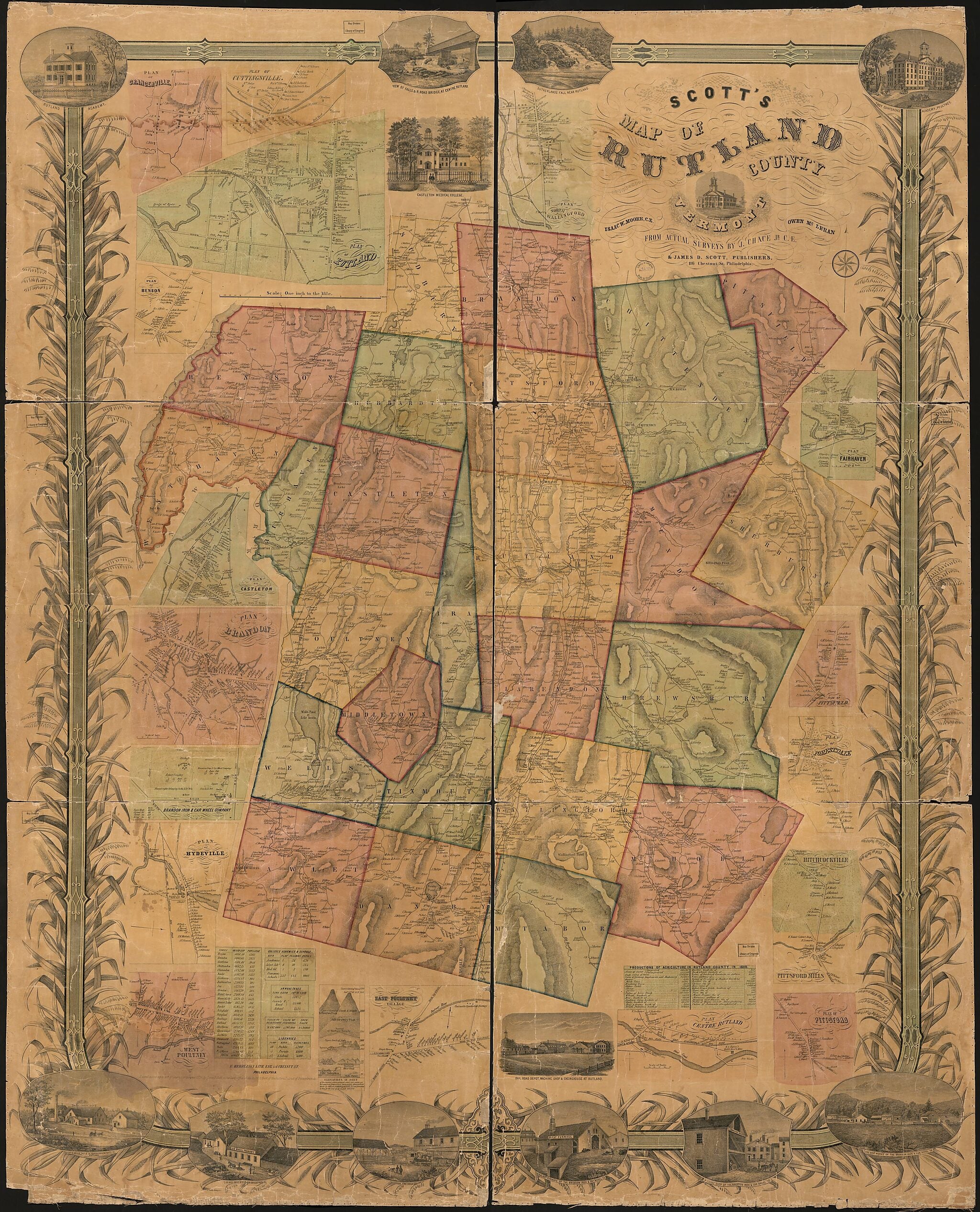
Scott's Map of Rutland County, Vermont (Map of Rutland County, Vermont) 1854
- Regular price
-
$214.95 - Regular price
-
$262.95 - Sale price
-
$214.95
Map Description
Old cadastral map / wall map of Rutland County, United States, Vermont.
Created by J. Chace, James D. Scott & Owen McLeran, Isaac W. Moore in 1854.
- Relief shown by hachures.
- Land Ownership Map
- "Entered according to act of Congress in the year 1854 by James D. Scott in the clerk's office of the district court of the eastern district of Pennsylvania."
- Includes statistics, diagram of elevations, and thirteen views of scenery and structures.
- Insets: Brandon Iron & Car Wheel Company -- East Poultney village -- Hitchcockville, Pittsford Mills -- Plan of Benson -- Plan of Brandon -- Plan of Castleton -- Plan of centre Rutland -- Plan of Cuttingsville -- Plan of Fairhaven -- Plan of Forestdale -- Plan of Grangerville -- Plan of Hydeville -- Plan of Pittsfield -- Plan of Pittsford -- Plan of Rutland -- West Poultney.
Map Subjects
Cadastral Maps
Landowners
Real Property
Rutland County
Rutland County (Vt.)
United States
Vermont
Wall Maps
J. Chace
James D. Scott & Owen McLeran
Isaac W. Moore
1854
Map Tags
1854
Cadastral Maps
Isaac W. Moore
J. Chace
James D. Scott & Owen McLeran
Landowners
Map
Maps
Real Property
Rutland County
Rutland County (Vt.)
United States
Vermont
Wall Maps
Fine Art Quality
Printed on heavyweight (230 gsm) archival paper with a classic matte finish
Professionally Restored
For the best presentation, your map will be carefully retouched by our experienced team
Free Shipping & Free Returns
Orders of $75 or more ship for free and arrive in 3-5 business days
Proudly Made in the USA
All of our maps are custom printed to order in Portland, Maine
Couldn't load pickup availability
Secure Checkout
Lifetime Warranty
Money-Back Guarantee

Map Sizing Information
- For the best legibility, order your map in the original size or larger. Most maps have intricate detail and small text that is best appreciated when the print size hasn't been reduced.
- Sizes labeled "Fits a Standard Frame" will drop right into any frame that you purchase in that size. The sizes that we offer are commonly available online and at most retail stores.
- Our standard sizes are recommendations based on the aspect ratio of the original map, but still may require some added "white space" in one dimension to fit.
- Non-standard sizes will require custom framing, and we suggest taking your print to the frame shop of your choice after you receive it for the best results.
- Custom sizes are available, simply contact us for a quote.
Below is an approximation of the scale of a few standard sizes, and how they might appear in your space.