
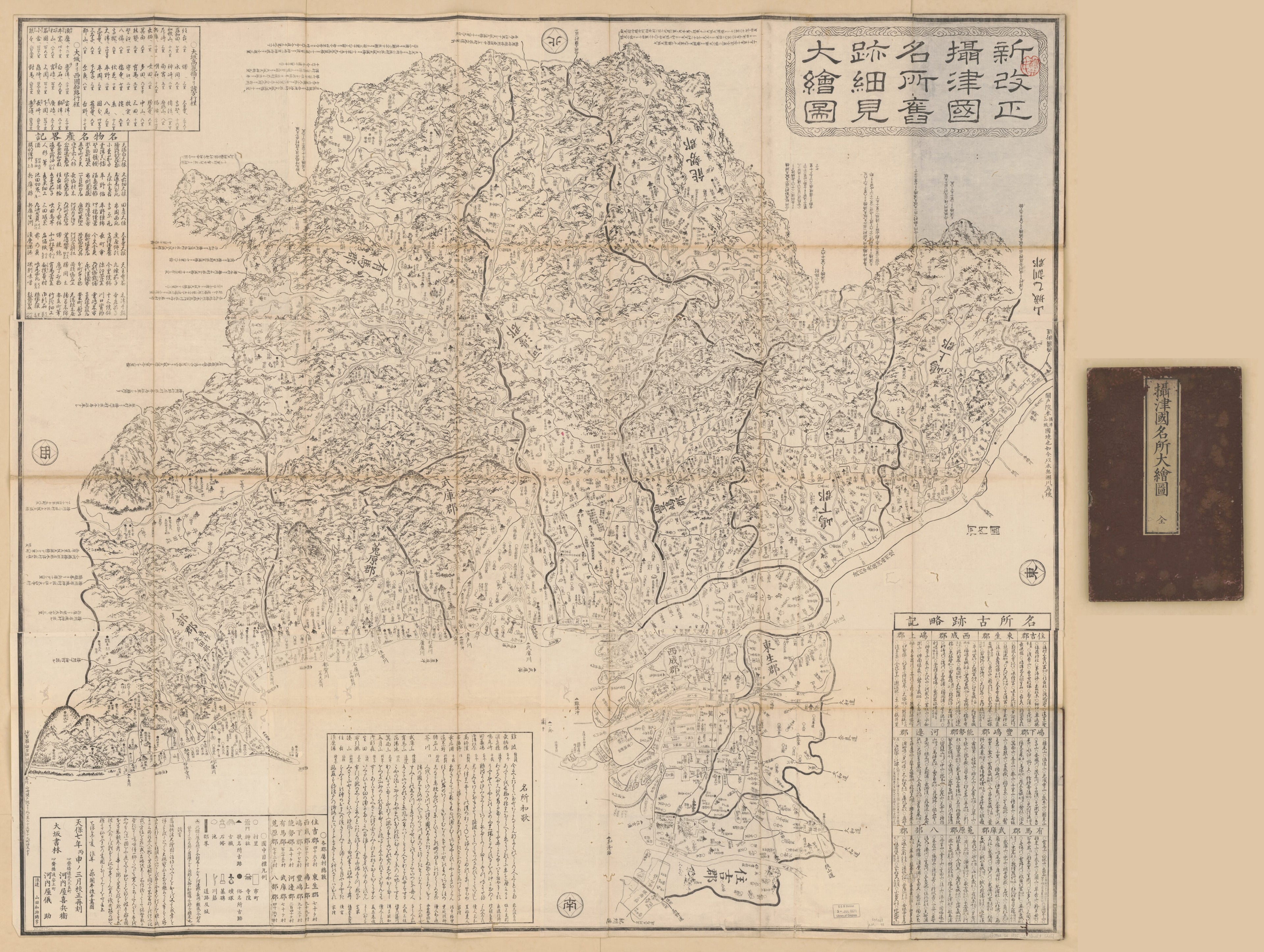
新改正攝津國名所舊跡細見大繪圖 /, Settsu No Kuni Meishō ōezu in 1836
- Regular price
-
$202.95 - Regular price
-
$197.95 - Sale price
-
$202.95
Shipping calculated at checkout.
Buy one map, get any other map in our collection for 50% OFF! Add to cart to see discount.
Couldn't load pickup availability
About This Map
Old map of Japan, Settsu Region, Shi.
Created by Gisuke Kawachiya, Kangyū Shitomi in 1836.
Created by Gisuke Kawachiya, Kangyū Shitomi in 1836.
- "Tenpō otsubi 6" [i.e. 1835].
- Cover title: Settsu no Kuni meisho ōezu.
- Wood block print.
- Relief shown pictorially.
- Pictorial map.
- Includes descriptive list of points of interest, songs for points of interest, text, and distance chart.
- Call no. will be chaned to G7962.S4 1836 .S5 Vault Shelf.
Map Sizing Information
- For the best legibility, order your map in the original size or larger. Most maps have intricate detail and small text that is best appreciated when the print size hasn't been reduced.
- Sizes labeled "Fits a Standard Frame" will drop right into any frame that you purchase in that size. The sizes that we offer are commonly available online and at most retail stores.
- Our standard sizes are recommendations based on the aspect ratio of the original map, but still may require some added "white space" in one dimension to fit.
- Non-standard sizes will require custom framing, and we suggest taking your print to the frame shop of your choice after you receive it for the best results.
- Custom sizes are available, simply contact us for a quote.
Below is an approximation of the scale of a few standard sizes, and how they might appear in your space.

