
Sixth Map of Asia. (Sexta Asiae Tabula) 1478
- Regular price
-
$69.95 - Regular price
-
$64.95 - Sale price
-
$69.95
Buy one map, get any other map in our collection for 50% OFF! Add to cart to see discount.
Couldn't load pickup availability
About This Map
Discover the timeless beauty of our fine art quality printed reproduction of this antique map. Perfect for history enthusiasts, collectors, and interior decorators.
Restored with meticulous attention to detail by our team with over a decade of experience, this stunning reproduction captures the intricate artistry and historical significance of the original map.
Whether you're a collector or seeking a unique decor piece, this archival-quality map reproduction is a timeless addition to any space. Order now to bring history to life!
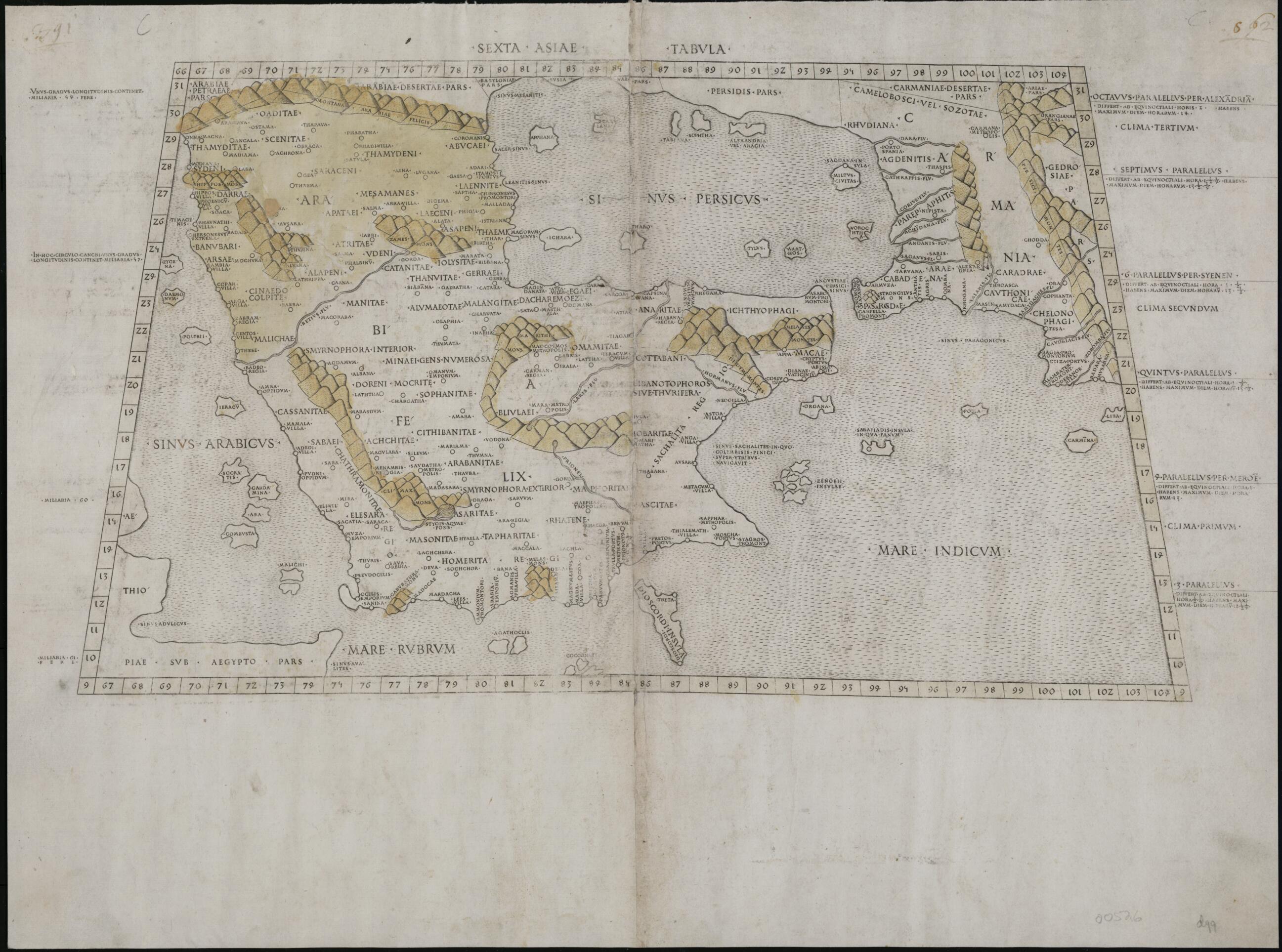
Old map of Iraq, Israel, Jordan, Kuwait, Oman, Qatar, Saudi Arabia, Syrian Arab Republic, United Arab Emirates, Yemen.Several editions of Ptolemy's Geographia (Geography), translated into Latin from the original Greek, were published in Europe in the 15th century. This map is from the 1478 edition, which was published in Rome. Ptolemaic atlases included 12 maps of Asia. The "Sixth Map of Asia" covered the Arabian Peninsula. The outlines of this map are crude, but many geographic features, including the Red Sea, the Indian Ocean, and different features of the peninsula are clearly recognizable.
Created by 2nd Century Ptolemy in 1478.
- Title devised, in English, by Library staff.
- Original resource extent: 1 map; 26 x 47 centimeters.
- Original resource at: Qatar National Library.
- Content in Latin.
- Description based on data extracted from World Digital Library, which may be extracted from partner institutions.
- For the best legibility, order your map in the original size or larger. Most maps have intricate detail and small text that is best appreciated when the print size hasn't been reduced.
- Sizes labeled "Fits a Standard Frame" will drop right into any frame that you purchase in that size. The sizes that we offer are commonly available online and at most retail stores.
- Our standard sizes are recommendations based on the aspect ratio of the original map, but still may require some added "white space" in one dimension to fit.
- Non-standard sizes will require custom framing, and we suggest taking your print to the frame shop of your choice after you receive it for the best results.
- Custom sizes are available, simply contact us for a quote.
Below is an approximation of the scale of a few standard sizes, and how they might appear in your space.

