
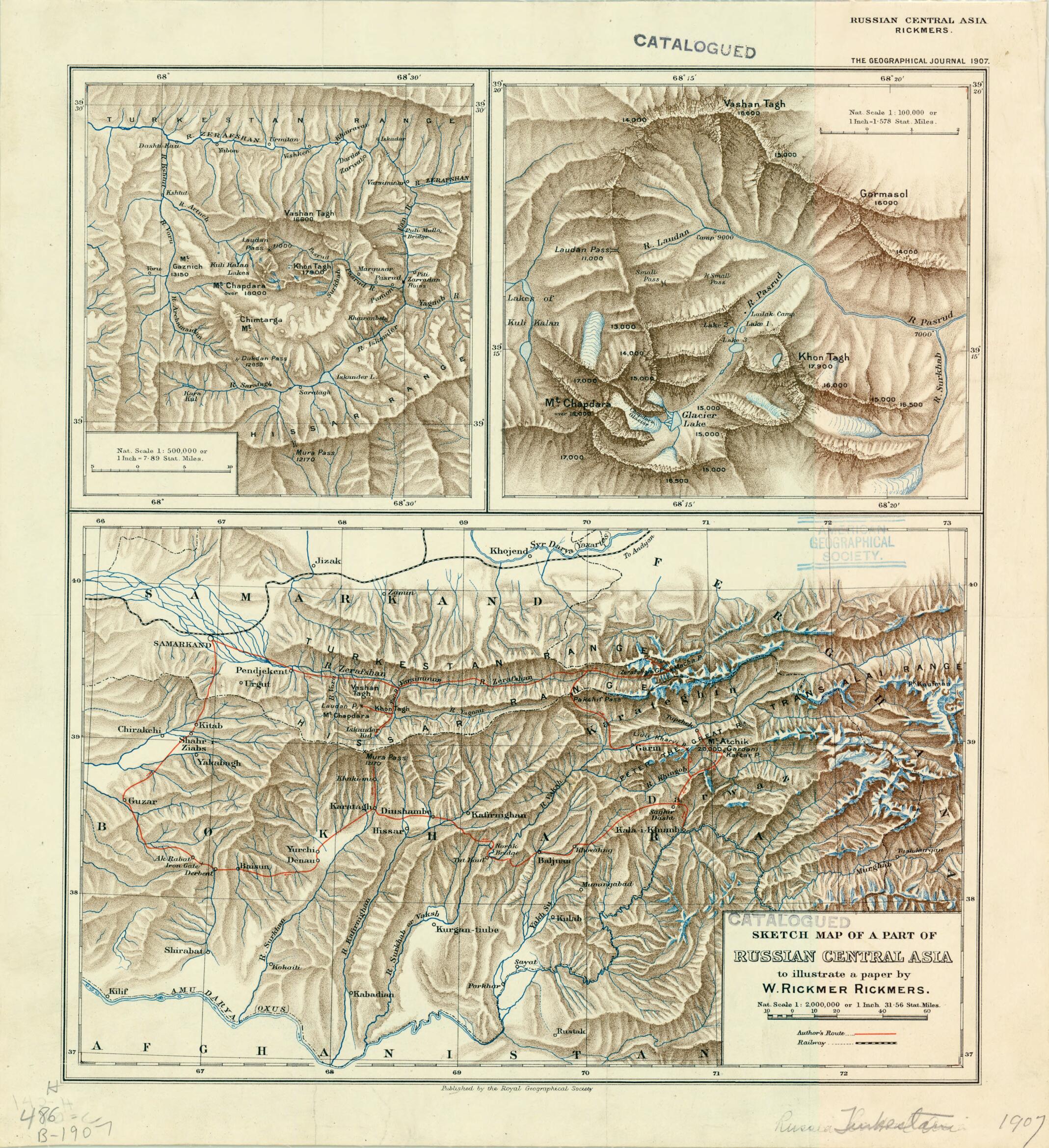
Sketch Map of a Part of Russian Central Asia to Illustrate a Paper by W. Rickmer Rickmers 1907
- Regular price
-
$49.95 - Regular price
-
$34.95 - Sale price
-
$49.95
Buy one map, get any other map in our collection for 50% OFF! Add to cart to see discount.
Couldn't load pickup availability
About This Map
Discover the timeless beauty of our fine art quality printed reproduction of this antique map. Perfect for history enthusiasts, collectors, and interior decorators.
Restored with meticulous attention to detail by our team with over a decade of experience, this stunning reproduction captures the intricate artistry and historical significance of the original map.
Whether you're a collector or seeking a unique decor piece, this archival-quality map reproduction is a timeless addition to any space. Order now to bring history to life!
Old map of Afghanistan, Tajikistan, Uzbekistan.day Tajikistan, Uzbekistan, and Afghanistan. At the time the map was made, most of this vast territory was part of the Russian Empire. Willi Rickmer Rickmers (1873--1965) was a German mountaineer and explorer who undertook several expeditions in Central Asia and the Caucasus before journeying to the foothills of the Pamir range in eastern Tajikistan in 1906. This expedition, on which Rickmers was accompanied by his wife and fellow mountaineer C. Mabel Duff Rickmers, reached as far east as the Darvaz region in Tajikistan and explored along the way the Zarafshan River valley and the Zarafshan glacier as well as the Fann Mountains of western Tajikistan. The map includes two insets highlighting the Fann Mountains in greater detail. The map was made to illustrate a lecture delivered by Rickmers at the Royal Geographical Society in London, and Rickmers's paper was published in the June 1907 edition of the Geographical Journal. An avid explorer in her own right, Mabel Rickmers was the author of The Chronology of India from Earliest Times to the Beginning of the Sixteenth Century (1899) and was a member of the Royal Asiatic Society and a fellow of the Royal Geographical Society.
Created by Royal Geographical Society (Great Britain) in 1907.
- Title devised, in English, by Library staff.
- Original resource extent: 3 maps on 1 sheet : color ; on sheet 40 x 37 centimeters.
- Original resource at: University of Wisconsin-Milwaukee Libraries.
- Content in English.
- Description based on data extracted from World Digital Library, which may be extracted from partner institutions.
- For the best legibility, order your map in the original size or larger. Most maps have intricate detail and small text that is best appreciated when the print size hasn't been reduced.
- Sizes labeled "Fits a Standard Frame" will drop right into any frame that you purchase in that size. The sizes that we offer are commonly available online and at most retail stores.
- Our standard sizes are recommendations based on the aspect ratio of the original map, but still may require some added "white space" in one dimension to fit.
- Non-standard sizes will require custom framing, and we suggest taking your print to the frame shop of your choice after you receive it for the best results.
- Custom sizes are available, simply contact us for a quote.
Below is an approximation of the scale of a few standard sizes, and how they might appear in your space.

