
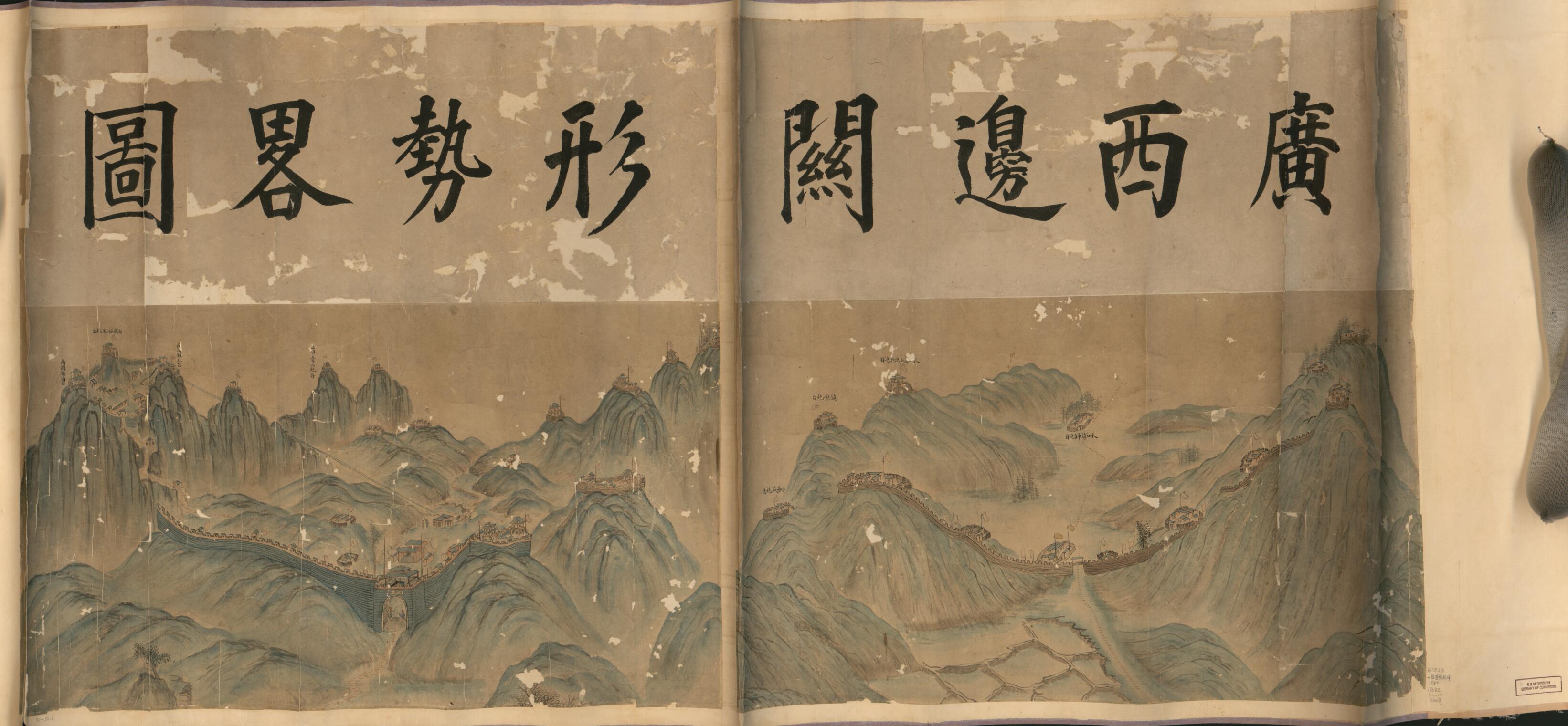
廣西邊關形勢略圖, Sketch Map of the Guangxi Border in 1887
- Regular price
-
$109.95 - Regular price
-
$104.95 - Sale price
-
$109.95
Shipping calculated at checkout.
Buy one map, get any other map in our collection for 50% OFF! Add to cart to see discount.
Couldn't load pickup availability
About This Map
Old pictorial map / manuscript map of China, Guangxi Zhuangzu Zizhiqu, Guangxi Zhuangzu Zizhiqu Region.
Created by Arthur W. (Arthur William) Hummel in 1887.
Created by Arthur W. (Arthur William) Hummel in 1887.
- Labels pasted on verso: Guxiangzhai su biao zi hua.
- Relief shown pictorially.
- Pictorial map.
- Shows Zhennanguan Pass along the French-Indo China border. Zhennanguan Pass is an important defense post of Longzhou against French intrusion in the late 19th century in Guangxi Province.
- Hummel purchase 1930, no. 33.
Map Sizing Information
- For the best legibility, order your map in the original size or larger. Most maps have intricate detail and small text that is best appreciated when the print size hasn't been reduced.
- Sizes labeled "Fits a Standard Frame" will drop right into any frame that you purchase in that size. The sizes that we offer are commonly available online and at most retail stores.
- Our standard sizes are recommendations based on the aspect ratio of the original map, but still may require some added "white space" in one dimension to fit.
- Non-standard sizes will require custom framing, and we suggest taking your print to the frame shop of your choice after you receive it for the best results.
- Custom sizes are available, simply contact us for a quote.
Below is an approximation of the scale of a few standard sizes, and how they might appear in your space.
