
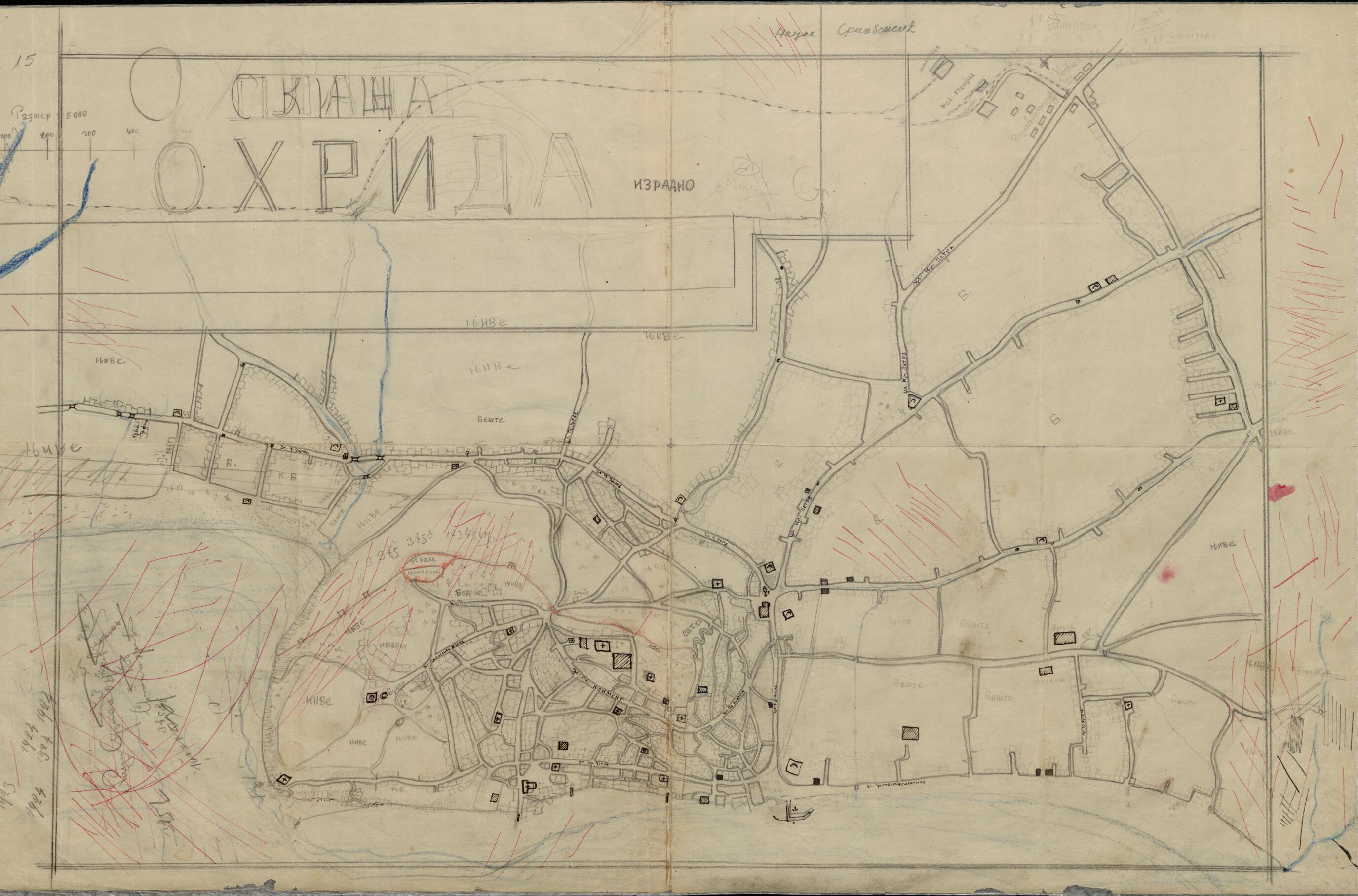
Sketch of Ohrid 1923
- Regular price
-
$51.95 - Regular price
-
$46.95 - Sale price
-
$51.95
Buy one map, get any other map in our collection for 50% OFF! Add to cart to see discount.
Couldn't load pickup availability
About This Map
Discover the timeless beauty of our fine art quality printed reproduction of this antique map. Perfect for history enthusiasts, collectors, and interior decorators.
Restored with meticulous attention to detail by our team with over a decade of experience, this stunning reproduction captures the intricate artistry and historical significance of the original map.
Whether you're a collector or seeking a unique decor piece, this archival-quality map reproduction is a timeless addition to any space. Order now to bring history to life!
Old map of Former Yugoslav Republic of Macedonia, Ohrid.This pencil drawing is a sketch made in 1923 for a tourist map of the city of Ohrid, Former Yugoslav Republic of Macedonia. Ohrid was at that time part of the newly established Kingdom of Serbs, Croats, and Slovenes; until 1912 it was under Ottoman rule. Situated on the shores of Lake Ohrid, the city is the site of one of the oldest human settlements in Europe, dating back to the Neolithic period. Known as Lychnidos at the time of the ancient Greeks, it developed into an important center of medieval Slavic culture in the period from the sixth century to the ninth century. Saint Clement of Ohrid, a student of Saints Cyril and Methodius and an important figure in the development of Slavic literature and culture, worked in Ohrid from 886 to 916. Lake Ohrid was inscribed on the UNESCO World Heritage List in 1979; in 1980 the listing was expanded to include the city, which is home to numerous archeological sites and ancient monasteries and churches.
Created by Naum Srbinović in 1923.
- Title devised, in English, by Library staff.
- Original resource extent: Pencil drawing ; 67 x 42 centimeters.
- Original resource at: National and University Library "St Kliment Ohridski" -- Skopje.
- Content in Macedonian.
- Description based on data extracted from World Digital Library, which may be extracted from partner institutions.
- For the best legibility, order your map in the original size or larger. Most maps have intricate detail and small text that is best appreciated when the print size hasn't been reduced.
- Sizes labeled "Fits a Standard Frame" will drop right into any frame that you purchase in that size. The sizes that we offer are commonly available online and at most retail stores.
- Our standard sizes are recommendations based on the aspect ratio of the original map, but still may require some added "white space" in one dimension to fit.
- Non-standard sizes will require custom framing, and we suggest taking your print to the frame shop of your choice after you receive it for the best results.
- Custom sizes are available, simply contact us for a quote.
Below is an approximation of the scale of a few standard sizes, and how they might appear in your space.
