
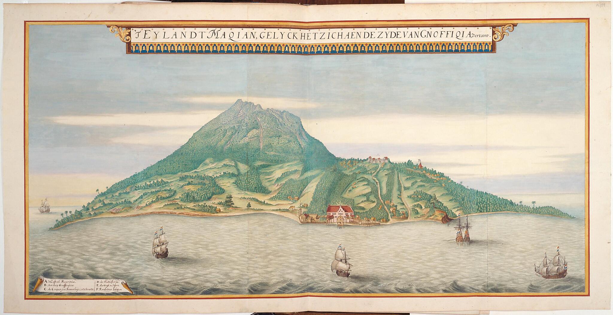
Makian As It Appears from the Side of Ngofakiaha. (T Eylandt Maqian, Gelyck Het Zich Aen De Zyde Van Gnoffiqia, Vertoond) 1670
- Regular price
-
$49.95 - Regular price
-
$34.95 - Sale price
-
$49.95
Buy one map, get any other map in our collection for 50% OFF! Add to cart to see discount.
Couldn't load pickup availability
About This Map
Discover the timeless beauty of our fine art quality printed reproduction of this antique map. Perfect for history enthusiasts, collectors, and interior decorators.
Restored with meticulous attention to detail by our team with over a decade of experience, this stunning reproduction captures the intricate artistry and historical significance of the original map.
Whether you're a collector or seeking a unique decor piece, this archival-quality map reproduction is a timeless addition to any space. Order now to bring history to life!
Old map of Indonesia.day Indonesia) is from the Atlas Blaeu-Van der Hem. Representing the entire surface of the Earth, the 50 volume work is often considered the most beautiful and most remarkable atlas ever composed. The collectors atlas (a special form of compiling cartographic material) was based on the Atlas Maior (Great atlas), published in Amsterdam by Joan Blaeu (1596--1673) in various editions between 1662 and 1672. This was the largest and most expensive book produced in the 17th century. The Amsterdam patrician, bibliophile, and lawyer Laurens Van der Hem (1621--78) acquired the 1662 Latin edition of Blaeu's atlas, containing 593 maps. He added more than 1,800 maps, charts, townscapes, and other drawings and prints, many of them beautifully colored by well-known artists of the day. Among the most important additions made by Van der Hem was a four-volume set of manuscript maps and topographical drawings originally produced for the Vereenigde Oost-Indische Compagnie (VOC--Dutch East India Company), containing confidential information belonging to the company. These volumes, from which this view is taken, became known as the "secret atlas of the VOC." In 1730, after the death of Van der Hems's daughter, the atlas was purchased by Prince Eugene of Savoy (1663--1736). It later came into the possession of the Hofbibliotek (Imperial Library) in Vienna. The Atlas Blaeu-Van der Hem was inscribed on the UNESCO Memory of the World Register in 2003.
Created by Laurens Van Der Hem, Joan Vinckeboons in 1670.
- Title devised, in English, by Library staff.
- Original resource at: Austrian National Library.
- Content in Dutch.
- Description based on data extracted from World Digital Library, which may be extracted from partner institutions.
Map Subjects
Indian Ocean
Indonesia
Islands
Memory Of The World
Indische Compagnie
Ships
Villages
Laurens Van Der Hem
Joan Vinckeboons
1670
- For the best legibility, order your map in the original size or larger. Most maps have intricate detail and small text that is best appreciated when the print size hasn't been reduced.
- Sizes labeled "Fits a Standard Frame" will drop right into any frame that you purchase in that size. The sizes that we offer are commonly available online and at most retail stores.
- Our standard sizes are recommendations based on the aspect ratio of the original map, but still may require some added "white space" in one dimension to fit.
- Non-standard sizes will require custom framing, and we suggest taking your print to the frame shop of your choice after you receive it for the best results.
- Custom sizes are available, simply contact us for a quote.
Below is an approximation of the scale of a few standard sizes, and how they might appear in your space.
