
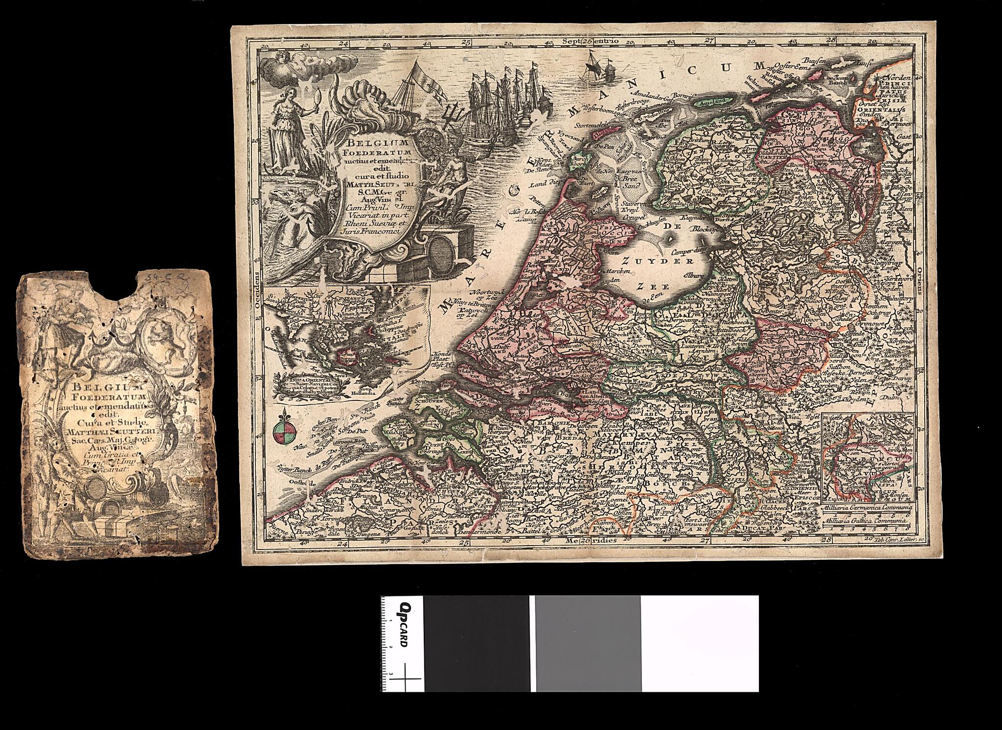
The Dutch Republic, Enlarged and Edited: Produced With the Care and Work of Matthaeus Seutter. (Belgium Foederatum Auctius Et Emendatius / Edit Cura Et Studio Matthaei Seutteri) 1730
- Regular price
-
$53.95 - Regular price
-
$37.95 - Sale price
-
$53.95
Buy one map, get any other map in our collection for 50% OFF! Add to cart to see discount.
Couldn't load pickup availability
About This Map
Discover the timeless beauty of our fine art quality printed reproduction of this antique map. Perfect for history enthusiasts, collectors, and interior decorators.
Restored with meticulous attention to detail by our team with over a decade of experience, this stunning reproduction captures the intricate artistry and historical significance of the original map.
Whether you're a collector or seeking a unique decor piece, this archival-quality map reproduction is a timeless addition to any space. Order now to bring history to life!
Old map of Belgium, Indonesia, Netherlands.1757), an engraver and publisher from Augsburg, Germany. Seutter studied printing in Nuremburg and in Augsburg, as an apprentice to Jeremias Wolff, before setting up his own printing house in 1710. Seutter generally enlarged and engraved the work of others but did very little drawing of original maps. This map was printed by Tobias Conrad Lotter (1717-77), Seutter's son-in-law, who took over the business after Seutter's death.
Created by Tobias Conrad Lotter, Matthaeus Seutter in 1730.
- Title devised, in English, by Library staff.
- Original resource extent: 1 colored map ; 20 x 26 centimeters.
- Original resource at: National Library of Brazil.
- Content in Latin.
- Description based on data extracted from World Digital Library, which may be extracted from partner institutions.
Map Subjects
1730 To 1745
Belgium
Colonies
Indonesia
Netherlands
Tobias Conrad Lotter
Matthaeus Seutter
1730
- For the best legibility, order your map in the original size or larger. Most maps have intricate detail and small text that is best appreciated when the print size hasn't been reduced.
- Sizes labeled "Fits a Standard Frame" will drop right into any frame that you purchase in that size. The sizes that we offer are commonly available online and at most retail stores.
- Our standard sizes are recommendations based on the aspect ratio of the original map, but still may require some added "white space" in one dimension to fit.
- Non-standard sizes will require custom framing, and we suggest taking your print to the frame shop of your choice after you receive it for the best results.
- Custom sizes are available, simply contact us for a quote.
Below is an approximation of the scale of a few standard sizes, and how they might appear in your space.

