
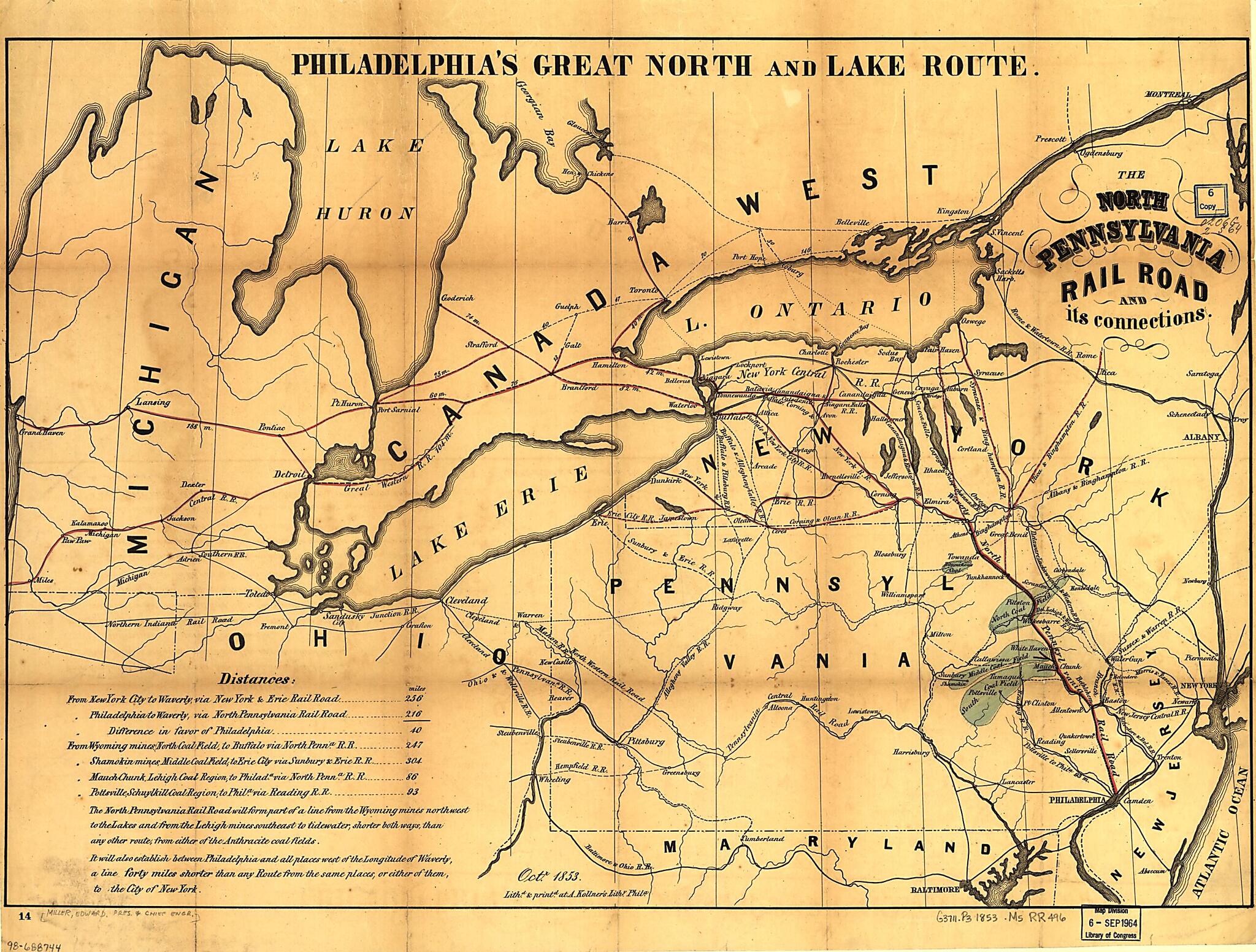
The North Pennsylvania Rail Road and Its Connections, Octr. 1853
- Regular price
-
$55.95 - Regular price
-
$50.95 - Sale price
-
$55.95
Buy one map, get any other map in our collection for 50% OFF! Add to cart to see discount.
Couldn't load pickup availability
About This Map
Discover the timeless beauty of our fine art quality printed reproduction of this antique map. Perfect for history enthusiasts, collectors, and interior decorators.
Restored with meticulous attention to detail by our team with over a decade of experience, this stunning reproduction captures the intricate artistry and historical significance of the original map.
Whether you're a collector or seeking a unique decor piece, this archival-quality map reproduction is a timeless addition to any space. Order now to bring history to life!
Old map of Northeastern States, United States.Gap Railroad. See entry 529.
Created by Edward Miller, North Pennsylvania Railroad Company in 1853.
- Scale ca. 1:1,800,000.
- Across top of map: "Philadelphia's great north and Lake route."
- A table of distances appears in the lower left of map.
- "The North Pennsylvania Rail Road will form part of a line from the Wyoming mines northwest to the Lakes and from the Lehigh mines southeast to tidewater, shorter both ways, than any other route, from either of the anthracite coal fields. It will also establish between Philadelphia and all places west of the longitude of Waverly, a line forty miles shorter than any route from the same places, or either of them, to the City of New York."
- Description derived from published bibliography.
Map Subjects
North Pennsylvania Railroad Company
Northeastern States
Railroads
United States
Edward Miller
1853
- For the best legibility, order your map in the original size or larger. Most maps have intricate detail and small text that is best appreciated when the print size hasn't been reduced.
- Sizes labeled "Fits a Standard Frame" will drop right into any frame that you purchase in that size. The sizes that we offer are commonly available online and at most retail stores.
- Our standard sizes are recommendations based on the aspect ratio of the original map, but still may require some added "white space" in one dimension to fit.
- Non-standard sizes will require custom framing, and we suggest taking your print to the frame shop of your choice after you receive it for the best results.
- Custom sizes are available, simply contact us for a quote.
Below is an approximation of the scale of a few standard sizes, and how they might appear in your space.

