
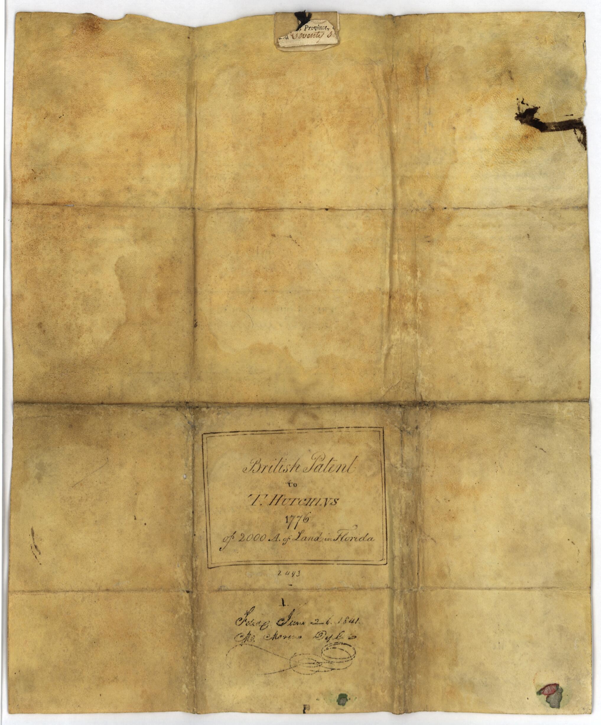
Thomas Hutchins' Land Grant and Map to 2000 Acres In West Florida 1841
- Regular price
-
$49.95 - Regular price
-
$34.95 - Sale price
-
$49.95
Buy one map, get any other map in our collection for 50% OFF! Add to cart to see discount.
Couldn't load pickup availability
About This Map
Discover the timeless beauty of our fine art quality printed reproduction of this antique map. Perfect for history enthusiasts, collectors, and interior decorators.
Restored with meticulous attention to detail by our team with over a decade of experience, this stunning reproduction captures the intricate artistry and historical significance of the original map.
Whether you're a collector or seeking a unique decor piece, this archival-quality map reproduction is a timeless addition to any space. Order now to bring history to life!
Old map of Baton Rouge Suburban Area, Louisiana, United States.Created by Elias Walker Durnford in 1841.
- Shows land grant 4 miles east of the Mississippi River "slightly removed from Baton Rouge."
- Title from vendor's letter.
- Panel title: British patent to T. Hutchins, 1776, of 2000 a. of lands in Florida.
- Date of "June 26, 1841" and indecipherable signature also on panel.
- Oriented with north toward the lower edge.
- Pen-and-ink.
- This map has some imperfections: holes along fold lines. We'll do our best to restore the image before printing.
- Includes text.
- "2443."
- Acquisitions control no. 52-84
- For the best legibility, order your map in the original size or larger. Most maps have intricate detail and small text that is best appreciated when the print size hasn't been reduced.
- Sizes labeled "Fits a Standard Frame" will drop right into any frame that you purchase in that size. The sizes that we offer are commonly available online and at most retail stores.
- Our standard sizes are recommendations based on the aspect ratio of the original map, but still may require some added "white space" in one dimension to fit.
- Non-standard sizes will require custom framing, and we suggest taking your print to the frame shop of your choice after you receive it for the best results.
- Custom sizes are available, simply contact us for a quote.
Below is an approximation of the scale of a few standard sizes, and how they might appear in your space.

