
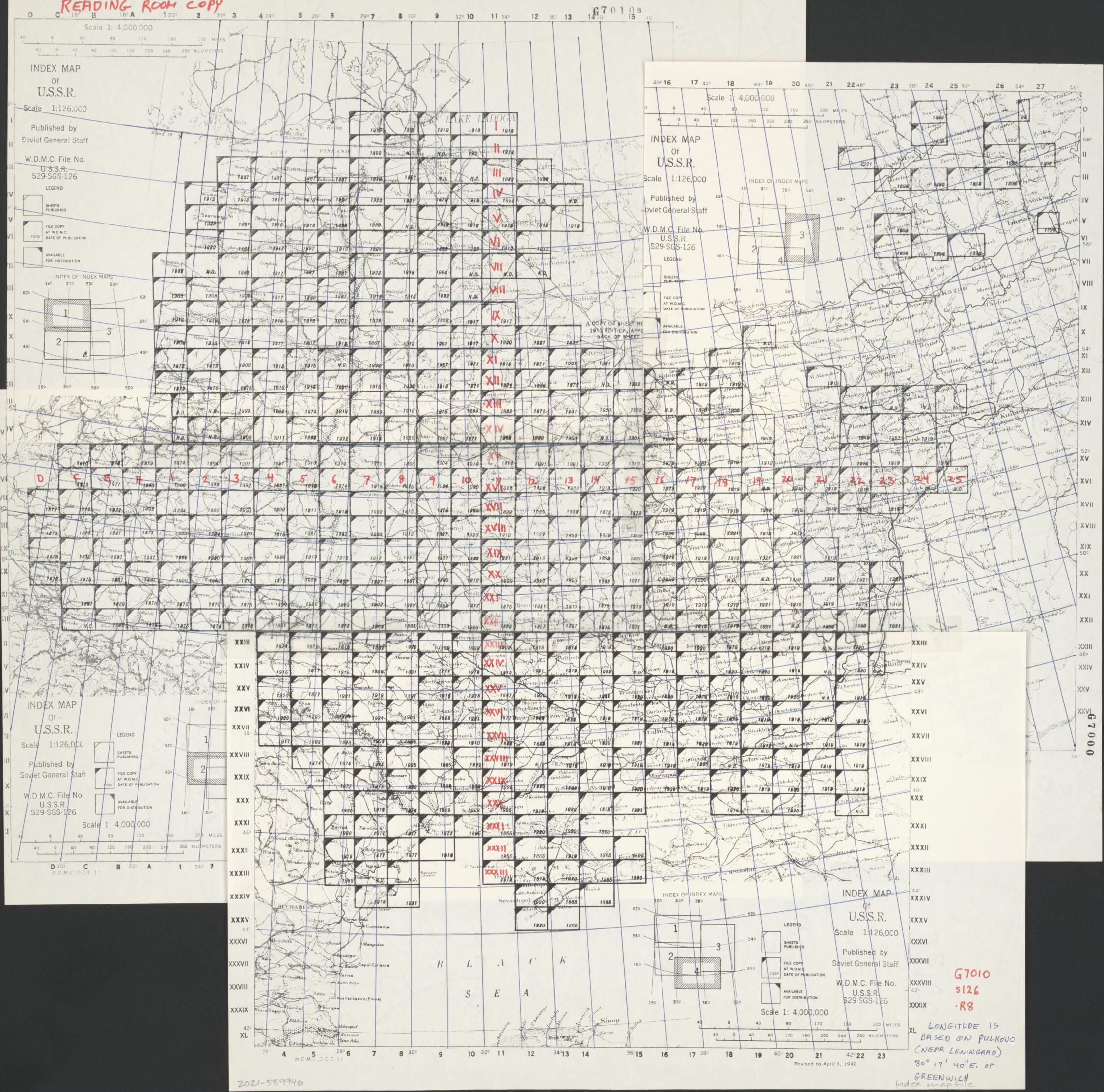
Topograficheskie Karty Evropeĭskoĭ Chasti Rossiĭskoĭ Imperii Masstaba 1:126 000 = Topographic Maps of the European Part of the Russian Empire at Scale 1:126,000 (Topographic Maps of the European Part of the Russian Empire at Scale 1:126,000, Topog...
- Regular price
-
$63.95 - Regular price
-
$58.95 - Sale price
-
$63.95
Buy one map, get any other map in our collection for 50% OFF! Add to cart to see discount.
Couldn't load pickup availability
About This Map
Discover the timeless beauty of our fine art quality printed reproduction of this antique map. Perfect for history enthusiasts, collectors, and interior decorators.
Restored with meticulous attention to detail by our team with over a decade of experience, this stunning reproduction captures the intricate artistry and historical significance of the original map.
Whether you're a collector or seeking a unique decor piece, this archival-quality map reproduction is a timeless addition to any space. Order now to bring history to life!
Old topographic map / military map / quadrangle map of Russia, Russia, Western, Western.Created by Prussia (Germany). Landesaufnahme, Russia. Armii︠a︡. Glavnyĭ Shtab. Kartograficheskoe Zavedenīe in 1865.
- Relief shown by hachures and spot heights.
- Common titles devised by cataloguer.
- Individual sheet titles in upper margin on some sheets.
- Sheets issued by the Imperial Russian government before the First World War (using old-orthography alphabet).
- Various editions of some sheets.
- Some sheets have been reissued and reprinted by German ("Auflagedruck 1917") and Polish mapping agencies.
- The sheets have row numbers (for example--Ri︠a︡d VII, Ri︠a︡d XXIII, Reihe XXXIII) and sheet numbers (for example--List 27, Blatt 12) in the upper margin.
- This map has some imperfections: holdings incomplete, variously torn, portions missing, fold-lined, annotated, mounted on cloth backing, encapsulated, any quadrangle sheets from the world-war-one period at scale 1:126,000 seem to have been included. We'll do our best to restore the image before printing.
- Sheets variously include notes, diagrams, compilers' names, insets, and other data.
- For the best legibility, order your map in the original size or larger. Most maps have intricate detail and small text that is best appreciated when the print size hasn't been reduced.
- Sizes labeled "Fits a Standard Frame" will drop right into any frame that you purchase in that size. The sizes that we offer are commonly available online and at most retail stores.
- Our standard sizes are recommendations based on the aspect ratio of the original map, but still may require some added "white space" in one dimension to fit.
- Non-standard sizes will require custom framing, and we suggest taking your print to the frame shop of your choice after you receive it for the best results.
- Custom sizes are available, simply contact us for a quote.
Below is an approximation of the scale of a few standard sizes, and how they might appear in your space.

