
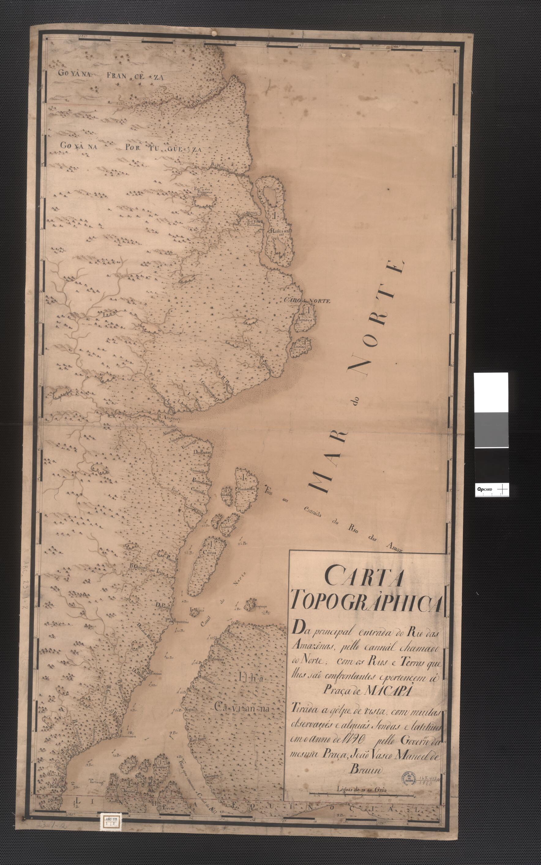
Topographic Map of the Principal Entry to the Amazon River. (Carta Topografica: Da Principal Entrada Do Rio Amazônas) 1790
- Regular price
-
$88.95 - Regular price
-
$83.95 - Sale price
-
$88.95
Buy one map, get any other map in our collection for 50% OFF! Add to cart to see discount.
Couldn't load pickup availability
About This Map
Discover the timeless beauty of our fine art quality printed reproduction of this antique map. Perfect for history enthusiasts, collectors, and interior decorators.
Restored with meticulous attention to detail by our team with over a decade of experience, this stunning reproduction captures the intricate artistry and historical significance of the original map.
Whether you're a collector or seeking a unique decor piece, this archival-quality map reproduction is a timeless addition to any space. Order now to bring history to life!
Old map of Amapá, Brazil, Macapa.This manuscript topographic map shows the main outlet of the Amazon River into the Atlantic Ocean. The river's estuary is more than 330 kilometers wide. Early explorers called it the "sweet sea" because of the vast amount of fresh water pouring into the ocean. The map is the work of João Vasco Manuel de Braun, a Brazilian of English descent who served as governor of Macapá, the equatorial region in which the mouth of the Amazon is located.
Created by João Vasco Manuel De Braun in 1790.
- Title devised, in English, by Library staff.
- Original resource extent: 1 manuscript map ; 91 x 39 centimeters.
- Original resource at: National Library of Brazil.
- Content in Portuguese.
- Description based on data extracted from World Digital Library, which may be extracted from partner institutions.
- For the best legibility, order your map in the original size or larger. Most maps have intricate detail and small text that is best appreciated when the print size hasn't been reduced.
- Sizes labeled "Fits a Standard Frame" will drop right into any frame that you purchase in that size. The sizes that we offer are commonly available online and at most retail stores.
- Our standard sizes are recommendations based on the aspect ratio of the original map, but still may require some added "white space" in one dimension to fit.
- Non-standard sizes will require custom framing, and we suggest taking your print to the frame shop of your choice after you receive it for the best results.
- Custom sizes are available, simply contact us for a quote.
Below is an approximation of the scale of a few standard sizes, and how they might appear in your space.

