
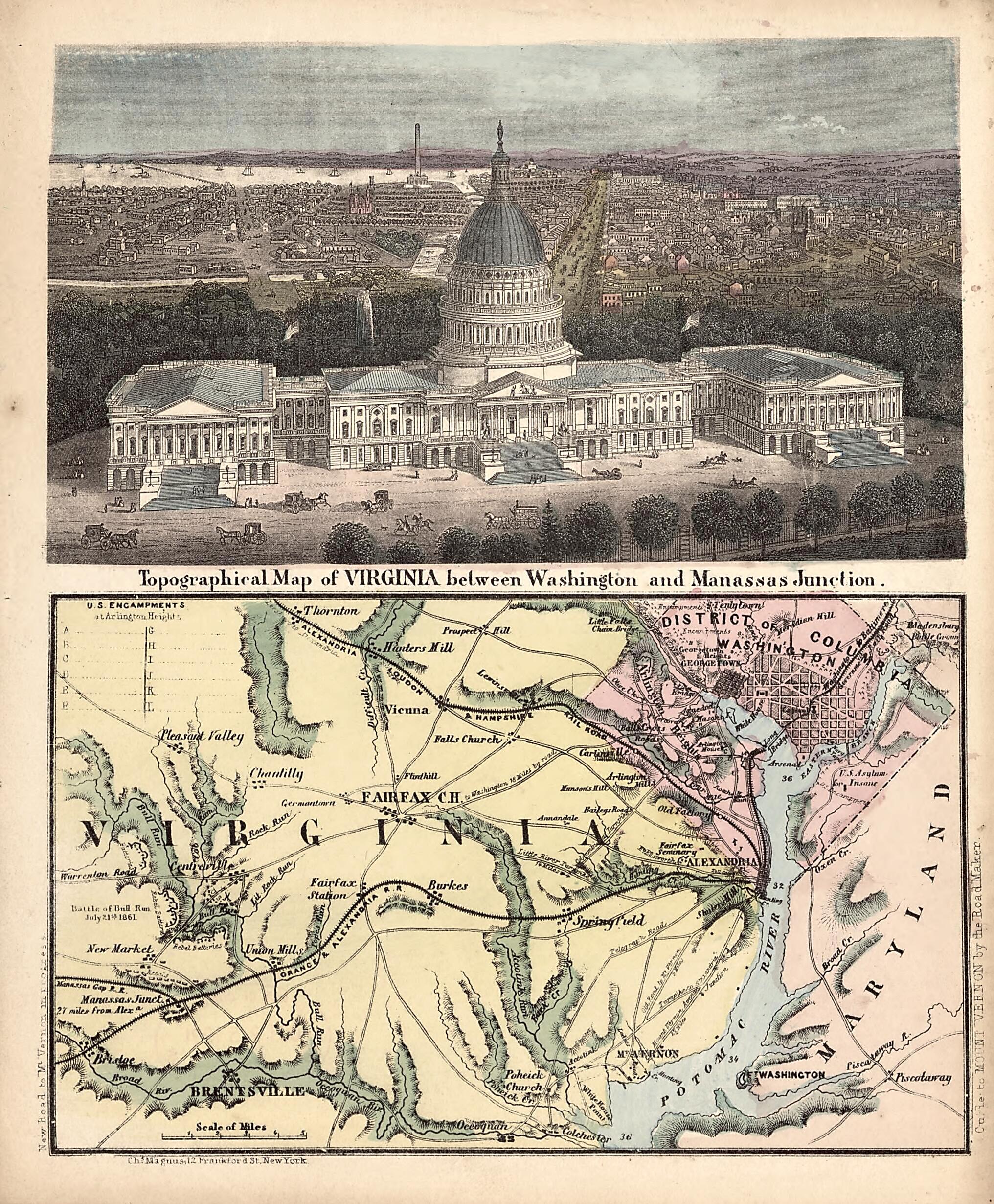
Topographical Map of Virginia Between Washington and Manassas Junction 1861
- Regular price
-
$49.95 - Regular price
-
$29.95 - Sale price
-
$49.95
Buy one map, get any other map in our collection for 50% OFF! Add to cart to see discount.
Couldn't load pickup availability
About This Map
Discover the timeless beauty of our fine art quality printed reproduction of this antique map. Perfect for history enthusiasts, collectors, and interior decorators.
Restored with meticulous attention to detail by our team with over a decade of experience, this stunning reproduction captures the intricate artistry and historical significance of the original map.
Whether you're a collector or seeking a unique decor piece, this archival-quality map reproduction is a timeless addition to any space. Order now to bring history to life!
Old map of District of Columbia, Manassas Region, United States, Virginia, Washington D.C., Washington Metropolitan Area.Created by Charles Magnus in 1861.
- Shows Union and Confederate positions at "Battle of Bull Run, July 21st 1861."
- Relief shown by hachures. Depths shown by soundings.
- In right margin at bottom: Guide to Mount Vernon by the Road Maker.
- Gift (copy 1); Edward Stead; 25 Oct. 1991.
- Includes index of "U.S. encampments at Arlington Heights" and hand col. ill. of U.S. Capitol in upper half of sheet.
- CW3
- 2 copies
Map Subjects
Civil War
District Of Columbia
History
Manassas Region
Manassas Region (Va.)
United States
Virginia
Washington (D.C.)
Washington Metropolitan Area
Washington D.C.
Charles Magnus
1861
- For the best legibility, order your map in the original size or larger. Most maps have intricate detail and small text that is best appreciated when the print size hasn't been reduced.
- Sizes labeled "Fits a Standard Frame" will drop right into any frame that you purchase in that size. The sizes that we offer are commonly available online and at most retail stores.
- Our standard sizes are recommendations based on the aspect ratio of the original map, but still may require some added "white space" in one dimension to fit.
- Non-standard sizes will require custom framing, and we suggest taking your print to the frame shop of your choice after you receive it for the best results.
- Custom sizes are available, simply contact us for a quote.
Below is an approximation of the scale of a few standard sizes, and how they might appear in your space.

