
Topographical Map of Wisconsin Territory 1837
- Regular price
-
$157.95 - Regular price
-
$152.95 - Sale price
-
$157.95
Buy one map, get any other map in our collection for 50% OFF! Add to cart to see discount.
Couldn't load pickup availability
About This Map
Discover the timeless beauty of our fine art quality printed reproduction of this antique map. Perfect for history enthusiasts, collectors, and interior decorators.
Restored with meticulous attention to detail by our team with over a decade of experience, this stunning reproduction captures the intricate artistry and historical significance of the original map.
Whether you're a collector or seeking a unique decor piece, this archival-quality map reproduction is a timeless addition to any space. Order now to bring history to life!
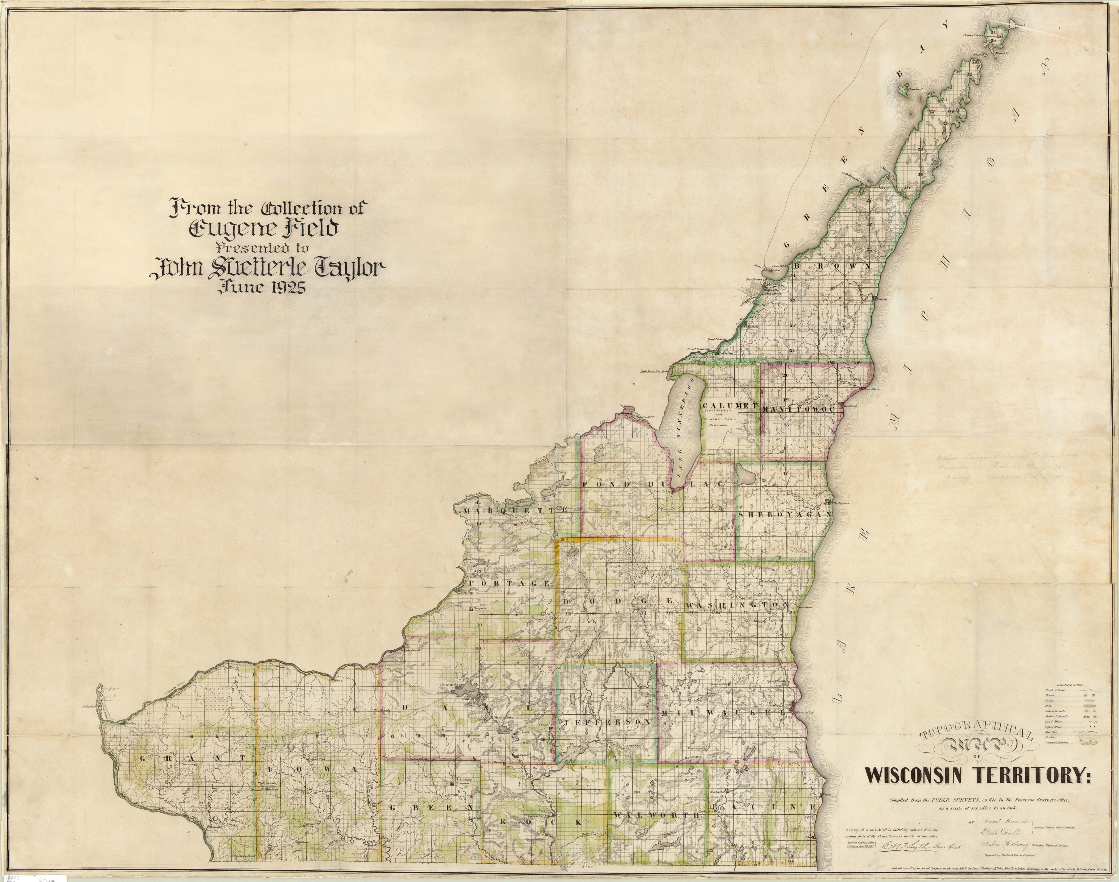
Old map of United States of America, Wisconsin.scale map of the Wisconsin Territory based on actual surveys. The map was compiled and published by the surveyors Samuel Morrison, Elisha Dwelle, and Joshua Hathaway and engraved on three copperplates. In 1785, the United States Congress passed the Land Survey Ordinance, which provided for a system of square townships six miles on a side, divided into 36 one-square-mile sections. The map shows townships in the Wisconsin Territory surveyed by 1837. Also depicted are roads, trails, natural land forms, vegetation, mill sites, and the lead and copper deposits known at the time. The long lots in Green Bay and Prairie du Chien reflect the French system of land holdings along riverfronts. Maps such as these helped immigrants and settlers understand the survey system and locate the land they bought. A prospective buyer could go to any U.S. Government Land Office and look in tract books that contained detailed descriptions of the land. As the inscription states, the map once belonged to the American writer Eugene Field (1850--95).
Created by Doolittle & Munson, Elisha Dwelle, Joshua Hathaway, Samuel Morrison, Wisconsin. Board of Commissioners of Public Lands in 1837.
- Title devised, in English, by Library staff.
- "Scale 1:200,000. Relief shown by hachures."--Note extracted from World Digital Library.
- Original resource extent: 1 map : color ; 113 x 90 centimeters.
- Original resource at: University of Wisconsin-Milwaukee Libraries.
- Content in English.
- Description based on data extracted from World Digital Library, which may be extracted from partner institutions.
- For the best legibility, order your map in the original size or larger. Most maps have intricate detail and small text that is best appreciated when the print size hasn't been reduced.
- Sizes labeled "Fits a Standard Frame" will drop right into any frame that you purchase in that size. The sizes that we offer are commonly available online and at most retail stores.
- Our standard sizes are recommendations based on the aspect ratio of the original map, but still may require some added "white space" in one dimension to fit.
- Non-standard sizes will require custom framing, and we suggest taking your print to the frame shop of your choice after you receive it for the best results.
- Custom sizes are available, simply contact us for a quote.
Below is an approximation of the scale of a few standard sizes, and how they might appear in your space.

