
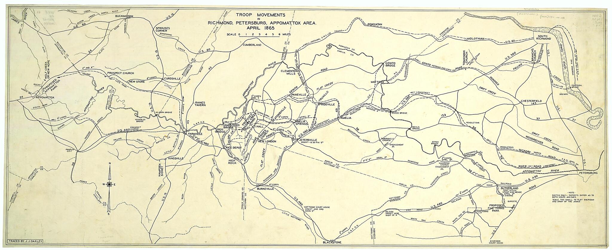
Troop Movements In Richmond, Petersburg, Appomattox Area, April 1865 1900
- Regular price
-
$72.95 - Regular price
-
$67.95 - Sale price
-
$72.95
Buy one map, get any other map in our collection for 50% OFF! Add to cart to see discount.
Couldn't load pickup availability
About This Map
Discover the timeless beauty of our fine art quality printed reproduction of this antique map. Perfect for history enthusiasts, collectors, and interior decorators.
Restored with meticulous attention to detail by our team with over a decade of experience, this stunning reproduction captures the intricate artistry and historical significance of the original map.
Whether you're a collector or seeking a unique decor piece, this archival-quality map reproduction is a timeless addition to any space. Order now to bring history to life!
Old map of Appomattox Region, Petersburg Region, Richmond Region, United States, Virginia.Created by J. J. Oakley in 1900.
- Drawn on tracing paper.
- Shows towns, rivers, roads, railroads, troop movements and proposed parks at Five Forks and Appomattox.
- This item is in the Map Collection of the Library of Virginia; please contact the Library's Archives Research Services department for more information.
- April 2003, Conservation Commission (1949), gift; Map Cataloging Team.
- Civil War project no.: lva00130.
- Conservation: Etherington Conservation Center, April 2003.
- Digital image available: 17.75 x 44.5 in.
- Map accession no. 1137 (1949).
- Previously filed as: 755.5 M6 1861-1865 1865 (2).
Map Subjects
Appomattox Campaign
Appomattox Region
Appomattox Region (Va.)
Civil War
History
Maps Manuscript
Petersburg Region
Petersburg Region (Va.)
Richmond Region
Richmond Region (Va.)
United States
Virginia
J. J. Oakley
1900
- For the best legibility, order your map in the original size or larger. Most maps have intricate detail and small text that is best appreciated when the print size hasn't been reduced.
- Sizes labeled "Fits a Standard Frame" will drop right into any frame that you purchase in that size. The sizes that we offer are commonly available online and at most retail stores.
- Our standard sizes are recommendations based on the aspect ratio of the original map, but still may require some added "white space" in one dimension to fit.
- Non-standard sizes will require custom framing, and we suggest taking your print to the frame shop of your choice after you receive it for the best results.
- Custom sizes are available, simply contact us for a quote.
Below is an approximation of the scale of a few standard sizes, and how they might appear in your space.
