
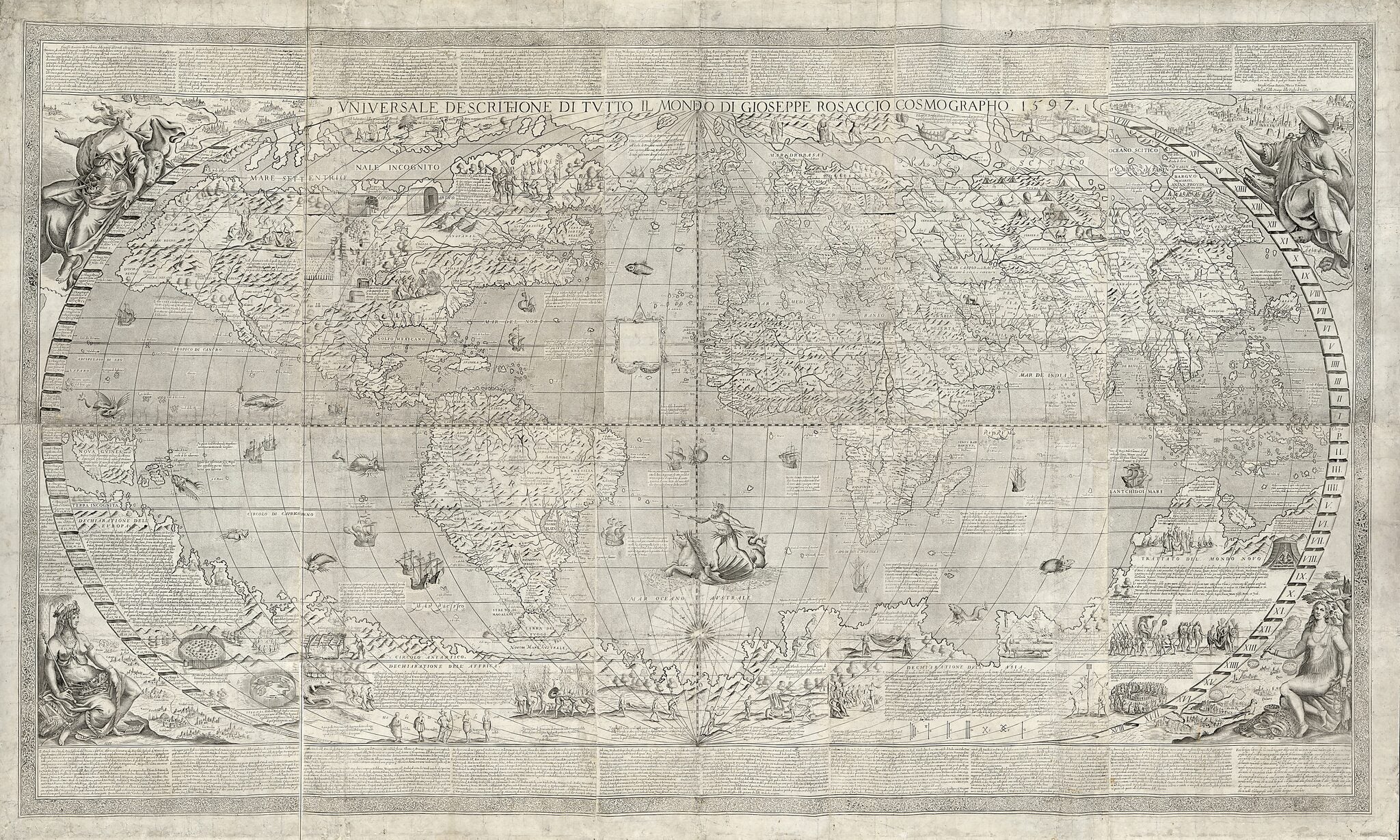
Vniversale Descrittione Di Tvtto Il Monde (Universale Descrittione Di Tutto Il Monde) 1643
- Regular price
-
$293.95 - Regular price
-
$288.95 - Sale price
-
$293.95
Buy one map, get any other map in our collection for 50% OFF! Add to cart to see discount.
Couldn't load pickup availability
About This Map
Discover the timeless beauty of our fine art quality printed reproduction of this antique map. Perfect for history enthusiasts, collectors, and interior decorators.
Restored with meticulous attention to detail by our team with over a decade of experience, this stunning reproduction captures the intricate artistry and historical significance of the original map.
Whether you're a collector or seeking a unique decor piece, this archival-quality map reproduction is a timeless addition to any space. Order now to bring history to life!
Created by Giuseppe Rosaccio in 1643.- Relief shown pictorially.
- Probably the second state of the map. Differs from the first state in the reworking of Tierra del Fuego to include the Straits of Magellan. Presents Staten Island, west of Tierra del Fuego, as an island, presumably based on the observations of Hendrik Brouwer in 1643. Differs from the state owned by the Harry Ransom Center by the presence of a blank cartouche off the west coast of Africa in the center of the map.
- Includes text and illustrations.
- Wall map assembled from 10 engraved folio sheets.
Map Subjects
Early Maps
Earth
World Maps
World Maps
Early Maps
Giuseppe Rosaccio
1643
- For the best legibility, order your map in the original size or larger. Most maps have intricate detail and small text that is best appreciated when the print size hasn't been reduced.
- Sizes labeled "Fits a Standard Frame" will drop right into any frame that you purchase in that size. The sizes that we offer are commonly available online and at most retail stores.
- Our standard sizes are recommendations based on the aspect ratio of the original map, but still may require some added "white space" in one dimension to fit.
- Non-standard sizes will require custom framing, and we suggest taking your print to the frame shop of your choice after you receive it for the best results.
- Custom sizes are available, simply contact us for a quote.
Below is an approximation of the scale of a few standard sizes, and how they might appear in your space.
