
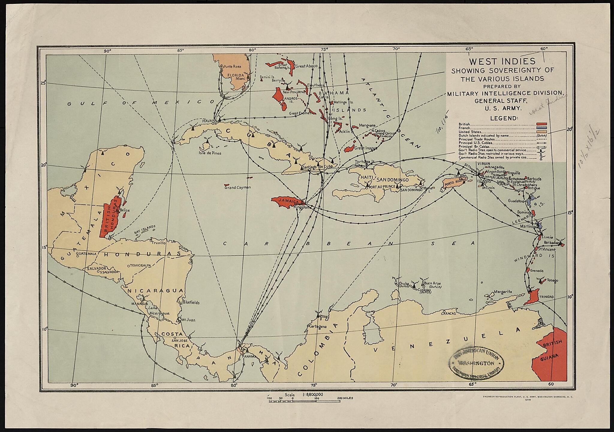
West Indies Showing Sovereignty of the Various Islands 1914
- Regular price
-
$52.95 - Regular price
-
$47.95 - Sale price
-
$52.95
Buy one map, get any other map in our collection for 50% OFF! Add to cart to see discount.
Couldn't load pickup availability
About This Map
Discover the timeless beauty of our fine art quality printed reproduction of this antique map. Perfect for history enthusiasts, collectors, and interior decorators.
Restored with meticulous attention to detail by our team with over a decade of experience, this stunning reproduction captures the intricate artistry and historical significance of the original map.
Whether you're a collector or seeking a unique decor piece, this archival-quality map reproduction is a timeless addition to any space. Order now to bring history to life!
going traffic between the Atlantic and Pacific coasts of the United States increased the strategic importance of the region. During World War II, the United States took diplomatic and military steps to prevent the Caribbean colonies of France and the Netherlands from falling into German hands after these countries were overrun by Nazi Germany in May--June 1940.Created by United States. Department of the Army. General Staff. Military Intelligence Division in 1914.
- Title devised, in English, by Library staff.
- "Scale 1:8,800,000"--Note extracted from World Digital Library.
- Original resource extent: 1 map : color ; 47 x 32 centimeters.
- Original resource at: Columbus Memorial Library, Organization of American States.
- Content in English.
- Description based on data extracted from World Digital Library, which may be extracted from partner institutions.
Map Subjects
1914 To 1940
Colonies
France
Great Britain
Military Maps
Panama Canal
West Indies
United States. Department Of The Army. General Staff. Military Intelligence Division
1914
- For the best legibility, order your map in the original size or larger. Most maps have intricate detail and small text that is best appreciated when the print size hasn't been reduced.
- Sizes labeled "Fits a Standard Frame" will drop right into any frame that you purchase in that size. The sizes that we offer are commonly available online and at most retail stores.
- Our standard sizes are recommendations based on the aspect ratio of the original map, but still may require some added "white space" in one dimension to fit.
- Non-standard sizes will require custom framing, and we suggest taking your print to the frame shop of your choice after you receive it for the best results.
- Custom sizes are available, simply contact us for a quote.
Below is an approximation of the scale of a few standard sizes, and how they might appear in your space.

