
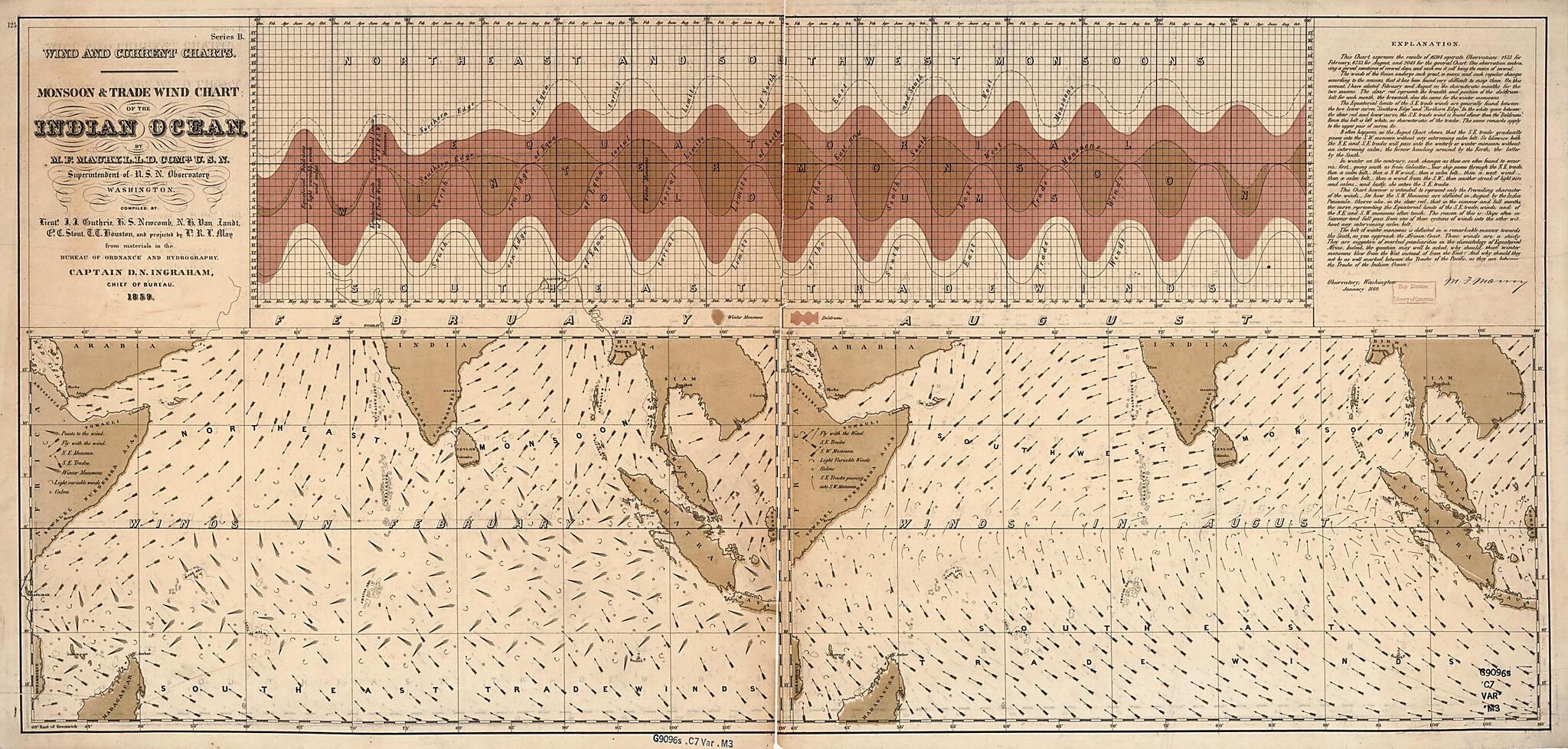
Monsoon & Trade Wind Chart of the Indian Ocean (Wind and Current Charts, Monsoon and Trade Wind Chart of the Indian Ocean, Indian Ocean) 1859
- Regular price
-
$73.95 - Regular price
-
$68.95 - Sale price
-
$73.95
Buy one map, get any other map in our collection for 50% OFF! Add to cart to see discount.
Couldn't load pickup availability
About This Map
Discover the timeless beauty of our fine art quality printed reproduction of this antique map. Perfect for history enthusiasts, collectors, and interior decorators.
Restored with meticulous attention to detail by our team with over a decade of experience, this stunning reproduction captures the intricate artistry and historical significance of the original map.
Whether you're a collector or seeking a unique decor piece, this archival-quality map reproduction is a timeless addition to any space. Order now to bring history to life!
Old map of Indian Ocean.Created by John Julien Guthrie, Matthew Fontaine Maury, R. L. May, United States Naval Observatory, United States. Bureau of Ordnance and Hydrography, United States. Hydrographic Office in 1859.
- "Series B."
- Explanation dated "January 1860."
- The trade wind charts were released as series B a part of Maury's "Wind and current charts", series A-F. Two sheets were produced, one for the Atlantic and the other for the Indian Ocean. For complete discussion, see "The wind and current chart series produced by Matthew Fontaine Maury," by Marc I. Pinsel, in Navigation : Journal of the Institute of Navigation, v. 28, no. 2 (Summer, 1981), p. 123-137.
- Copy This map has some imperfections: mounted on cloth backing. We'll do our best to restore the image before printing.
- Includes notes in map area with signature of M.F. Maury.
Map Subjects
Indian Ocean
Monsoons
Nautical Charts
Trade Winds
Winds
John Julien Guthrie
Matthew Fontaine Maury
R. L. May
United States Naval Observatory
United States. Bureau Of Ordnance And Hydrography
United States. Hydrographic Office
1859
- For the best legibility, order your map in the original size or larger. Most maps have intricate detail and small text that is best appreciated when the print size hasn't been reduced.
- Sizes labeled "Fits a Standard Frame" will drop right into any frame that you purchase in that size. The sizes that we offer are commonly available online and at most retail stores.
- Our standard sizes are recommendations based on the aspect ratio of the original map, but still may require some added "white space" in one dimension to fit.
- Non-standard sizes will require custom framing, and we suggest taking your print to the frame shop of your choice after you receive it for the best results.
- Custom sizes are available, simply contact us for a quote.
Below is an approximation of the scale of a few standard sizes, and how they might appear in your space.
