
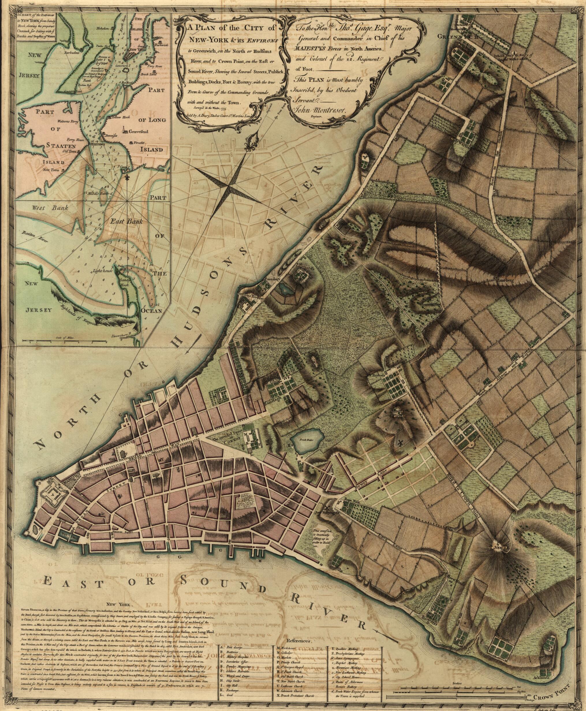
York & Its Environs to Greenwich, On the North Or Hudsons River, and to Crown Point, On the East Or Sound River, Shewing the Several Streets, Publick Buildings, Docks, Fort & Battery, With the True Form & Course of the Commanding Grounds, With and Wit...
- Regular price
-
$57.95 - Regular price
-
$40.95 - Sale price
-
$57.95
Buy one map, get any other map in our collection for 50% OFF! Add to cart to see discount.
Couldn't load pickup availability
About This Map
Discover the timeless beauty of our fine art quality printed reproduction of this antique map. Perfect for history enthusiasts, collectors, and interior decorators.
Restored with meticulous attention to detail by our team with over a decade of experience, this stunning reproduction captures the intricate artistry and historical significance of the original map.
Whether you're a collector or seeking a unique decor piece, this archival-quality map reproduction is a timeless addition to any space. Order now to bring history to life!
Old map of New York, New York (State), New York City, United States.Created by Peter Andrews, Andrew Dury, John Montrésor in 1775.
- Scale ca. 1:6,300.
- Relief shown by hachures. Depths shown by form lines.
- Dedicated to Major Gen. Thos. Gage.
- Includes descriptive note, "References," and inset "A chart of the entrance to New York from Sandy Hook, shewing the properest channel for sailing, with ye banks and depths of water" ca. 1:128,000.
- Stokes, I. N. P. Iconography of Manhattan Island.
- For the best legibility, order your map in the original size or larger. Most maps have intricate detail and small text that is best appreciated when the print size hasn't been reduced.
- Sizes labeled "Fits a Standard Frame" will drop right into any frame that you purchase in that size. The sizes that we offer are commonly available online and at most retail stores.
- Our standard sizes are recommendations based on the aspect ratio of the original map, but still may require some added "white space" in one dimension to fit.
- Non-standard sizes will require custom framing, and we suggest taking your print to the frame shop of your choice after you receive it for the best results.
- Custom sizes are available, simply contact us for a quote.
Below is an approximation of the scale of a few standard sizes, and how they might appear in your space.

