
Zehn Karten Und Ansichten Den Schlachtfelden Des Amerikanischen Unabhängigkeitskreiges In Den Staaten Pennsylvanien Und New York 1777
- Regular price
-
$49.95 - Regular price
-
$34.95 - Sale price
-
$49.95
Buy one map, get any other map in our collection for 50% OFF! Add to cart to see discount.
Couldn't load pickup availability
About This Map
Discover the timeless beauty of our fine art quality printed reproduction of this antique map. Perfect for history enthusiasts, collectors, and interior decorators.
Restored with meticulous attention to detail by our team with over a decade of experience, this stunning reproduction captures the intricate artistry and historical significance of the original map.
Whether you're a collector or seeking a unique decor piece, this archival-quality map reproduction is a timeless addition to any space. Order now to bring history to life!
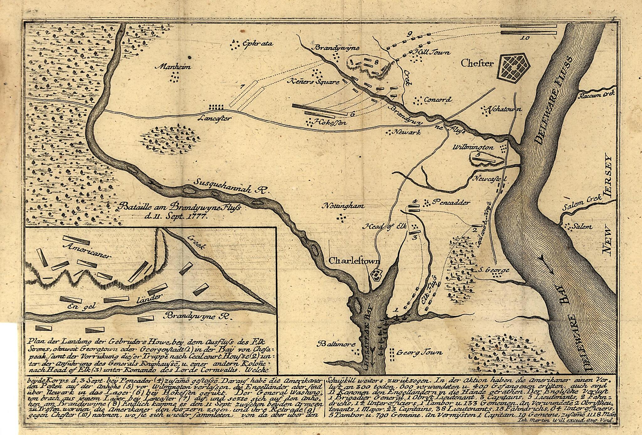
Old map of Chestnut Hill (Philadelphia), Germantown (Philadelphia), New York, New York (State), Pennsylvania, Philadelphia Region, United States.Created by Johann Martin Will in 1777.
- Relief shown by hachures on some maps and by landform drawings on some views.
- Individual map/view titles in German; statements of attribution in Latin.
- Statements of attribution differ: Ioh. Martin Will excudit Aug. Vind. -- Ioh. Martin Will. excud. Aug. Vind. -- Ioh. Mart. Will exc. Aug. Vind.
- Title devised by cataloger.
- Orientation differs.
- Includes index to military points of interest. Some maps also include text and local-area inset.
Map Subjects
Aerial Views
Brandywine Battle Of PA
Burgoyne's Invasion
Chestnut Hill (Philadelphia)
Chestnut Hill Battle Of Philadelphia PA
Clinton's Hudson River Expedition
Early Works To 1800
Germantown (Philadelphia)
Germantown Battle Of Philadelphia PA
History
New York (State)
Pennsylvania
Philadelphia Region (Pa.)
Revolution
United States
New York
Philadelphia Region
Johann Martin Will
1777
- For the best legibility, order your map in the original size or larger. Most maps have intricate detail and small text that is best appreciated when the print size hasn't been reduced.
- Sizes labeled "Fits a Standard Frame" will drop right into any frame that you purchase in that size. The sizes that we offer are commonly available online and at most retail stores.
- Our standard sizes are recommendations based on the aspect ratio of the original map, but still may require some added "white space" in one dimension to fit.
- Non-standard sizes will require custom framing, and we suggest taking your print to the frame shop of your choice after you receive it for the best results.
- Custom sizes are available, simply contact us for a quote.
Below is an approximation of the scale of a few standard sizes, and how they might appear in your space.
