Quick links
25001 products
-
 4 Views of Property from Combination Atlas Map of Cumberland County, New Jersey 18764 Views of Property from Combination Atlas Map of Cumberland County, New Jersey 1876
- Regular price
-
$39.95 $83.95 - Regular price
-
$10.95 - Sale price
-
$39.95 $83.95
-
 4 Views of Property from Combination Atlas Map of Cumberland County, New Jersey 18764 Views of Property from Combination Atlas Map of Cumberland County, New Jersey 1876
- Regular price
-
$39.95 $83.95 - Regular price
-
$10.95 - Sale price
-
$39.95 $83.95
-
 4 Views of Property from Combination Atlas Map of Cumberland County, New Jersey 18764 Views of Property from Combination Atlas Map of Cumberland County, New Jersey 1876
- Regular price
-
$39.95 $83.95 - Regular price
-
$10.95 - Sale price
-
$39.95 $83.95
-
 4 Views of Saginaw City from Atlas of Saginaw County, Michigan : from Recent and Actual Surveys and Records 18774 Views of Saginaw City from Atlas of Saginaw County, Michigan : from Recent and Actual Surveys and Records 1877
- Regular price
-
$39.95 $83.95 - Regular price
-
$7.95 - Sale price
-
$39.95 $83.95
-
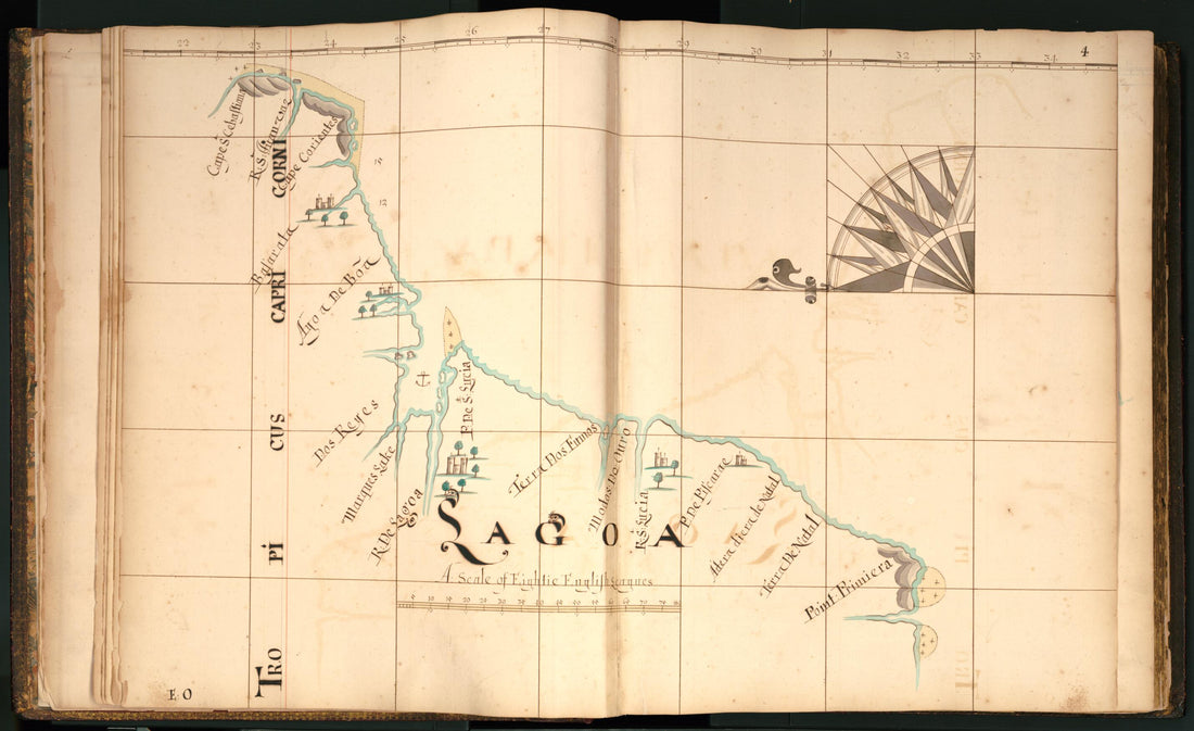 4) Lagao from Buccaneer Atlas 16904) Lagao from Buccaneer Atlas 1690
- Regular price
-
$46.95 $207.95 - Regular price
-
$41.95 - Sale price
-
$46.95 $207.95
-
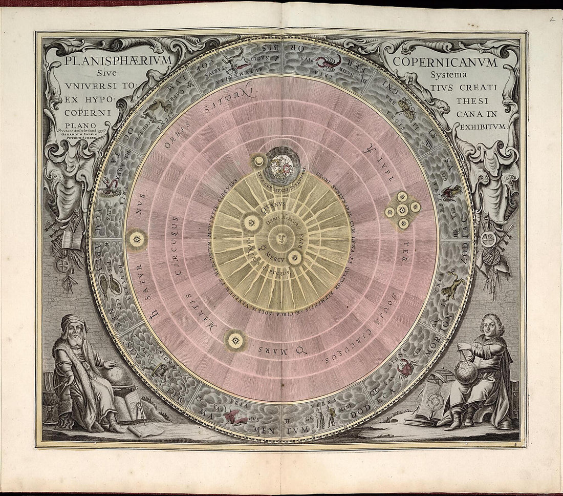 4. Planisphaerium Copernicanum Sive Systema Universi from Atlas Universalis Et Novus 17084. Planisphaerium Copernicanum Sive Systema Universi from Atlas Universalis Et Novus 1708
- Regular price
-
$39.95 $171.95 - Regular price
-
$34.95 - Sale price
-
$39.95 $171.95
-
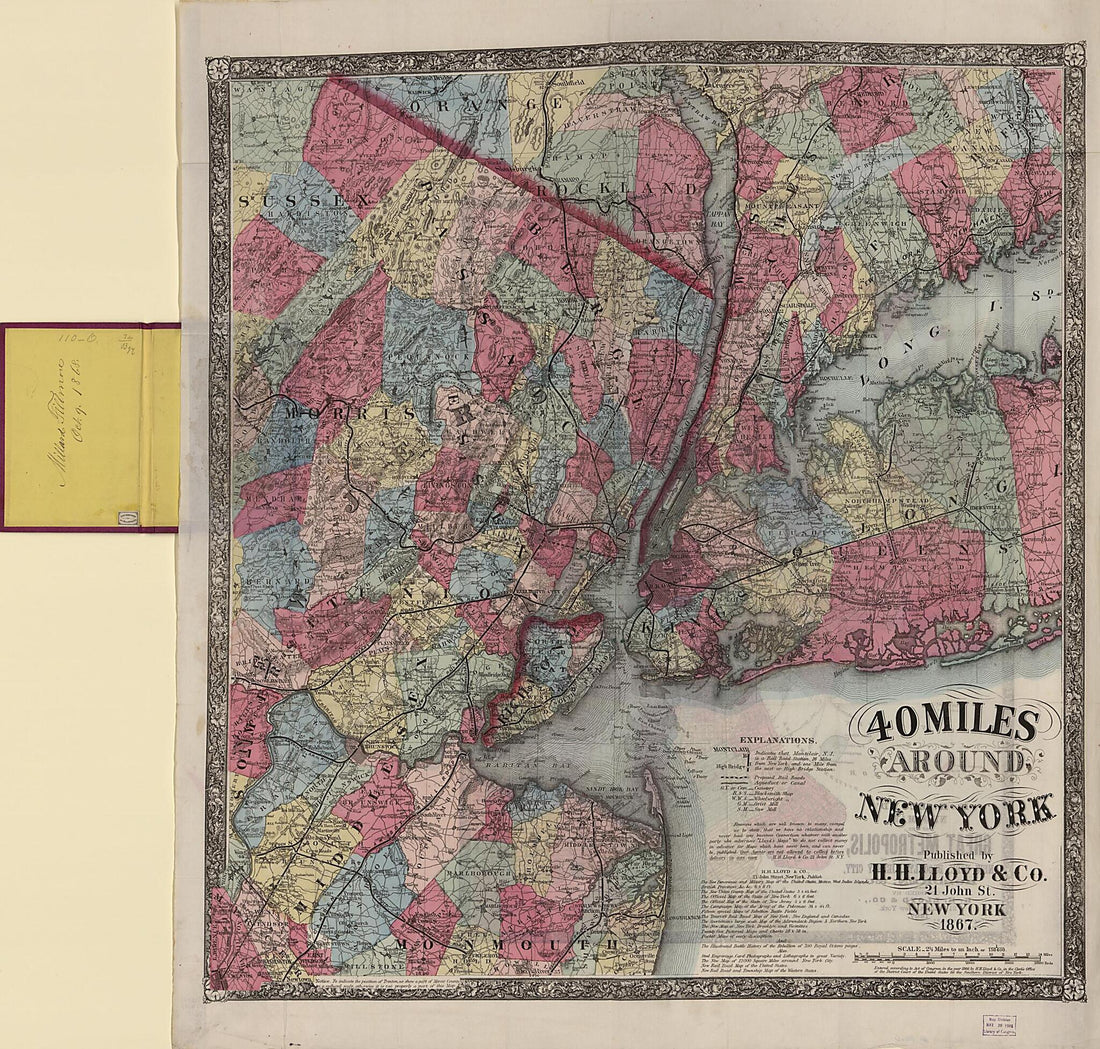 40 Miles Around New York (Forty Miles Around New York, H.H. Lloyd's New York and Forty Miles Around It :, New York and Forty Miles Around It) 186740 Miles Around New York (Forty Miles Around New York, H.H. Lloyd's New York and Forty Miles Around It :, New York and Forty Miles Around It) 1867
- Regular price
-
$39.95 $205.95 - Regular price
-
$34.95 - Sale price
-
$39.95 $205.95
-
 40) Comarin from Buccaneer Atlas 169040) Comarin from Buccaneer Atlas 1690
- Regular price
-
$46.95 $226.95 - Regular price
-
$41.95 - Sale price
-
$46.95 $226.95
-
 41) Ceiloan from Buccaneer Atlas 169041) Ceiloan from Buccaneer Atlas 1690
- Regular price
-
$46.95 $224.95 - Regular price
-
$41.95 - Sale price
-
$46.95 $224.95
-
 41: Arcola from Plat Book of Douglas County, Illinois 189341: Arcola from Plat Book of Douglas County, Illinois 1893
- Regular price
-
$39.95 $99.95 - Regular price
-
$36.95 - Sale price
-
$39.95 $99.95
-
 42) Ceiloan from Buccaneer Atlas 169042) Ceiloan from Buccaneer Atlas 1690
- Regular price
-
$46.95 $222.95 - Regular price
-
$41.95 - Sale price
-
$46.95 $222.95


