Quick links
25001 products
-
 A Celestial Planisphere, Or Map of the Heavens 1835A Celestial Planisphere, Or Map of the Heavens 1835
- Regular price
-
$43.95 $88.95 - Regular price
-
$38.95 - Sale price
-
$43.95 $88.95
-
 A Centennial Map of the Lexington Presbytery of the Synod of Virginia of the Presbyterian Church In the United States, Organized Sept. 26, 1786, Centennial Sept. 26, 1886, at Timber Ridge ChurchA Centennial Map of the Lexington Presbytery of the Synod of Virginia of the Presbyterian Church In the United States, Organized Sept. 26, 1786, Centennial Sept. 26, 1886, at Timber Ridge Church
- Regular price
-
$43.95 $83.95 - Regular price
-
$38.95 - Sale price
-
$43.95 $83.95
-
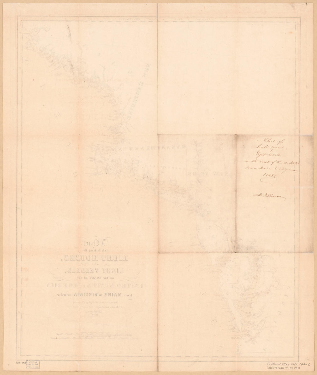 A Chart Exhibiting the Light Houses and Light Vessels On the Coast of the United States of America : from Maine to Virginia Inclusive (Chart Exhibiting the Light Houses and Light Vessels from Maine to Virginia Inclusive) 1848A Chart Exhibiting the Light Houses and Light Vessels On the Coast of the United States of America : from Maine to Virginia Inclusive (Chart Exhibiting the Light Houses and Light Vessels from Maine to Virginia Inclusive) 1848
- Regular price
-
$43.95 $83.95 - Regular price
-
$38.95 - Sale price
-
$43.95 $83.95
-
 A Chart Exhibiting the Lighthouses and Lightvessels On the Coasts of the United States of America : from Virginia Exclusive to Texas Inclusive (Chart Exhibiting the Lighthouses and Lightvessels from Virginia Exclusive to Texas Inclusive) 1848A Chart Exhibiting the Lighthouses and Lightvessels On the Coasts of the United States of America : from Virginia Exclusive to Texas Inclusive (Chart Exhibiting the Lighthouses and Lightvessels from Virginia Exclusive to Texas Inclusive) 1848
- Regular price
-
$46.95 $258.95 - Regular price
-
$41.95 - Sale price
-
$46.95 $258.95
-
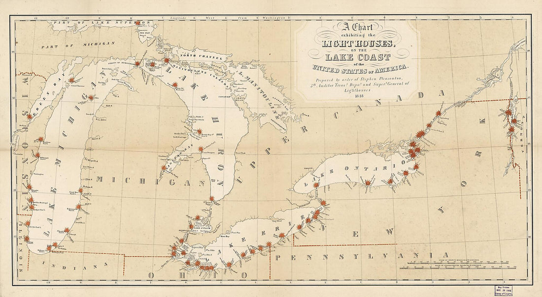 A Chart Exhibiting the Lighthouses of the Lake Coast of the United States of America 1848A Chart Exhibiting the Lighthouses of the Lake Coast of the United States of America 1848
- Regular price
-
$46.95 $127.95 - Regular price
-
$41.95 - Sale price
-
$46.95 $127.95
-
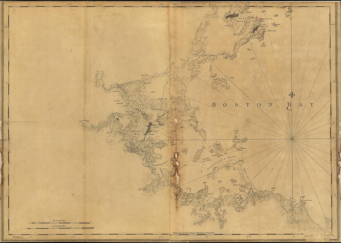 A Chart of Boston Bay and Vicinity 1776A Chart of Boston Bay and Vicinity 1776
- Regular price
-
$43.95 $130.95 - Regular price
-
$32.95 - Sale price
-
$43.95 $130.95
-
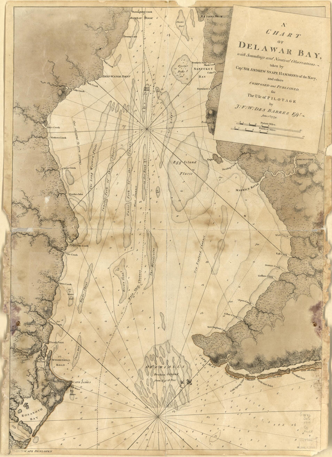 A Chart of Delawar Bay, With Soundings and Nautical Observations 1779A Chart of Delawar Bay, With Soundings and Nautical Observations 1779
- Regular price
-
$43.95 $88.95 - Regular price
-
$32.95 - Sale price
-
$43.95 $88.95
-
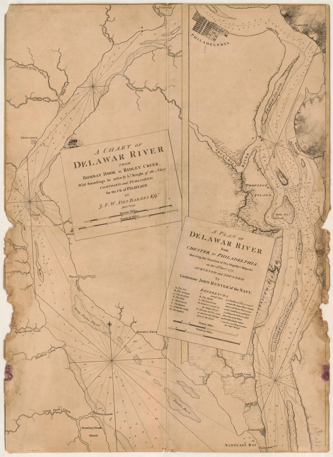 A Chart of Delawar River from Bombay Hook to Ridley Creek, With Soundings &c Taken by Lt. Knight of the Navy 1779A Chart of Delawar River from Bombay Hook to Ridley Creek, With Soundings &c Taken by Lt. Knight of the Navy 1779
- Regular price
-
$43.95 $88.95 - Regular price
-
$38.95 - Sale price
-
$43.95 $88.95
-
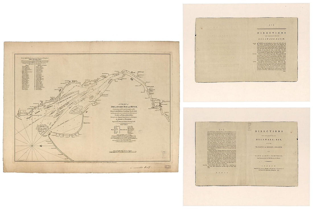
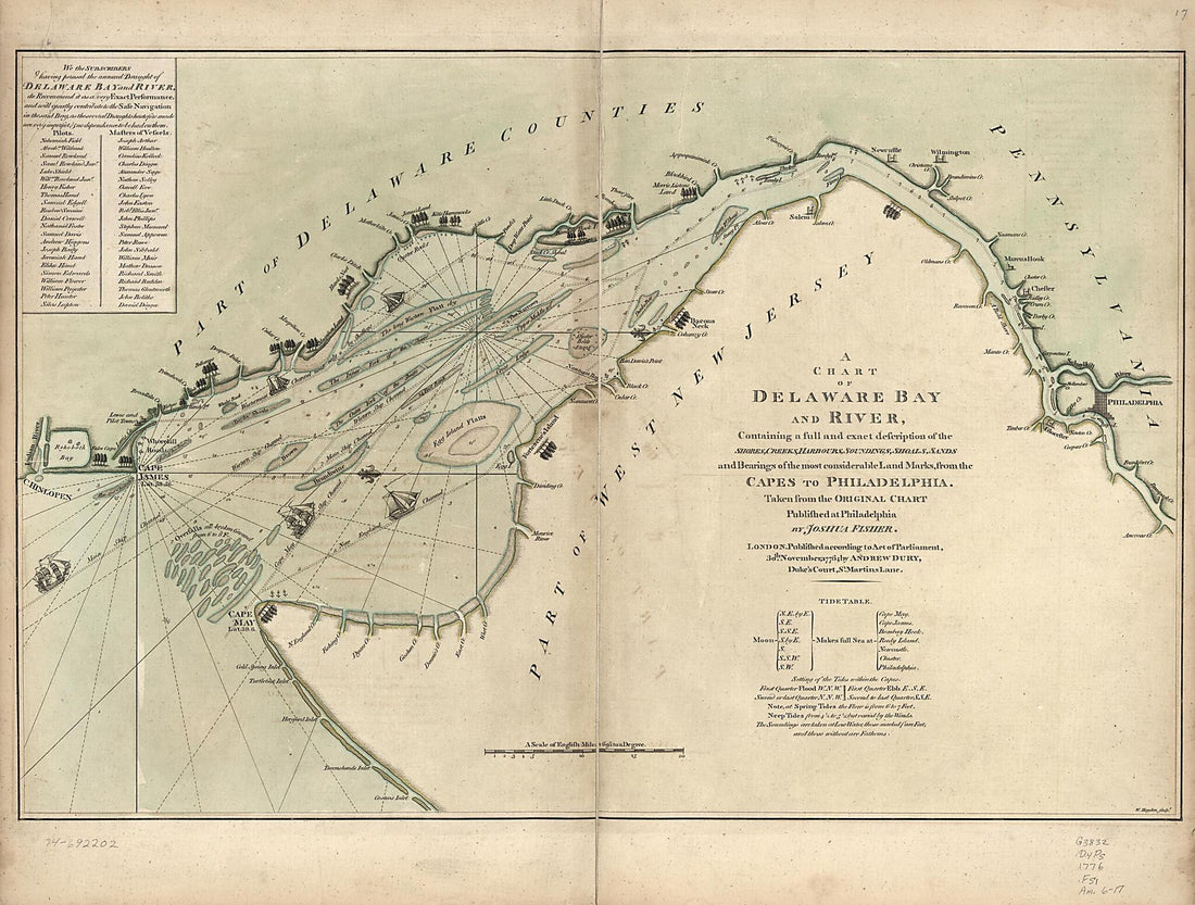 A Chart of Delaware Bay and River : Containing a Full and Exact Description of the Shores, Creeks, Harbours, Soundings, Shoals, Sands, and Bearings of the Most Considerable Land Marks, from the Capes to Philadelphia 1776A Chart of Delaware Bay and River : Containing a Full and Exact Description of the Shores, Creeks, Harbours, Soundings, Shoals, Sands, and Bearings of the Most Considerable Land Marks, from the Capes to Philadelphia 1776
- Regular price
-
$43.95 $217.95 - Regular price
-
$32.95 - Sale price
-
$43.95 $217.95
-
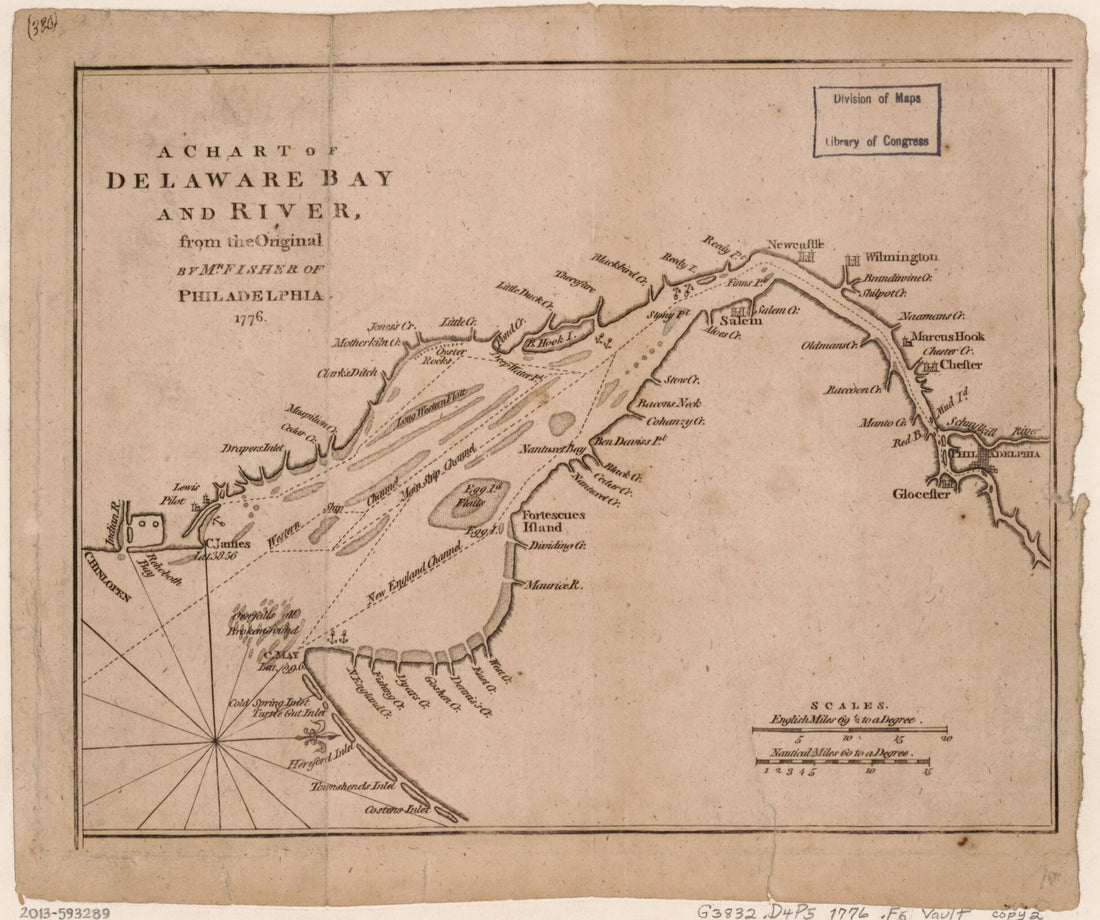 A Chart of Delaware Bay and River : from the Original 1776A Chart of Delaware Bay and River : from the Original 1776
- Regular price
-
$39.95 $83.95 - Regular price
-
$34.95 - Sale price
-
$39.95 $83.95
-
 A Chart of Delaware Bay and River from the North American Atlas, Selected from the Most Authentic Maps, Charts, Plans, &c. Hitherto Published. 1777A Chart of Delaware Bay and River from the North American Atlas, Selected from the Most Authentic Maps, Charts, Plans, &c. Hitherto Published. 1777
- Regular price
-
$46.95 $220.95 - Regular price
-
$41.95 - Sale price
-
$46.95 $220.95
-
 A Chart of Delaware Bay and River, Containing a Full & Exact Description of the Shores, Creeks, Harbours, Soundings, Shoals, Sands, and Bearings of the Most Considerable Land Marks, from the Cape to Philadelphia 1776A Chart of Delaware Bay and River, Containing a Full & Exact Description of the Shores, Creeks, Harbours, Soundings, Shoals, Sands, and Bearings of the Most Considerable Land Marks, from the Cape to Philadelphia 1776
- Regular price
-
$46.95 $326.95 - Regular price
-
$41.95 - Sale price
-
$46.95 $326.95


