Quick links
25001 products
-
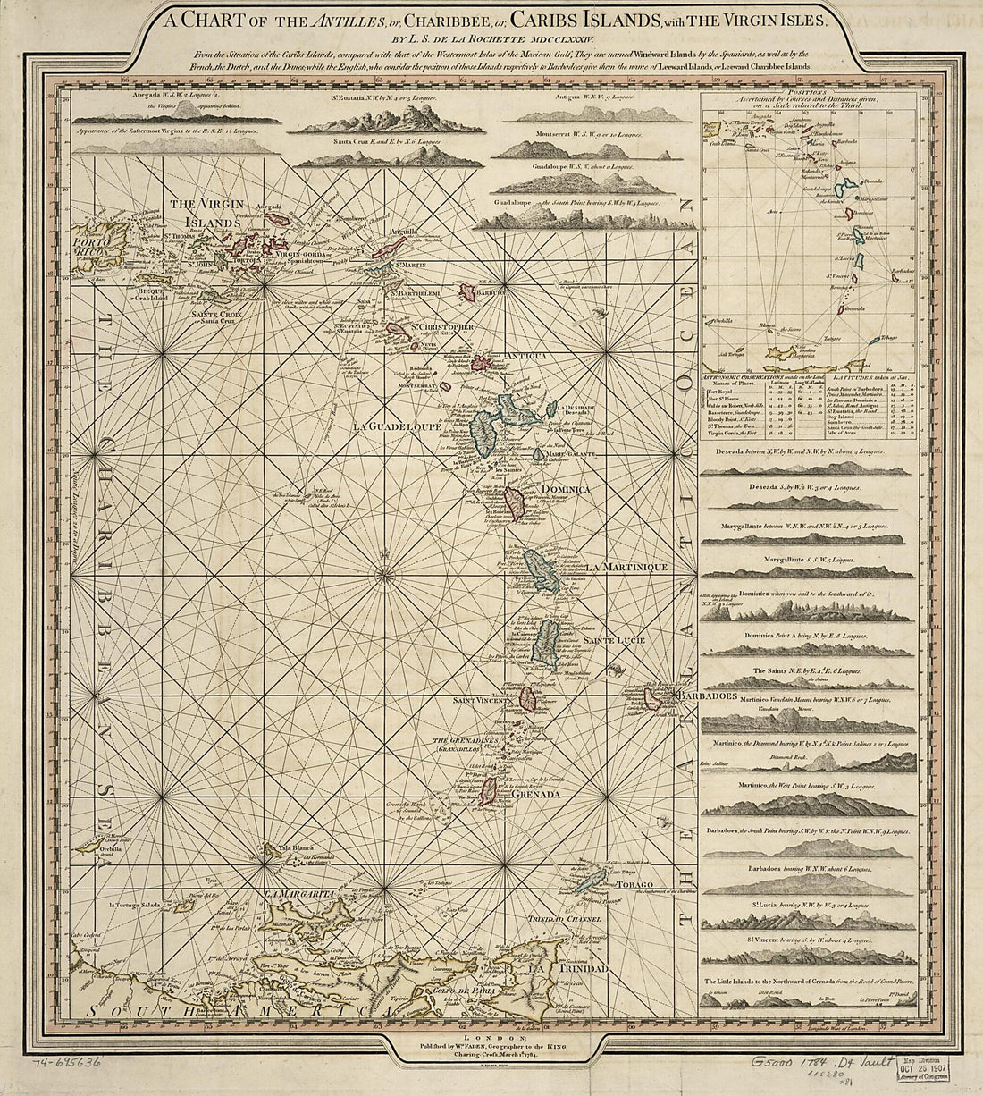 A Chart of the Antilles, Or, Charibbee, Or, Caribs Islands, With the Virgin Isles 1784A Chart of the Antilles, Or, Charibbee, Or, Caribs Islands, With the Virgin Isles 1784
- Regular price
-
$39.95 $162.95 - Regular price
-
$34.95 - Sale price
-
$39.95 $162.95
-
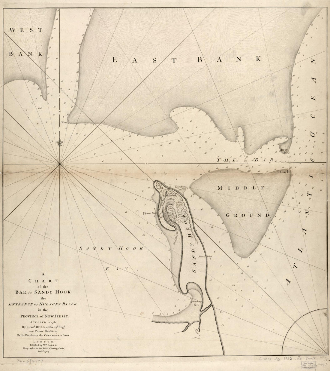 A Chart of the Bar of Sandy Hook the Entrance of Hudson's River In the Province of New Jersey; in 1782A Chart of the Bar of Sandy Hook the Entrance of Hudson's River In the Province of New Jersey; in 1782
- Regular price
-
$39.95 $115.95 - Regular price
-
$34.95 - Sale price
-
$39.95 $115.95
-
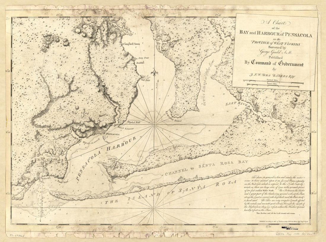 A Chart of the Bay and Harbour of Pensacola In the Province of West Florida 1780A Chart of the Bay and Harbour of Pensacola In the Province of West Florida 1780
- Regular price
-
$43.95 $88.95 - Regular price
-
$38.95 - Sale price
-
$43.95 $88.95
-
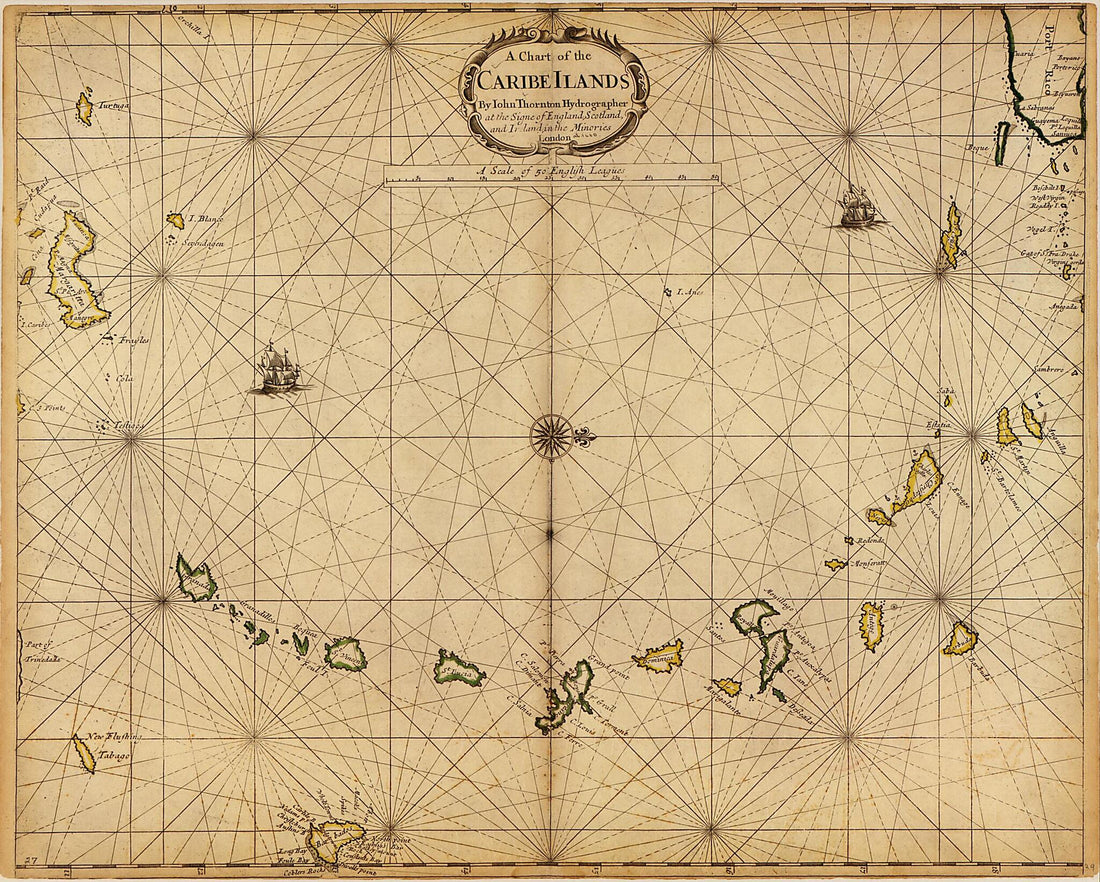 A Chart of the Caribe Ilands sic 1680A Chart of the Caribe Ilands sic 1680
- Regular price
-
$39.95 $93.95 - Regular price
-
$34.95 - Sale price
-
$39.95 $93.95
-
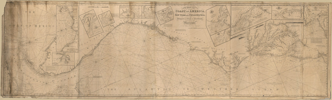 A Chart of the Coast of America : From New York and Philadelphia to the Strait Or Gulf of Florida, and From Thence to the Mississippi in 1837A Chart of the Coast of America : From New York and Philadelphia to the Strait Or Gulf of Florida, and From Thence to the Mississippi in 1837
- Regular price
-
$46.95 $285.95 - Regular price
-
$41.95 - Sale price
-
$46.95 $285.95
-
 A Chart of the Coast of Arabia, the Red Sea and Persian Gulf, Drawn from the Chart of the Eastern Ocean 1740A Chart of the Coast of Arabia, the Red Sea and Persian Gulf, Drawn from the Chart of the Eastern Ocean 1740
- Regular price
-
$39.95 $83.95 - Regular price
-
$34.95 - Sale price
-
$39.95 $83.95
-
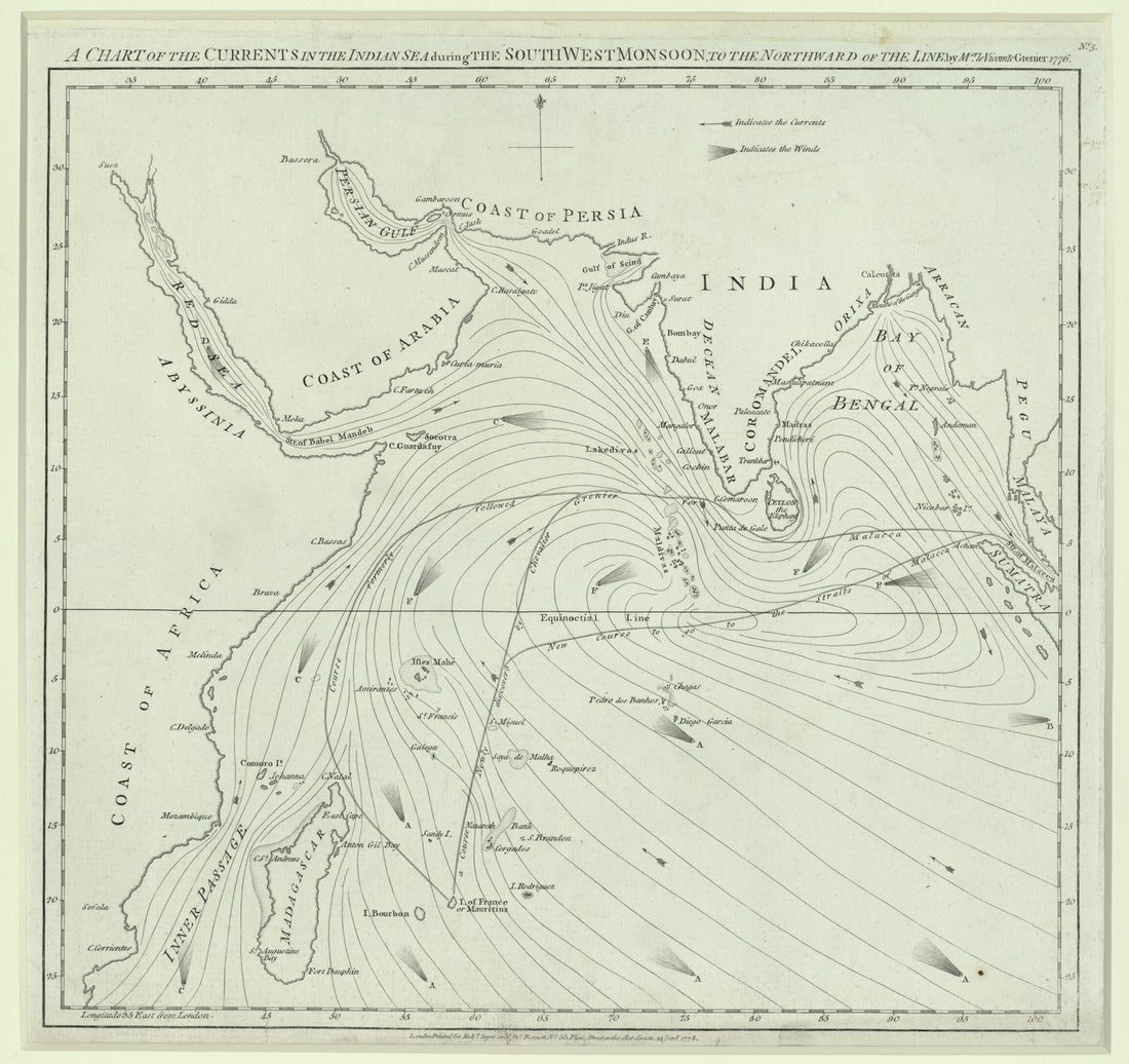 A Chart of the Currents In the Indian Sea During the Southwest Monsoon, to the Northward of the Line. (A Chart of the Currents In the Indian Sea During the Northeast Monsoon, to the Northward of the Line) 1778A Chart of the Currents In the Indian Sea During the Southwest Monsoon, to the Northward of the Line. (A Chart of the Currents In the Indian Sea During the Northeast Monsoon, to the Northward of the Line) 1778
- Regular price
-
$43.95 $83.95 - Regular price
-
$38.95 - Sale price
-
$43.95 $83.95
-
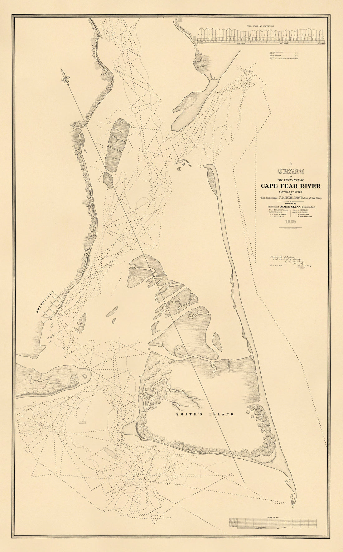 A Chart of the Entrance of Cape Fear River (Cape Fear River) 1839A Chart of the Entrance of Cape Fear River (Cape Fear River) 1839
- Regular price
-
$46.95 $284.95 - Regular price
-
$41.95 - Sale price
-
$46.95 $284.95
-
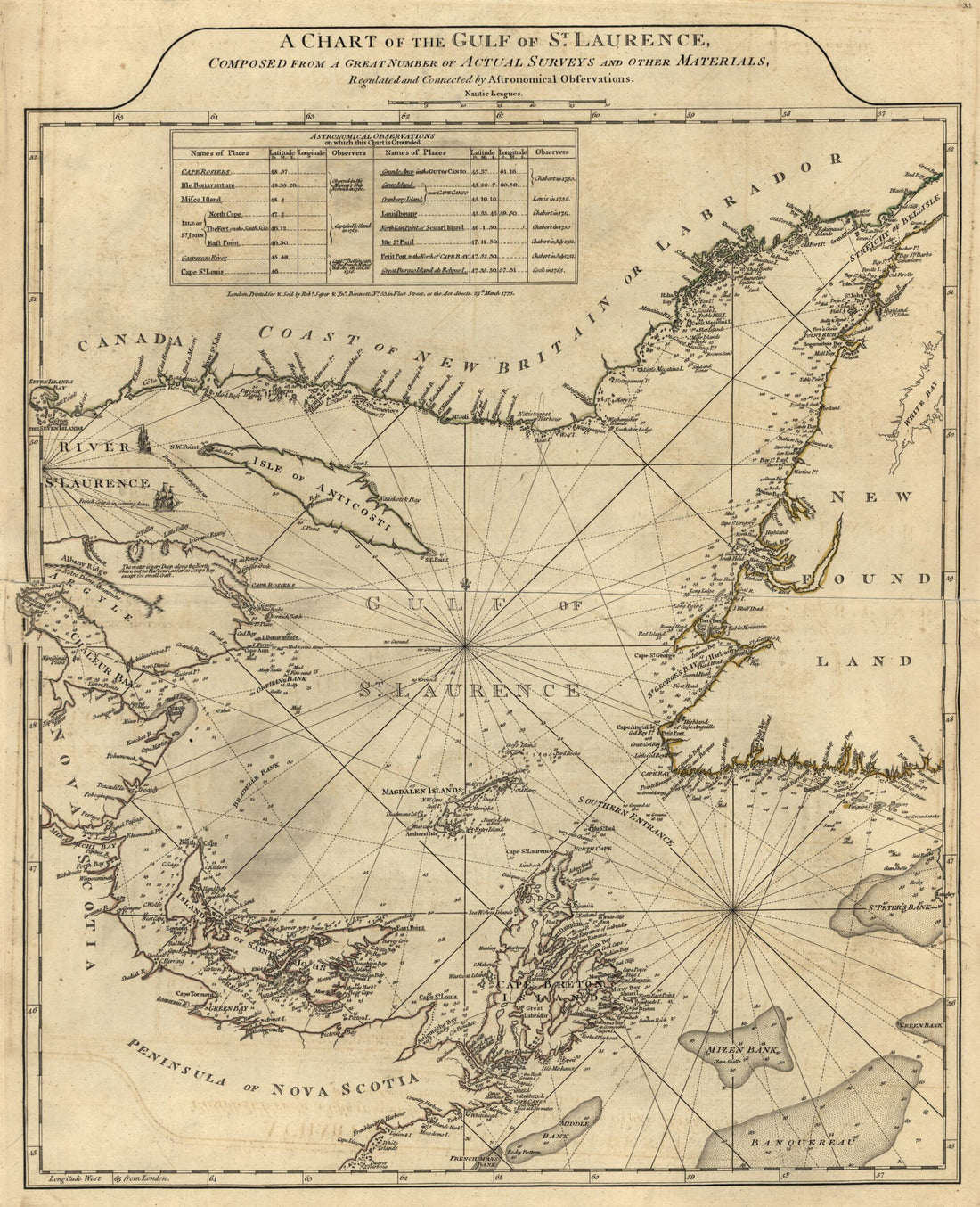
 A Chart of the Gulf of St. Laurence, Composed From a Great Number of Actual Surveys and Other Materials, Regulated and Connected by Astronomical Observations in 1775A Chart of the Gulf of St. Laurence, Composed From a Great Number of Actual Surveys and Other Materials, Regulated and Connected by Astronomical Observations in 1775
- Regular price
-
$43.95 $88.95 - Regular price
-
$38.95 - Sale price
-
$43.95 $88.95
-
 A Chart of the Gulf of St. Lawrence from the North American Atlas, Selected from the Most Authentic Maps, Charts, Plans, &c. Hitherto Published. 1777A Chart of the Gulf of St. Lawrence from the North American Atlas, Selected from the Most Authentic Maps, Charts, Plans, &c. Hitherto Published. 1777
- Regular price
-
$43.95 $208.95 - Regular price
-
$38.95 - Sale price
-
$43.95 $208.95
-
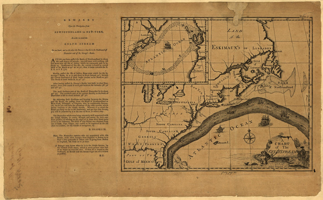 A Chart of the Gulf Stream 1786A Chart of the Gulf Stream 1786
- Regular price
-
$39.95 $99.95 - Regular price
-
$34.95 - Sale price
-
$39.95 $99.95
-
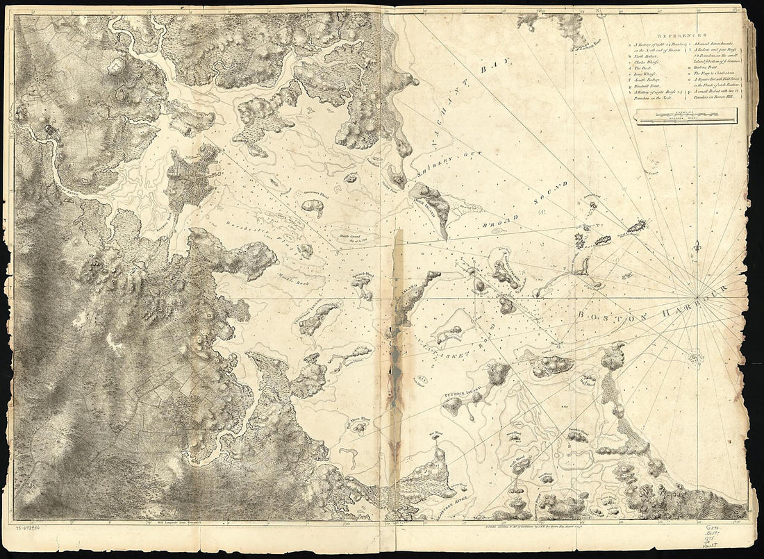 A Chart of the Harbour of Boston 1775A Chart of the Harbour of Boston 1775
- Regular price
-
$43.95 $131.95 - Regular price
-
$32.95 - Sale price
-
$43.95 $131.95


