Quick links
25001 products
-
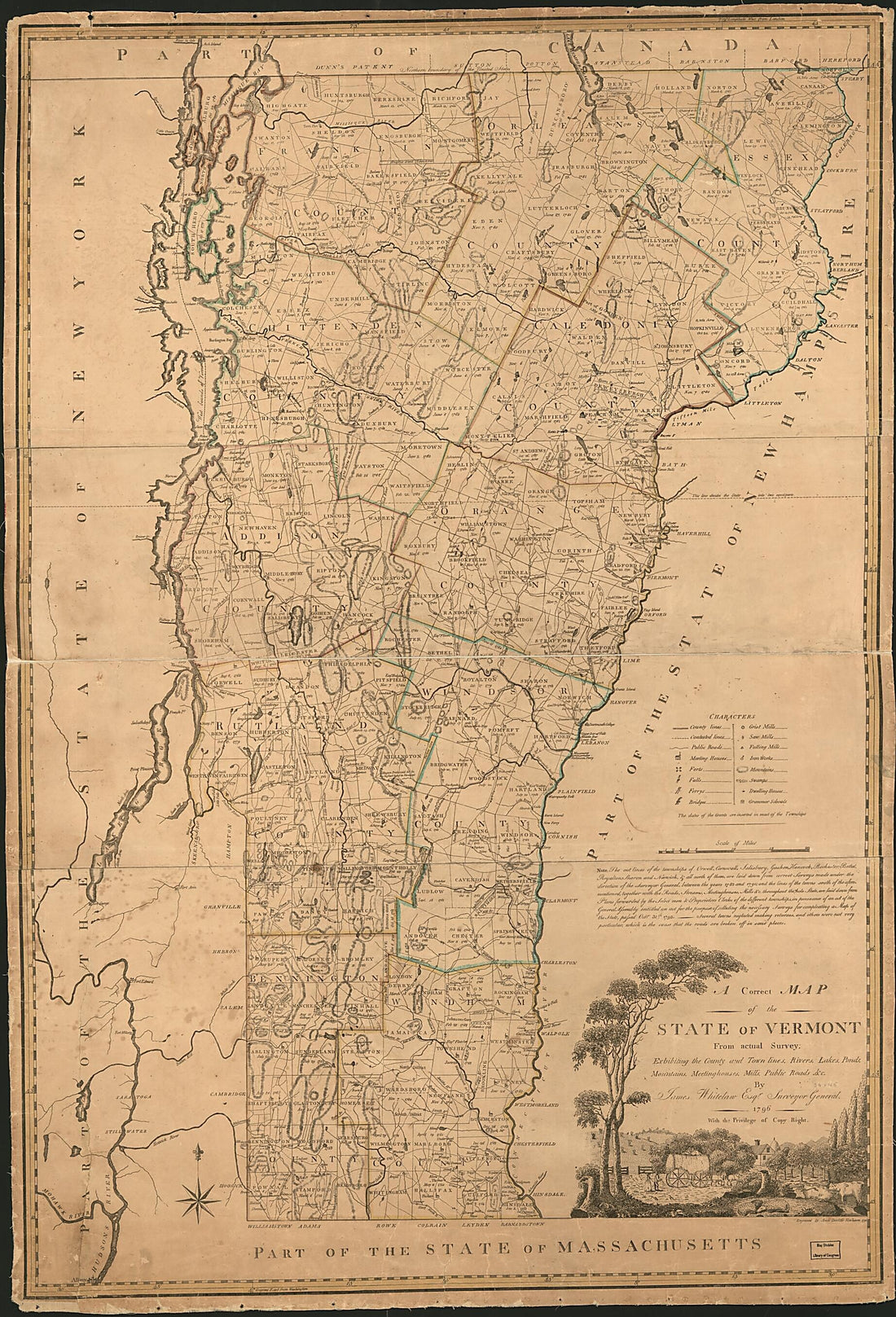 A Correct Map of the State of Vermont : Exhibiting the County and Town Lines, Rivers, Lakes, Ponds, Mountains, Meetinghouses, Mills, Public Roads &c in 1796A Correct Map of the State of Vermont : Exhibiting the County and Town Lines, Rivers, Lakes, Ponds, Mountains, Meetinghouses, Mills, Public Roads &c in 1796
- Regular price
-
$46.95 $263.95 - Regular price
-
$41.95 - Sale price
-
$46.95 $263.95
-
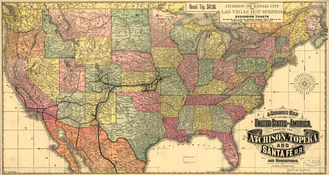 A Correct Map of the United States of America Showing the Atchison, Topeka, and Santa Fé R.R. and Connections 1888A Correct Map of the United States of America Showing the Atchison, Topeka, and Santa Fé R.R. and Connections 1888
- Regular price
-
$46.95 $99.95 - Regular price
-
$41.95 - Sale price
-
$46.95 $99.95
-
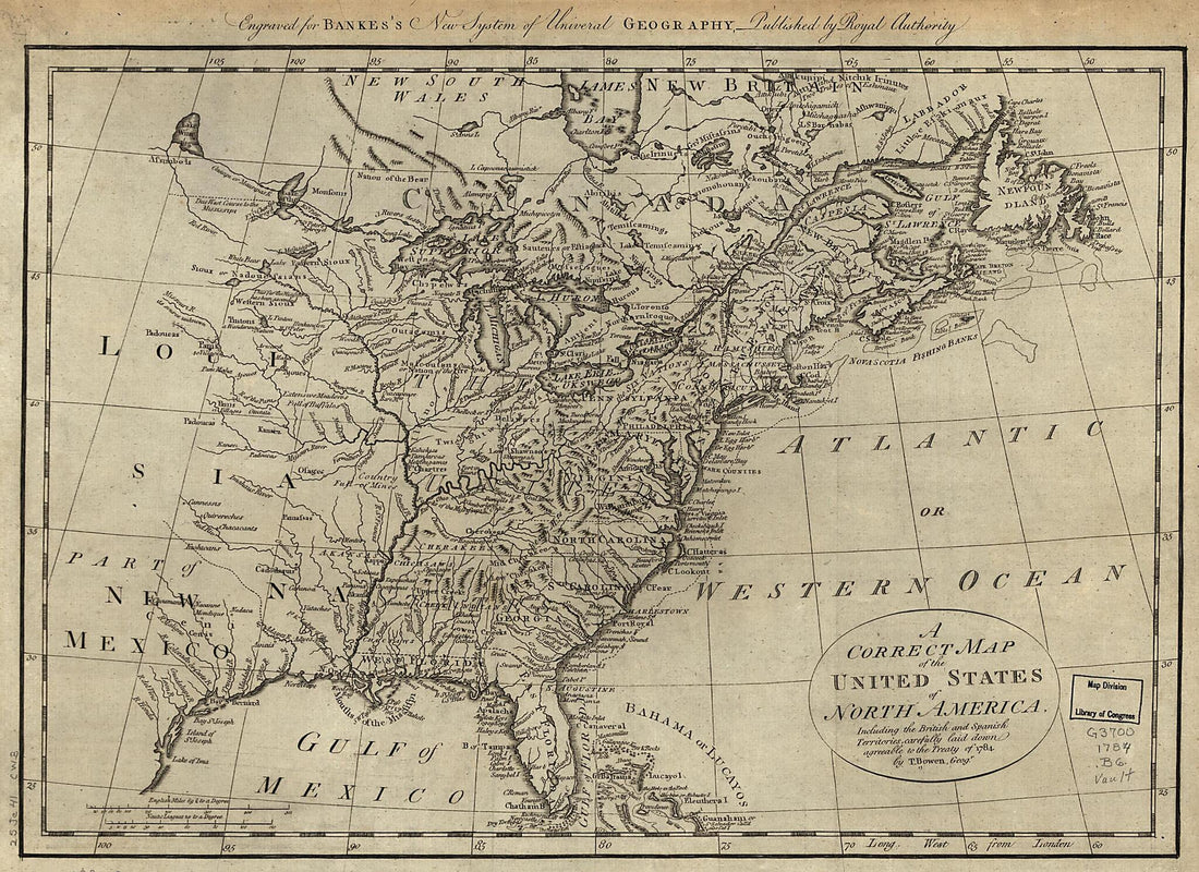 A Correct Map of the United States of North America; Including the British and Spanish Territories, Carefully Laid Down Agreeable to the Treaty of 1784 1780A Correct Map of the United States of North America; Including the British and Spanish Territories, Carefully Laid Down Agreeable to the Treaty of 1784 1780
- Regular price
-
$39.95 $88.95 - Regular price
-
$29.95 - Sale price
-
$39.95 $88.95
-
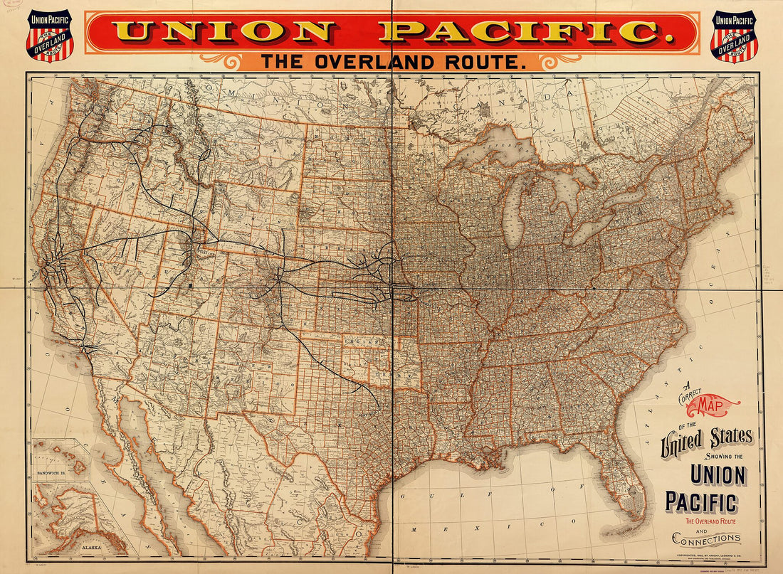 A Correct Map of the United States Showing the Union Pacific, the Overland Route and Connections 1892A Correct Map of the United States Showing the Union Pacific, the Overland Route and Connections 1892
- Regular price
-
$43.95 $229.95 - Regular price
-
$32.95 - Sale price
-
$43.95 $229.95
-
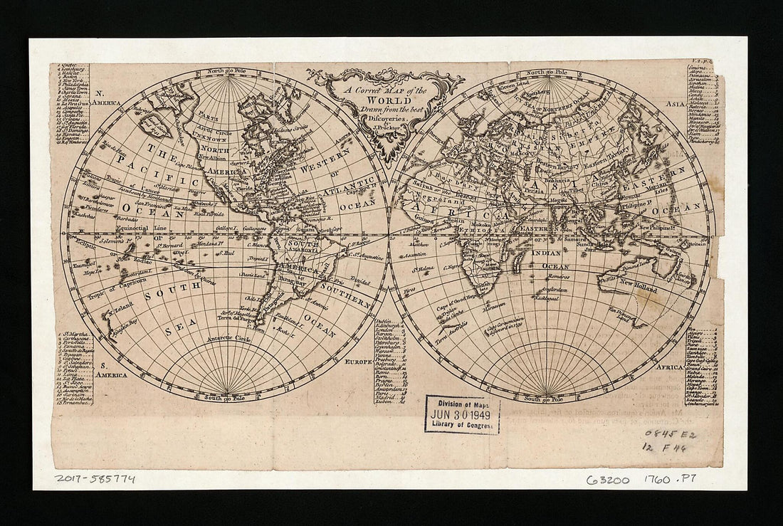 A Correct Map of the World Drawn from the Best Discoveries 1760A Correct Map of the World Drawn from the Best Discoveries 1760
- Regular price
-
$39.95 $99.95 - Regular price
-
$34.95 - Sale price
-
$39.95 $99.95
-
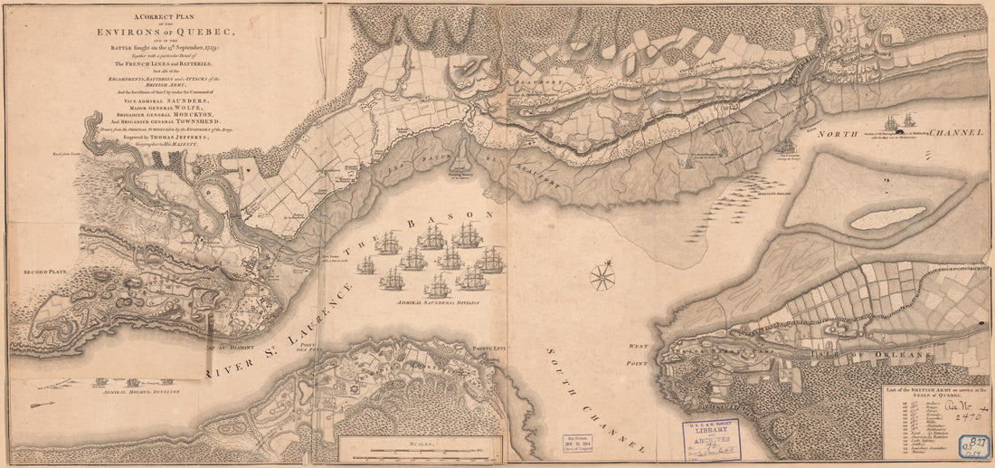 A Correct Plan of the Environs of Quebec, and of the Battle Fought On the 13th September, 1759 : Together With a Particular Detail of the French Lines and Batteries, and Also of the Encampments, Batteries and Attacks of the British Army, and the Inves...A Correct Plan of the Environs of Quebec, and of the Battle Fought On the 13th September, 1759 : Together With a Particular Detail of the French Lines and Batteries, and Also of the Encampments, Batteries and Attacks of the British Army, and the Inves...
- Regular price
-
$46.95 $104.95 - Regular price
-
$41.95 - Sale price
-
$46.95 $104.95
-
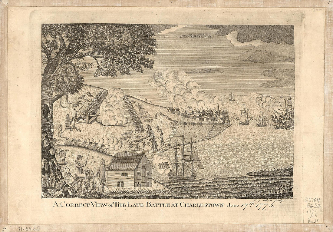 A Correct View of the Late Battle at Charlestown : June 17th, 1775 (Correct View of the Late Battle at Charlestown)A Correct View of the Late Battle at Charlestown : June 17th, 1775 (Correct View of the Late Battle at Charlestown)
- Regular price
-
$39.95 $99.95 - Regular price
-
$29.95 - Sale price
-
$39.95 $99.95
-
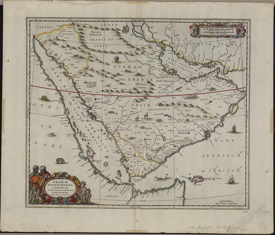 A Current and Correct Depiction of Arabia Felix, Arabia Petraea, and Arabia Deserta. (Arabie Felicis, Petraeae Et Desertae Nova Et Accurata Delineatio) 1658A Current and Correct Depiction of Arabia Felix, Arabia Petraea, and Arabia Deserta. (Arabie Felicis, Petraeae Et Desertae Nova Et Accurata Delineatio) 1658
- Regular price
-
$43.95 $214.95 - Regular price
-
$38.95 - Sale price
-
$43.95 $214.95
-
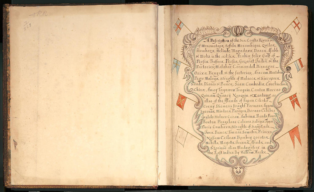 A Description of the Sea Coasts ... In the East Indies (Hack's Descript of Ye East Indies, Buccaneer Atlas) 1690A Description of the Sea Coasts ... In the East Indies (Hack's Descript of Ye East Indies, Buccaneer Atlas) 1690
- Regular price
-
$46.95 $202.95 - Regular price
-
$41.95 - Sale price
-
$46.95 $202.95
-
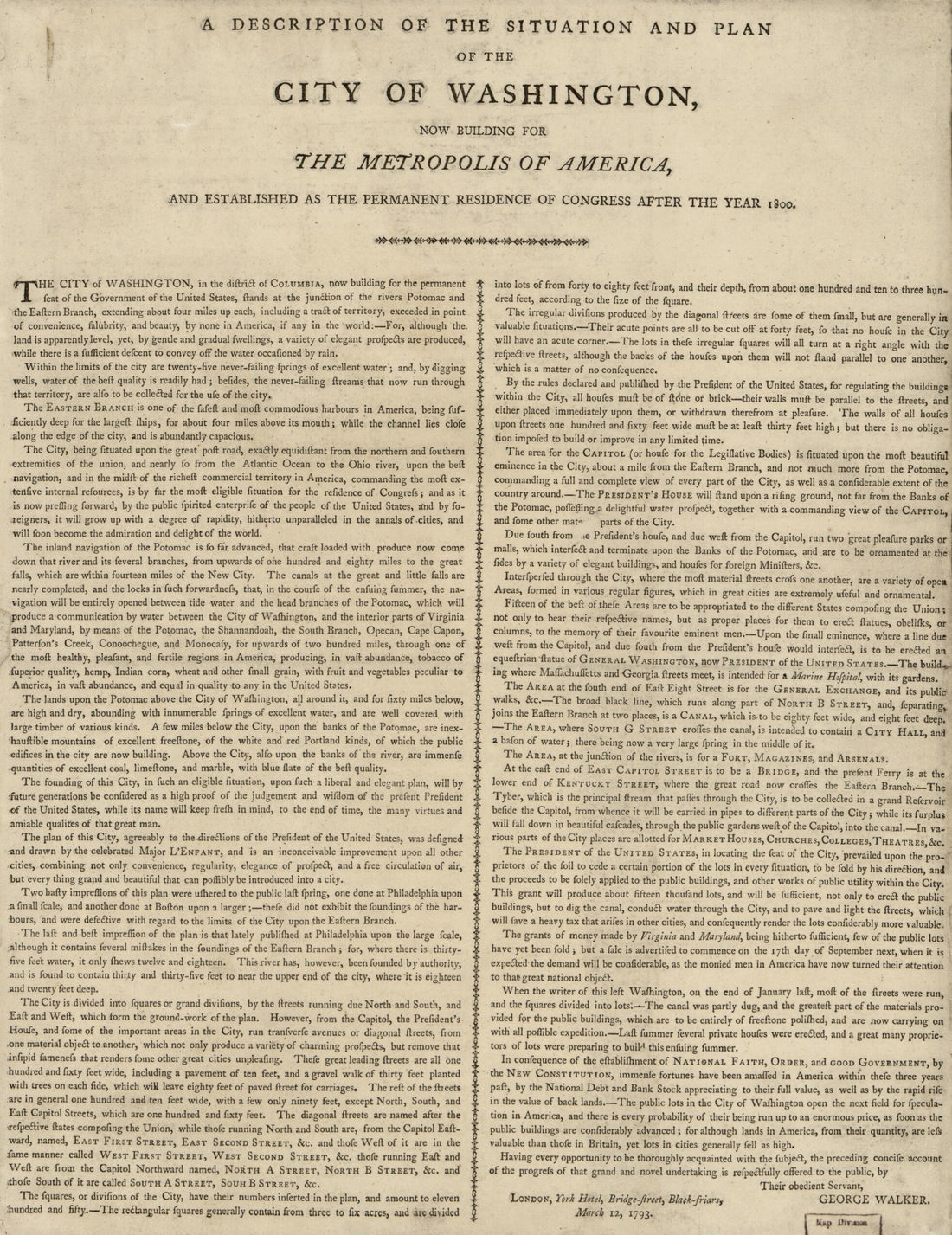 A Description of the Situation and Plan of the City of Washington : Now Building for the Metropolis of America, and Established As the Permanent Residence of Congress After the Year 1800 1793A Description of the Situation and Plan of the City of Washington : Now Building for the Metropolis of America, and Established As the Permanent Residence of Congress After the Year 1800 1793
- Regular price
-
$39.95 $88.95 - Regular price
-
$29.95 - Sale price
-
$39.95 $88.95
-
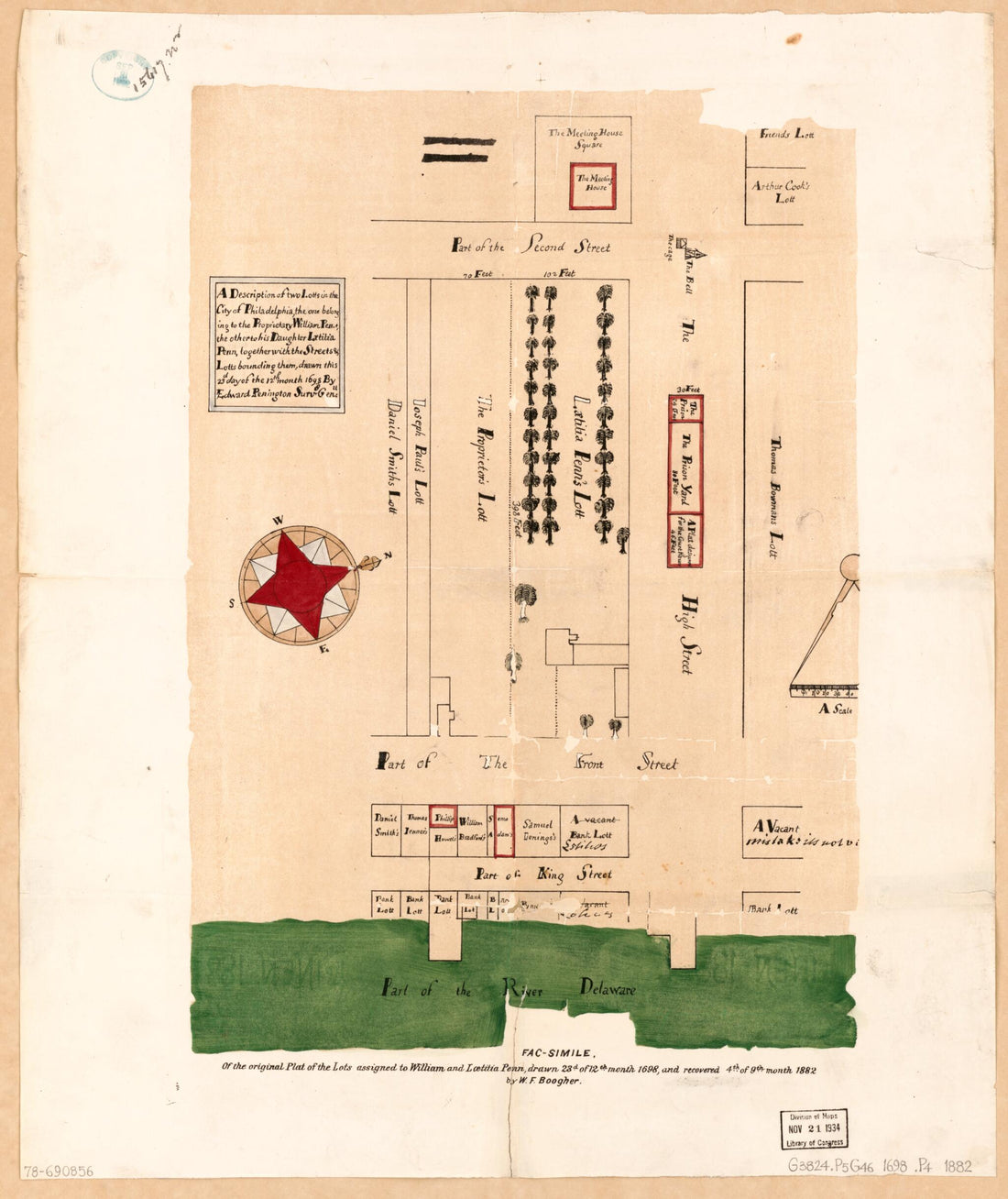 A Description of Two Lotts In the City of Philadelphia, the One Belonging to the Proprietary, William Penn, the Other to His Daughter, Lætitia Penn, Together With the Streets & Lotts Bounding Them 1882A Description of Two Lotts In the City of Philadelphia, the One Belonging to the Proprietary, William Penn, the Other to His Daughter, Lætitia Penn, Together With the Streets & Lotts Bounding Them 1882
- Regular price
-
$39.95 $83.95 - Regular price
-
$34.95 - Sale price
-
$39.95 $83.95
-
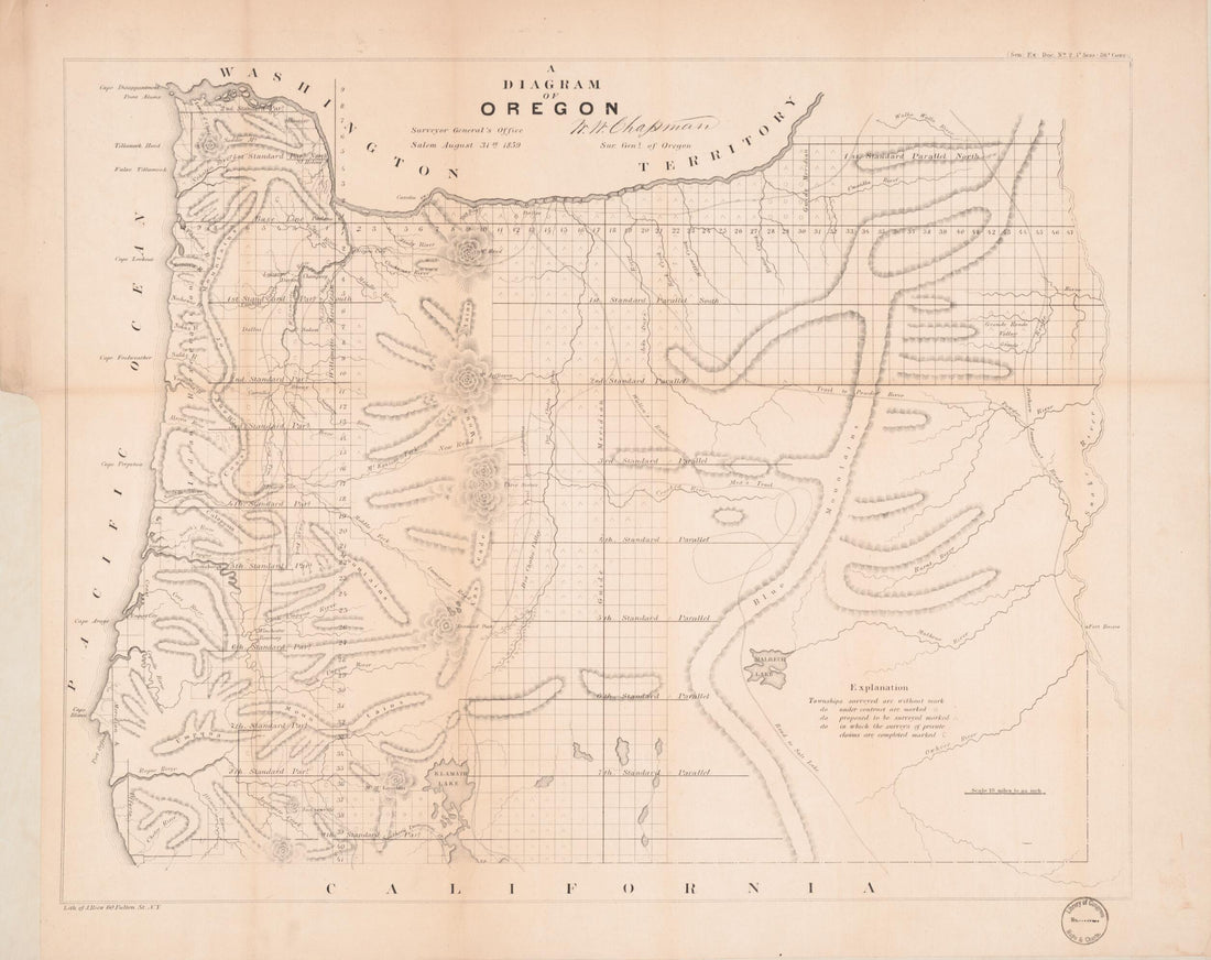 A Diagram of Oregon 1859A Diagram of Oregon 1859
- Regular price
-
$43.95 $83.95 - Regular price
-
$38.95 - Sale price
-
$43.95 $83.95


